
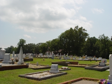
| Memorials | : | 1 |
| Location | : | Randolph County, USA |
| Coordinate | : | 33.3569020, -85.4286910 |
frequently asked questions (FAQ):
-
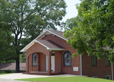
Where is Liberty Grove Church Cemetery?
Liberty Grove Church Cemetery is located at Randolph County ,Alabama ,USA.
-
Liberty Grove Church Cemetery cemetery's updated grave count on graveviews.com?
0 memorials
-
Where are the coordinates of the Liberty Grove Church Cemetery?
Latitude: 33.3569020
Longitude: -85.4286910


Nearby Cemetories:
1. Noon Day Congregational Christian Church Cemetery
New Hope, Randolph County, USA
Coordinate: 33.3265800, -85.4250400
2. Rocky Branch Baptist Church Cemetery
New Hope, Randolph County, USA
Coordinate: 33.3217087, -85.3998795
3. Old Rocky Branch Cemetery
New Hope, Randolph County, USA
Coordinate: 33.3171997, -85.3977966
4. Levens Baptist Church Cemetery
Randolph County, USA
Coordinate: 33.3785000, -85.4836900
5. Old Cool Spring Cemetery
Randolph County, USA
Coordinate: 33.3992004, -85.4824982
6. Greens Chapel Methodist Church Cemetery
Randolph County, USA
Coordinate: 33.2949510, -85.4256740
7. Haywood Cemetery
Haywood, Randolph County, USA
Coordinate: 33.3039700, -85.3899100
8. Cavers Grove Congregational Christian Cemetery
Randolph County, USA
Coordinate: 33.3927920, -85.4896480
9. Providence Baptist Church Cemetery
Providence, Randolph County, USA
Coordinate: 33.3970110, -85.3712540
10. Burden Cemetery
Newell, Randolph County, USA
Coordinate: 33.4225006, -85.4319458
11. Mount Gilead Baptist Church Cemetery
Newell, Randolph County, USA
Coordinate: 33.4239500, -85.4333100
12. West Napoleon Church of Christ Cemetery
Napoleon, Randolph County, USA
Coordinate: 33.3244900, -85.3582600
13. Hearn Gravesite
Randolph County, USA
Coordinate: 33.3098200, -85.4873080
14. Mount Carmel Cemetery
Randolph County, USA
Coordinate: 33.3498650, -85.3439040
15. East Napoleon Church of Christ Cemetery
Napoleon, Randolph County, USA
Coordinate: 33.3204560, -85.3494260
16. Antioch Baptist Church Cemetery
Newell, Randolph County, USA
Coordinate: 33.4325430, -85.4383240
17. Piney Wood Church of Christ Church Cemetery
Randolph County, USA
Coordinate: 33.3841000, -85.5138000
18. Union Baptist Church Cemetery
Newell, Randolph County, USA
Coordinate: 33.4193300, -85.4880900
19. Harmony Congregational Methodist Church Cemetery
Newell, Randolph County, USA
Coordinate: 33.4413872, -85.4130554
20. Pine Hill Church of Christ Cemetery
Randolph County, USA
Coordinate: 33.4460600, -85.4085100
21. Friendship Christian Cemetery
Roanoke, Randolph County, USA
Coordinate: 33.2585810, -85.4187610
22. Daniel Family Cemetery
Graham, Randolph County, USA
Coordinate: 33.3956100, -85.3200000
23. Bethel West Cemetery
Randolph County, USA
Coordinate: 33.3740463, -85.5468903
24. Highway First Congregational Cemetery
Roanoke, Randolph County, USA
Coordinate: 33.2768000, -85.3539700