
| Memorials | : | 162 |
| Location | : | Perrysville, Carroll County, USA |
| Coordinate | : | 40.4569016, -81.1016998 |
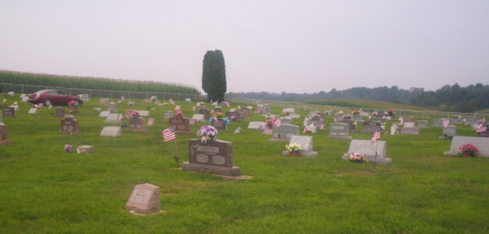
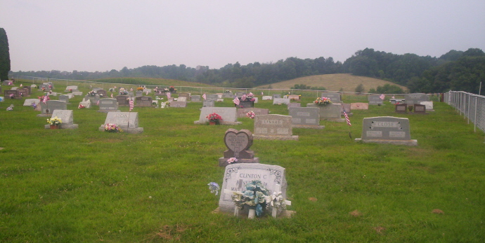
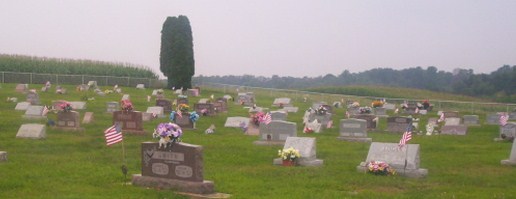
| Description | : | The cemetery is located on the south side of Amsterdam Road SW (Ohio State Route 164) about 600 feet west of its intersection with Chalon Road (County Road 61) and about 0.8 miles south of its intersection with Scio Road SW (Ohio State Route 332). The cemetery is owned and maintained by the Perrysville United Methodist Church. The cemetery is located in Perry Township, Carroll County, Ohio, and is # 14467 (Perrysville Cemetery (new)) in “Ohio Cemeteries 1803-2003”, compiled by the Ohio Genealogical Society. The cemetery is registered with the Ohio Division of Real Estate and Professional Licensing (ODRE) as the... Read More |
frequently asked questions (FAQ):
-
Where is New Perrysville Cemetery?
New Perrysville Cemetery is located at 20 – 42 Amsterdam Road SW (Ohio State Route 164) Perrysville, Carroll County ,Ohio , 43988USA.
-
New Perrysville Cemetery cemetery's updated grave count on graveviews.com?
161 memorials
-
Where are the coordinates of the New Perrysville Cemetery?
Latitude: 40.4569016
Longitude: -81.1016998
Nearby Cemetories:
1. Hagey Family Cemetery
Perrysville, Carroll County, USA
Coordinate: 40.4525980, -81.0996160
2. Perrysville United Methodist Cemetery
Perrysville, Carroll County, USA
Coordinate: 40.4625510, -81.0973610
3. Perrysville Methodist Episcopal Church Cemetery
Perrysville, Carroll County, USA
Coordinate: 40.4655991, -81.0982971
4. Mount Olive Cemetery
Carroll County, USA
Coordinate: 40.4488983, -81.1382980
5. Arabia Cemetery
Perrysville, Carroll County, USA
Coordinate: 40.4803009, -81.0678024
6. Mount Tabor Cemetery
Carroll County, USA
Coordinate: 40.4817009, -81.1483002
7. Allen Memorial Cemetery
Carroll County, USA
Coordinate: 40.4364014, -81.0511017
8. Wood Cemetery
Scio, Harrison County, USA
Coordinate: 40.4193500, -81.0707690
9. Palermo Cemetery
Carroll County, USA
Coordinate: 40.4894444, -81.1522220
10. Swinehart Cemetery
Carroll County, USA
Coordinate: 40.4327000, -81.1642170
11. Conotton Cemetery
Harrison County, USA
Coordinate: 40.4103012, -81.1489029
12. Methodist Episcopal Church Cemetery
Scio, Harrison County, USA
Coordinate: 40.3970800, -81.0864600
13. Grandview Cemetery
Scio, Harrison County, USA
Coordinate: 40.3903008, -81.0978012
14. Mount Pleasant Cemetery
Carrollton, Carroll County, USA
Coordinate: 40.5238991, -81.1003036
15. New Hagerstown Cemetery
New Hagerstown, Carroll County, USA
Coordinate: 40.4446983, -81.1893997
16. Abel Cemetery
Carroll County, USA
Coordinate: 40.4578018, -81.0113983
17. Longview Cemetery
Bowerston, Harrison County, USA
Coordinate: 40.4324989, -81.1872025
18. Bethel Cemetery
Leavittsville, Carroll County, USA
Coordinate: 40.4921989, -81.1841965
19. United Brethren Cemetery
Harrison County, USA
Coordinate: 40.4043999, -81.0353012
20. New Rumley Methodist Cemetery
New Rumley, Harrison County, USA
Coordinate: 40.4028015, -81.0346985
21. Kilgore Cemetery
Kilgore, Carroll County, USA
Coordinate: 40.4632988, -81.0014038
22. Kilgore Presbyterian Cemetery
Carroll County, USA
Coordinate: 40.4603004, -81.0002975
23. Evangelical Lutheran Cemetery
New Rumley, Harrison County, USA
Coordinate: 40.4019012, -81.0271988
24. Seceders Cemetery
Carroll County, USA
Coordinate: 40.5332985, -81.1446991