
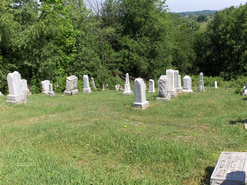
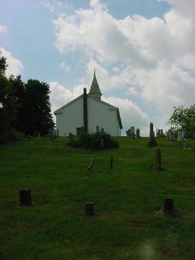
| Memorials | : | 35 |
| Location | : | Perrysville, Carroll County, USA |
| Coordinate | : | 40.4655991, -81.0982971 |
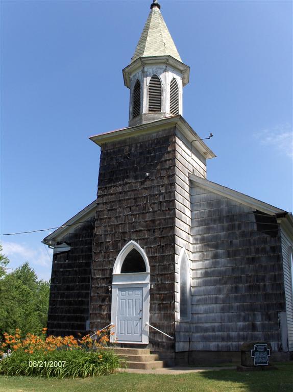
| Description | : | The cemetery is located on the northwest side of Amsterdam Road SW (Ohio State Route 164) at the right angle turn (east to south) of the road about 850 feet west of the intersection of Amsterdam Road SW with Scio Road SW (Ohio State Route 322). The cemetery is located behind (to the north) and to the (west) side of the former Perrysville Methodist Church, currently owned by the Carroll County Historical Society. The church was founded in 1833 as the Perrysville Methodist Episcopal Church. In 1939, the Methodist Episcopal and the Methodist Protestant denominations united, and the church became... Read More |
frequently asked questions (FAQ):
-
Where is Perrysville Methodist Episcopal Church Cemetery?
Perrysville Methodist Episcopal Church Cemetery is located at 137 Amsterdam Road SW (Ohio State Route 164) Perrysville, Carroll County ,Ohio , 43988USA.
-
Perrysville Methodist Episcopal Church Cemetery cemetery's updated grave count on graveviews.com?
35 memorials
-
Where are the coordinates of the Perrysville Methodist Episcopal Church Cemetery?
Latitude: 40.4655991
Longitude: -81.0982971

Nearby Cemetories:
1. Perrysville United Methodist Cemetery
Perrysville, Carroll County, USA
Coordinate: 40.4625510, -81.0973610
2. New Perrysville Cemetery
Perrysville, Carroll County, USA
Coordinate: 40.4569016, -81.1016998
3. Hagey Family Cemetery
Perrysville, Carroll County, USA
Coordinate: 40.4525980, -81.0996160
4. Arabia Cemetery
Perrysville, Carroll County, USA
Coordinate: 40.4803009, -81.0678024
5. Mount Olive Cemetery
Carroll County, USA
Coordinate: 40.4488983, -81.1382980
6. Mount Tabor Cemetery
Carroll County, USA
Coordinate: 40.4817009, -81.1483002
7. Allen Memorial Cemetery
Carroll County, USA
Coordinate: 40.4364014, -81.0511017
8. Palermo Cemetery
Carroll County, USA
Coordinate: 40.4894444, -81.1522220
9. Wood Cemetery
Scio, Harrison County, USA
Coordinate: 40.4193500, -81.0707690
10. Mount Pleasant Cemetery
Carrollton, Carroll County, USA
Coordinate: 40.5238991, -81.1003036
11. Swinehart Cemetery
Carroll County, USA
Coordinate: 40.4327000, -81.1642170
12. Abel Cemetery
Carroll County, USA
Coordinate: 40.4578018, -81.0113983
13. Conotton Cemetery
Harrison County, USA
Coordinate: 40.4103012, -81.1489029
14. Methodist Episcopal Church Cemetery
Scio, Harrison County, USA
Coordinate: 40.3970800, -81.0864600
15. Bethel Cemetery
Leavittsville, Carroll County, USA
Coordinate: 40.4921989, -81.1841965
16. New Hagerstown Cemetery
New Hagerstown, Carroll County, USA
Coordinate: 40.4446983, -81.1893997
17. Kilgore Cemetery
Kilgore, Carroll County, USA
Coordinate: 40.4632988, -81.0014038
18. Kilgore Presbyterian Cemetery
Carroll County, USA
Coordinate: 40.4603004, -81.0002975
19. Grandview Cemetery
Scio, Harrison County, USA
Coordinate: 40.3903008, -81.0978012
20. Longview Cemetery
Bowerston, Harrison County, USA
Coordinate: 40.4324989, -81.1872025
21. Seceders Cemetery
Carroll County, USA
Coordinate: 40.5332985, -81.1446991
22. United Brethren Cemetery
Harrison County, USA
Coordinate: 40.4043999, -81.0353012
23. New Rumley Methodist Cemetery
New Rumley, Harrison County, USA
Coordinate: 40.4028015, -81.0346985
24. Veteran's Grave
Orange Township, Carroll County, USA
Coordinate: 40.4931470, -81.2003677