
| Memorials | : | 1 |
| Location | : | Montague, Franklin County, USA |
| Coordinate | : | 42.5228004, -72.4822006 |
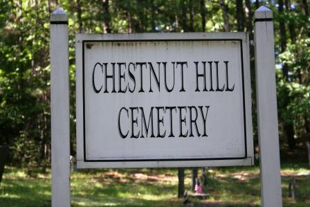
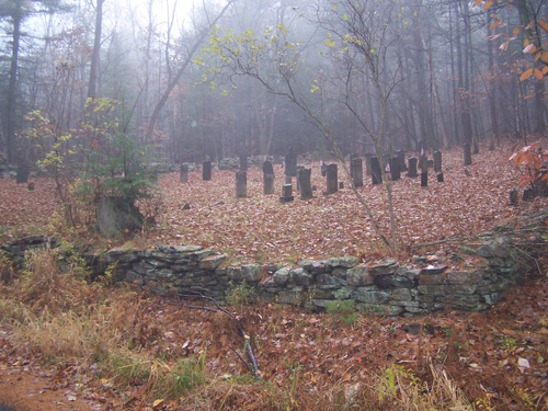
| Description | : | This is a town-owned cemetery. The Town of Montague refers to this cemetery in MassGIS as Parcel ID: 53-029. The Massachusetts Historical Commission does not refer to this cemetery in MACRIS. This burial place is referenced to in the book "Vital Records of Montague, Massachusetts to the end of the year 1849" as G.R.4. |
frequently asked questions (FAQ):
-
Where is Chestnut Hill Cemetery?
Chestnut Hill Cemetery is located at West Chestnut Hill Road Montague, Franklin County ,Massachusetts ,USA.
-
Chestnut Hill Cemetery cemetery's updated grave count on graveviews.com?
1 memorials
-
Where are the coordinates of the Chestnut Hill Cemetery?
Latitude: 42.5228004
Longitude: -72.4822006
Nearby Cemetories:
1. Mount Hope Cemetery
Leverett, Franklin County, USA
Coordinate: 42.5111008, -72.4906006
2. Jackson Hill Cemetery
Leverett, Franklin County, USA
Coordinate: 42.5028000, -72.5028000
3. Marvell Cemetery
Leverett, Franklin County, USA
Coordinate: 42.5028000, -72.5042038
4. Plain View Cemetery
Leverett, Franklin County, USA
Coordinate: 42.4972100, -72.4751900
5. Gardner Cemetery
Leverett, Franklin County, USA
Coordinate: 42.5036011, -72.4574966
6. Patrick Cemetery
Leverett, Franklin County, USA
Coordinate: 42.4995800, -72.4619500
7. Moores Corner Cemetery
Leverett, Franklin County, USA
Coordinate: 42.4924200, -72.4730700
8. Dry Hill Cemetery
Montague, Franklin County, USA
Coordinate: 42.5558300, -72.4647600
9. Old South Cemetery
Montague, Franklin County, USA
Coordinate: 42.5232500, -72.5360300
10. Locks Village Cemetery
Shutesbury, Franklin County, USA
Coordinate: 42.5010200, -72.4364000
11. Town Cemetery
Montague, Franklin County, USA
Coordinate: 42.5595000, -72.5070200
12. Mount Toby Cemetery
Leverett, Franklin County, USA
Coordinate: 42.4894810, -72.5174400
13. Locust Hill Cemetery
Montague, Franklin County, USA
Coordinate: 42.5394700, -72.5363400
14. Elm Grove Cemetery
Montague, Franklin County, USA
Coordinate: 42.5418600, -72.5359000
15. South Cemetery
Wendell, Franklin County, USA
Coordinate: 42.5092000, -72.4206000
16. North Sunderland Cemetery
Sunderland, Franklin County, USA
Coordinate: 42.4972000, -72.5492020
17. North Cemetery
Leverett, Franklin County, USA
Coordinate: 42.4673720, -72.4983230
18. Highland Cemetery
Montague, Franklin County, USA
Coordinate: 42.5778008, -72.5083008
19. Diemand Family Cemetery
Wendell, Franklin County, USA
Coordinate: 42.5769900, -72.4520600
20. Holton Cemetery
Erving, Franklin County, USA
Coordinate: 42.5799500, -72.4634600
21. East Mineral Road Cemetery
Montague, Franklin County, USA
Coordinate: 42.5810500, -72.5086300
22. Pine Nook Cemetery
Deerfield, Franklin County, USA
Coordinate: 42.5086300, -72.5661400
23. Wendell Center Cemetery
Wendell, Franklin County, USA
Coordinate: 42.5485400, -72.3962400
24. East Deerfield Cemetery
Deerfield, Franklin County, USA
Coordinate: 42.5555992, -72.5642014