
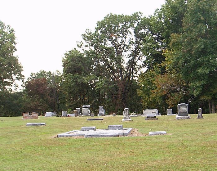
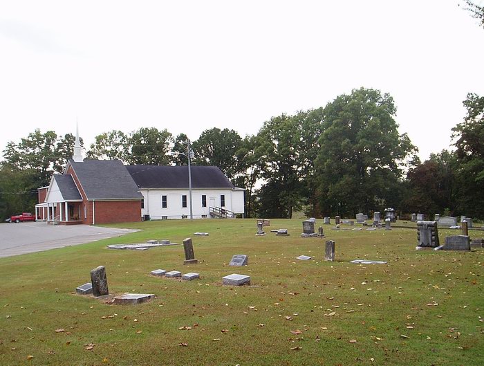
| Memorials | : | 43 |
| Location | : | Unionville, Dyer County, USA |
| Coordinate | : | 35.9605840, -89.4342750 |
| Description | : | From the intersection of Unionville Rd. & US-51 S, S of Dyersburg at 4-Points, travel west on Unionville Rd. for 2.7 mi.; turning into the parking lot of the Mt. Vernon Baptist Church on the west (right) side & to their cemetery on both side. |
frequently asked questions (FAQ):
-
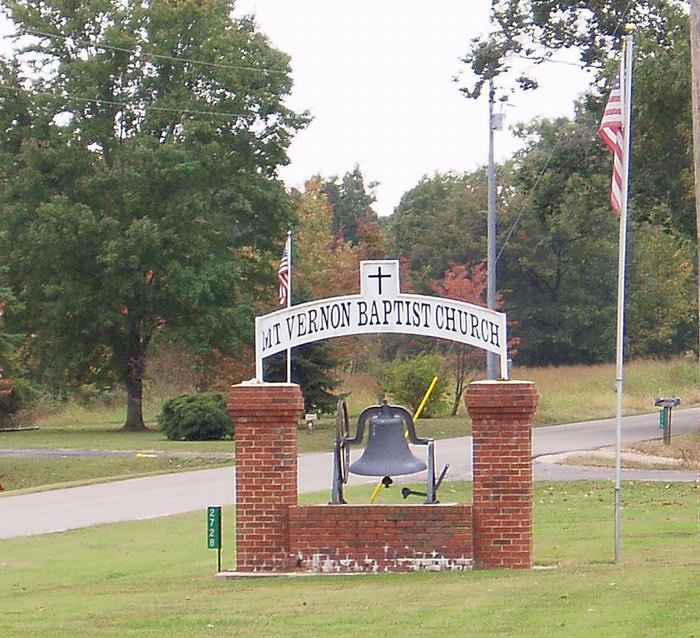
Where is Mount Vernon Baptist Church Cemetery?
Mount Vernon Baptist Church Cemetery is located at 2768 Unionville Road Unionville, Dyer County ,Tennessee ,USA.
-
Mount Vernon Baptist Church Cemetery cemetery's updated grave count on graveviews.com?
38 memorials
-
Where are the coordinates of the Mount Vernon Baptist Church Cemetery?
Latitude: 35.9605840
Longitude: -89.4342750
Nearby Cemetories:
1. Benton-Sharp Cemetery
Fowlkes, Dyer County, USA
Coordinate: 35.9706500, -89.4404700
2. Spate Cemetery
Double Bridges, Lauderdale County, USA
Coordinate: 35.9318890, -89.4396020
3. Fowlkes Methodist Church Cemetery
Fowlkes, Dyer County, USA
Coordinate: 35.9781560, -89.3996230
4. Poplar Grove Memorial Garden
Halls, Lauderdale County, USA
Coordinate: 35.9256840, -89.4211890
5. King Cemetery
Dyersburg, Dyer County, USA
Coordinate: 35.9810470, -89.3969130
6. Butterworth Cemetery
Fowlkes, Dyer County, USA
Coordinate: 35.9893990, -89.3974991
7. McCoy Cemetery
Dyer County, USA
Coordinate: 35.9536018, -89.3827972
8. Parr Cemetery
Halls, Lauderdale County, USA
Coordinate: 35.9123900, -89.4246010
9. Elon Cemetery
Double Bridges, Lauderdale County, USA
Coordinate: 35.9117510, -89.4492090
10. Holly Springs Cemetery
Fowlkes, Dyer County, USA
Coordinate: 35.9622940, -89.3685410
11. Rutherford Cemetery
Halls, Lauderdale County, USA
Coordinate: 35.9173140, -89.4748610
12. Carter Cemetery
Dyersburg, Dyer County, USA
Coordinate: 36.0150440, -89.4327580
13. Green Hill Memorial Garden Cemetery
Halls, Lauderdale County, USA
Coordinate: 35.9139570, -89.3922510
14. Antioch Church of Christ Cemetery
Porter Gap, Lauderdale County, USA
Coordinate: 35.9090140, -89.4799320
15. Mount Zion Baptist Church Cemetery
Double Bridges, Lauderdale County, USA
Coordinate: 35.8991930, -89.4565300
16. Sawyer Cemetery
Double Bridges, Lauderdale County, USA
Coordinate: 35.8953500, -89.4402170
17. Salisbury Cemetery
Halls, Lauderdale County, USA
Coordinate: 35.8959000, -89.4221000
18. Hodge Cemetery
Dyersburg, Dyer County, USA
Coordinate: 35.9836620, -89.3532490
19. Peal and Bailey Land Cemetery
Bruceville, Dyer County, USA
Coordinate: 35.9256960, -89.3584940
20. Carnell Family Cemetery
Halls, Lauderdale County, USA
Coordinate: 35.8877550, -89.4283130
21. Sorrell Chapel Cemetery
Bonicord, Dyer County, USA
Coordinate: 35.9772470, -89.3458570
22. Clay Cemetery
Fowlkes, Dyer County, USA
Coordinate: 35.9760780, -89.3453920
23. Pate Family Cemetery
Bonicord, Dyer County, USA
Coordinate: 35.9575110, -89.3389720
24. Palestine Cemetery
Bruceville, Dyer County, USA
Coordinate: 35.9183080, -89.3536090