
| Memorials | : | 0 |
| Location | : | Ampleforth, Ryedale District, England |
| Website | : | ryedalechristiancouncil.org.uk/HWeb/ryedalequakerpropertiess.pdf |
| Coordinate | : | 54.2023420, -1.1213330 |
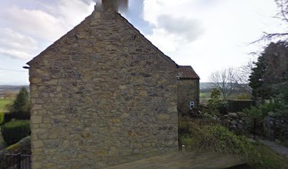
| Description | : | The Shallowdale Friends had a burial ground at their Meeting House. It was demolished in 1808 and the Friends moved to Helmsley. https://ampleforth.ryedaleconnect.org.uk/history/ states that by 1743, only 2 families out of the 59 families were Quakers. The burial ground is said to be part of a cottage garden on Westwood Lane; the map location is approximate. |
frequently asked questions (FAQ):
-
Where is Ampleforth Friends Burial Ground?
Ampleforth Friends Burial Ground is located at Ampleforth, Ryedale District ,North Yorkshire ,England.
-
Ampleforth Friends Burial Ground cemetery's updated grave count on graveviews.com?
0 memorials
-
Where are the coordinates of the Ampleforth Friends Burial Ground?
Latitude: 54.2023420
Longitude: -1.1213330
Nearby Cemetories:
1. St Hilda Churchyard
Ampleforth, Ryedale District, England
Coordinate: 54.2000630, -1.1075590
2. Our Lady & St Benedict RC Churchyard
Ampleforth, Ryedale District, England
Coordinate: 54.2009700, -1.1055400
3. Ampleforth Abbey - Monk's Wood
Ampleforth, Ryedale District, England
Coordinate: 54.2028689, -1.0841344
4. Ampleforth Abbey
Ampleforth, Ryedale District, England
Coordinate: 54.2019630, -1.0838000
5. Byland Abbey
Coxwold, Hambleton District, England
Coordinate: 54.2034480, -1.1589660
6. Newburgh Priory
Coxwold, Hambleton District, England
Coordinate: 54.1811000, -1.1731000
7. St. Michael's Churchyard
Coxwold, Hambleton District, England
Coordinate: 54.1878500, -1.1847120
8. Holy Cross Churchyard
Gilling East, Ryedale District, England
Coordinate: 54.1841290, -1.0580460
9. Holy Trinity Churchyard
Yearsley, Hambleton District, England
Coordinate: 54.1619100, -1.1052300
10. Gilling New Churchyard
Gilling East, Ryedale District, England
Coordinate: 54.1856070, -1.0559535
11. St Oswald Churchyard
Oswaldkirk, Ryedale District, England
Coordinate: 54.2022340, -1.0495510
12. Saint Mary’s Churchyard
Scawton, Ryedale District, England
Coordinate: 54.2451000, -1.1591000
13. Rievaulx Abbey
Helmsley, Ryedale District, England
Coordinate: 54.2449170, -1.0639570
14. St Mary Churchyard
Kilburn, Hambleton District, England
Coordinate: 54.2102360, -1.2138820
15. All Saints Churchyard
Helmsley, Ryedale District, England
Coordinate: 54.2469000, -1.0625000
16. Helmsley Town Cemetery
Helmsley, Ryedale District, England
Coordinate: 54.2483300, -1.0620300
17. St Nicholas Churchyard
Husthwaite, Hambleton District, England
Coordinate: 54.1692000, -1.2075900
18. St Michael Churchyard
Cold Kirby, Ryedale District, England
Coordinate: 54.2534580, -1.1827120
19. Husthwaite Cemetery
Husthwaite, Hambleton District, England
Coordinate: 54.1684400, -1.2142000
20. All Saints Churchyard
Brandsby, Hambleton District, England
Coordinate: 54.1397200, -1.0853500
21. All Saints Churchyard
Old Byland, Ryedale District, England
Coordinate: 54.2663000, -1.1558000
22. Harome Village Cemetery
Harome, Ryedale District, England
Coordinate: 54.2308650, -1.0096380
23. St Saviour Churchyard
Harome, Ryedale District, England
Coordinate: 54.2302000, -1.0088000
24. Stonegrave Minster Churchyard
Stonegrave, Ryedale District, England
Coordinate: 54.1925011, -0.9966000