
| Memorials | : | 0 |
| Location | : | Placerville, El Dorado County, USA |
| Coordinate | : | 38.7249107, -120.8024673 |
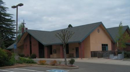
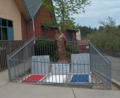
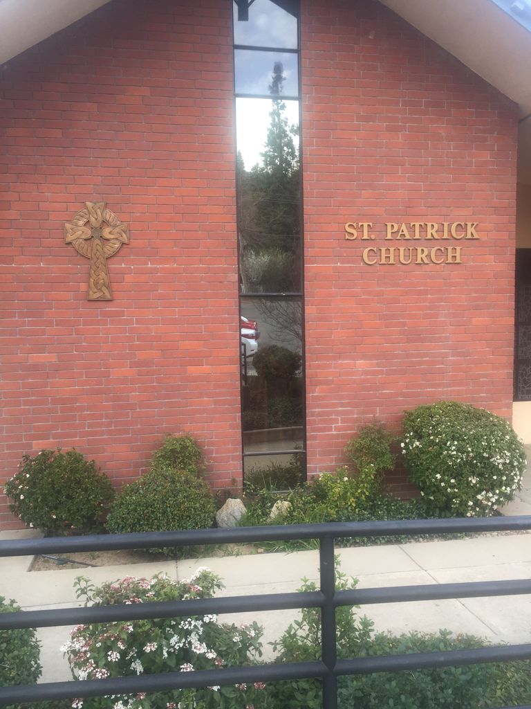
| Description | : | The St Patrick's Church Cemetery was located next to St. Patrick's Church and was the final resting place for the local Catholic faithful from 1851 through 1952. At least 97 burials are known. When the new church was built, the old cemetery was covered over by the new church site and a new Catholic cemetery was established off of Green Street in Placerville. A nice memorial sits next to the East side of the church building commemorating the old cemetery and the parishioners still buried there. The memorial can be accessed by the Fisk Street entrance... Read More |
frequently asked questions (FAQ):
-
Where is Old Saint Patricks Cemetery?
Old Saint Patricks Cemetery is located at 3109 Sacramento Street Placerville, El Dorado County ,California , 95667USA.
-
Old Saint Patricks Cemetery cemetery's updated grave count on graveviews.com?
0 memorials
-
Where are the coordinates of the Old Saint Patricks Cemetery?
Latitude: 38.7249107
Longitude: -120.8024673
Nearby Cemetories:
1. Old Placerville City Cemetery
Placerville, El Dorado County, USA
Coordinate: 38.7258987, -120.8059464
2. Boles Family Cemetery
Placerville, El Dorado County, USA
Coordinate: 38.7309860, -120.8069580
3. Jewish Pioneer Cemetery
Placerville, El Dorado County, USA
Coordinate: 38.7299500, -120.8091965
4. Methodist Episcopal Federated Cemetery
Placerville, El Dorado County, USA
Coordinate: 38.7283287, -120.7942200
5. Saint Patrick Cemetery
Placerville, El Dorado County, USA
Coordinate: 38.7327995, -120.8047638
6. Placerville Union Cemetery
Placerville, El Dorado County, USA
Coordinate: 38.7317390, -120.8084106
7. County Hospital Cemetery
Placerville, El Dorado County, USA
Coordinate: 38.7342796, -120.8028488
8. Uppertown Cemetery
Placerville, El Dorado County, USA
Coordinate: 38.7320900, -120.7890625
9. Middletown Cemetery
Placerville, El Dorado County, USA
Coordinate: 38.7358704, -120.8301010
10. Weberville Cemetery
Placerville, El Dorado County, USA
Coordinate: 38.7024170, -120.7901000
11. Westwood Hills Memorial Park Pet Cemetery
Placerville, El Dorado County, USA
Coordinate: 38.7365210, -120.8323130
12. Westwood Hills Memorial Park
Placerville, El Dorado County, USA
Coordinate: 38.7367363, -120.8326035
13. Odd Fellows Cemetery
Diamond Springs, El Dorado County, USA
Coordinate: 38.6963882, -120.8151932
14. Missouri Flat Cemetery
Placerville, El Dorado County, USA
Coordinate: 38.7157360, -120.8403400
15. Carpenter Family Residence Burial Plot
Diamond Springs, El Dorado County, USA
Coordinate: 38.6941590, -120.8187750
16. Diamond Springs Cemetery
Diamond Springs, El Dorado County, USA
Coordinate: 38.6940960, -120.8186620
17. Jacquier Family Cemetery
Placerville, El Dorado County, USA
Coordinate: 38.7424420, -120.7602750
18. Smiths Flat Cemetery
Placerville, El Dorado County, USA
Coordinate: 38.7325287, -120.7552414
19. Kingsville Cemetery
El Dorado, El Dorado County, USA
Coordinate: 38.6993870, -120.8516060
20. Chili Bar Toll House Cemetery
Placerville, El Dorado County, USA
Coordinate: 38.7700530, -120.8177660
21. El Dorado Cemetery
El Dorado, El Dorado County, USA
Coordinate: 38.6804085, -120.8490067
22. Cold Springs Cemetery
Cold Springs, El Dorado County, USA
Coordinate: 38.7441444, -120.8721619
23. Oak Hill Cemetery
Placerville, El Dorado County, USA
Coordinate: 38.6768990, -120.7481003
24. Kelsey Cemetery
Kelsey, El Dorado County, USA
Coordinate: 38.7949791, -120.8200073