
| Memorials | : | 0 |
| Location | : | Placerville, El Dorado County, USA |
| Coordinate | : | 38.7320900, -120.7890625 |
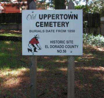
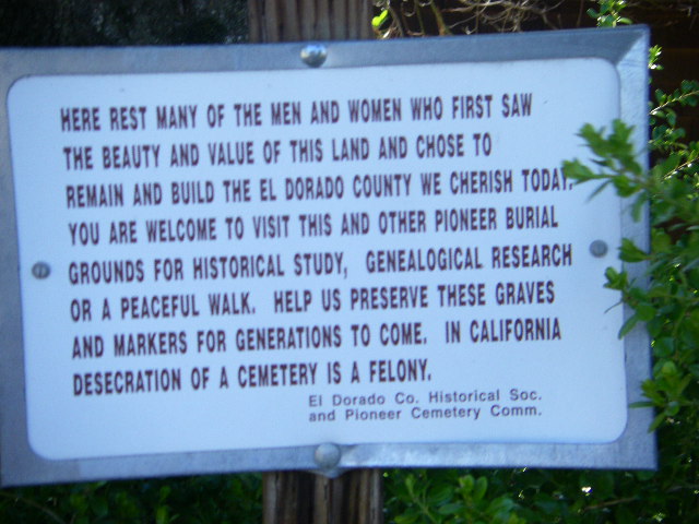
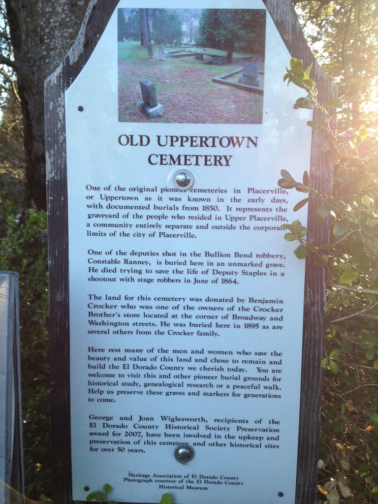
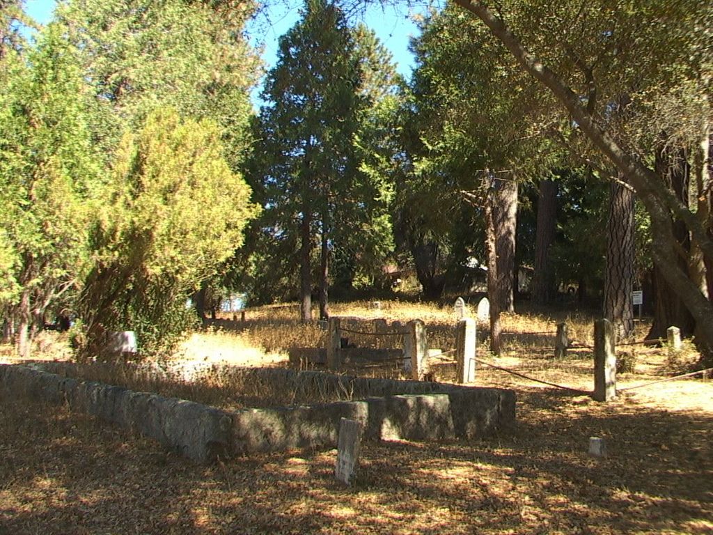
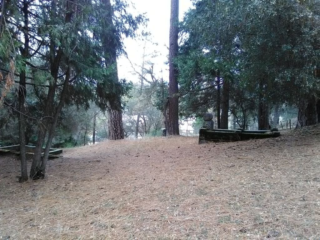
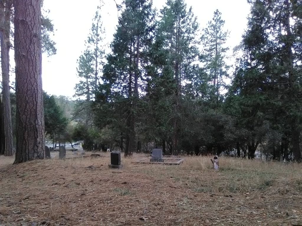
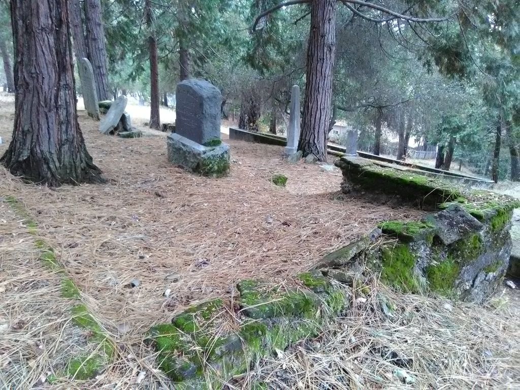
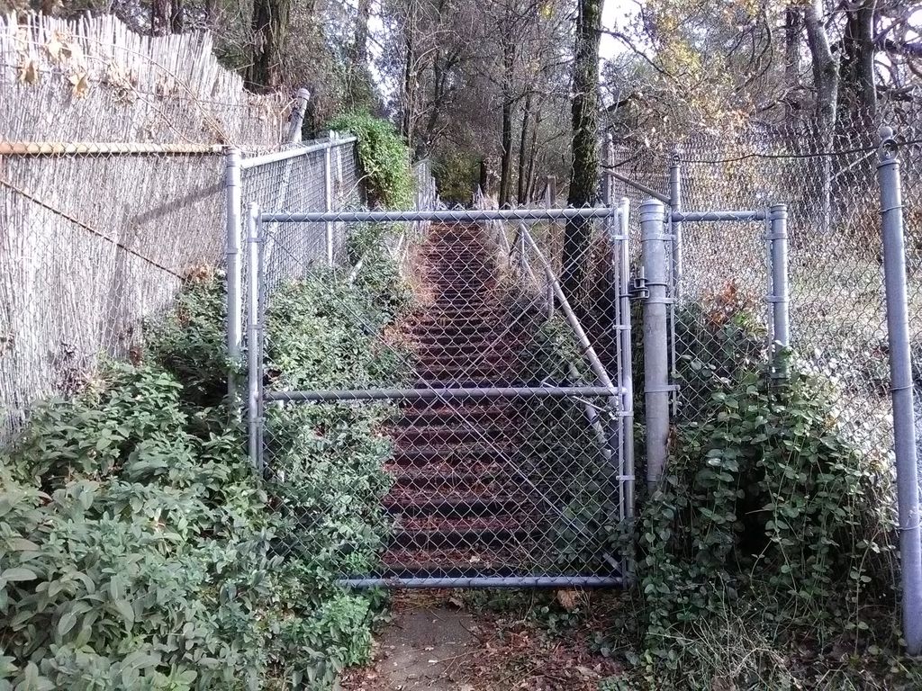
| Description | : | The Old Uppertown Cemetery is located on the north side of Freeway 50 off Mosquito Road. As you head north under the freeway, park in the area to your left, and carefully walk across Mosquito Road. There is a flight of stairs to the top where the cemetery is located. Placerville, aka Hangtown, was a major stop for gold seekers heading to the mines or to Sacramento from back east. Back then, Upper Placerville was a separate town from Placerville. The cemetery was started in 1850 with the first known burials, the oldest being Rev Amariah Kallock. Currently there are... Read More |
frequently asked questions (FAQ):
-
Where is Uppertown Cemetery?
Uppertown Cemetery is located at Placerville, El Dorado County ,California ,USA.
-
Uppertown Cemetery cemetery's updated grave count on graveviews.com?
0 memorials
-
Where are the coordinates of the Uppertown Cemetery?
Latitude: 38.7320900
Longitude: -120.7890625
Nearby Cemetories:
1. Methodist Episcopal Federated Cemetery
Placerville, El Dorado County, USA
Coordinate: 38.7283287, -120.7942200
2. County Hospital Cemetery
Placerville, El Dorado County, USA
Coordinate: 38.7342796, -120.8028488
3. Saint Patrick Cemetery
Placerville, El Dorado County, USA
Coordinate: 38.7327995, -120.8047638
4. Old Saint Patricks Cemetery
Placerville, El Dorado County, USA
Coordinate: 38.7249107, -120.8024673
5. Boles Family Cemetery
Placerville, El Dorado County, USA
Coordinate: 38.7309860, -120.8069580
6. Old Placerville City Cemetery
Placerville, El Dorado County, USA
Coordinate: 38.7258987, -120.8059464
7. Placerville Union Cemetery
Placerville, El Dorado County, USA
Coordinate: 38.7317390, -120.8084106
8. Jewish Pioneer Cemetery
Placerville, El Dorado County, USA
Coordinate: 38.7299500, -120.8091965
9. Jacquier Family Cemetery
Placerville, El Dorado County, USA
Coordinate: 38.7424420, -120.7602750
10. Smiths Flat Cemetery
Placerville, El Dorado County, USA
Coordinate: 38.7325287, -120.7552414
11. Weberville Cemetery
Placerville, El Dorado County, USA
Coordinate: 38.7024170, -120.7901000
12. Middletown Cemetery
Placerville, El Dorado County, USA
Coordinate: 38.7358704, -120.8301010
13. Westwood Hills Memorial Park Pet Cemetery
Placerville, El Dorado County, USA
Coordinate: 38.7365210, -120.8323130
14. Westwood Hills Memorial Park
Placerville, El Dorado County, USA
Coordinate: 38.7367363, -120.8326035
15. Odd Fellows Cemetery
Diamond Springs, El Dorado County, USA
Coordinate: 38.6963882, -120.8151932
16. Missouri Flat Cemetery
Placerville, El Dorado County, USA
Coordinate: 38.7157360, -120.8403400
17. Chili Bar Toll House Cemetery
Placerville, El Dorado County, USA
Coordinate: 38.7700530, -120.8177660
18. Carpenter Family Residence Burial Plot
Diamond Springs, El Dorado County, USA
Coordinate: 38.6941590, -120.8187750
19. Diamond Springs Cemetery
Diamond Springs, El Dorado County, USA
Coordinate: 38.6940960, -120.8186620
20. Kingsville Cemetery
El Dorado, El Dorado County, USA
Coordinate: 38.6993870, -120.8516060
21. Andre Family Cemetery
Placerville, El Dorado County, USA
Coordinate: 38.7822250, -120.7466710
22. Oak Hill Cemetery
Placerville, El Dorado County, USA
Coordinate: 38.6768990, -120.7481003
23. Blairs-Winkelman Cemetery
Camino, El Dorado County, USA
Coordinate: 38.7547140, -120.7098510
24. Cold Springs Cemetery
Cold Springs, El Dorado County, USA
Coordinate: 38.7441444, -120.8721619