
| Memorials | : | 0 |
| Location | : | Roanoke, Randolph County, USA |
| Coordinate | : | 33.1592510, -85.3901760 |
frequently asked questions (FAQ):
-
Where is Mount Pisgah Baptist Church Cemetery?
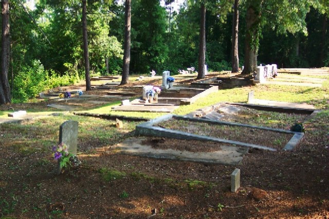
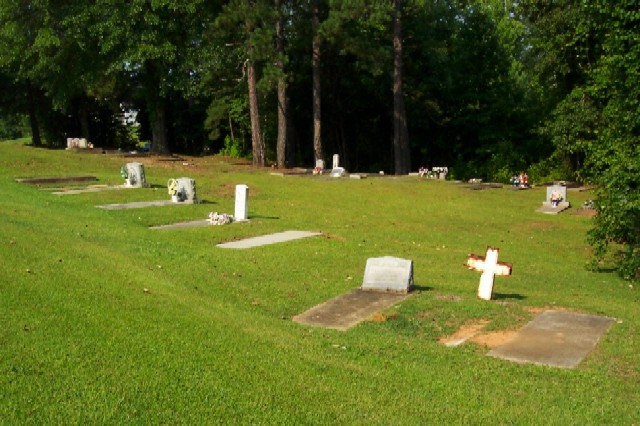
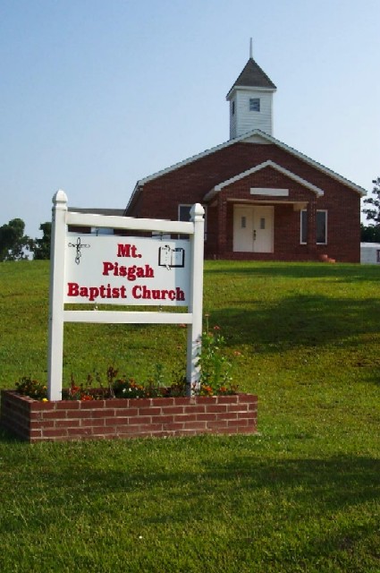
Mount Pisgah Baptist Church Cemetery is located at 372 Waller Mill Road Roanoke, Randolph County ,Alabama , 36274USA.
-
Mount Pisgah Baptist Church Cemetery cemetery's updated grave count on graveviews.com?
0 memorials
-
Where are the coordinates of the Mount Pisgah Baptist Church Cemetery?
Latitude: 33.1592510
Longitude: -85.3901760
Nearby Cemetories:
1. Roanoke Baptist Church Cemetery
Roanoke, Randolph County, USA
Coordinate: 33.1506600, -85.3730260
2. Cedarwood Cemetery
Roanoke, Randolph County, USA
Coordinate: 33.1519012, -85.3681030
3. Booger Hill Cemetery
Roanoke, Randolph County, USA
Coordinate: 33.1481018, -85.3610992
4. East Roanoke Cemetery
Roanoke, Randolph County, USA
Coordinate: 33.1432991, -85.3644028
5. Union Hill Baptist Church Cemetery
Roanoke, Randolph County, USA
Coordinate: 33.1893010, -85.4031770
6. Mount Bethel United Methodist Church Cemetery
Roanoke, Randolph County, USA
Coordinate: 33.1281290, -85.3992600
7. Peace and Goodwill Baptist Church Cemetery
Randolph County, USA
Coordinate: 33.1240270, -85.3954800
8. Mount Zion Christian Church Cemetery
Randolph County, USA
Coordinate: 33.1361850, -85.4246100
9. Macedonia Cemetery
Roanoke, Randolph County, USA
Coordinate: 33.1802040, -85.3505050
10. Zion's Rest Primitive Baptist Church Cemetery
Roanoke, Randolph County, USA
Coordinate: 33.2024250, -85.3797090
11. Lebanon Christian Church Cemetery
Springfield, Randolph County, USA
Coordinate: 33.1897400, -85.3500700
12. Pleasant Grove Baptist Church Cemetery
Broughton, Randolph County, USA
Coordinate: 33.1826700, -85.4420100
13. Center Chapel Baptist Church Cemetery
Randolph County, USA
Coordinate: 33.1735460, -85.3333320
14. Lanes Chapel Methodist Church Cemetery
Roanoke, Randolph County, USA
Coordinate: 33.1129210, -85.3645760
15. Rocky Mount United Methodist Church Cemetery
Roanoke, Randolph County, USA
Coordinate: 33.1880480, -85.4416230
16. High Pine Baptist Church Cemetery
Roanoke, Randolph County, USA
Coordinate: 33.1243210, -85.4435370
17. Radneys Chapel Cemetery
Peavy, Randolph County, USA
Coordinate: 33.1410590, -85.4559300
18. Antioch Christian Church Cemetery
Doublehead, Chambers County, USA
Coordinate: 33.0963330, -85.3916360
19. Randolph Memory Gardens
Rock Mills, Randolph County, USA
Coordinate: 33.1535988, -85.3107986
20. Rock Stand Congregational Christian Church Cemeter
Roanoke, Randolph County, USA
Coordinate: 33.2242350, -85.4084310
21. Rock Mills Missionary Baptist Church Cemetery
Randolph County, USA
Coordinate: 33.1570530, -85.3077420
22. Pike Family Cemetery
Randolph County, USA
Coordinate: 33.1960270, -85.3199710
23. Old Salem Primitive Baptist Cemetery
Bacon Level, Randolph County, USA
Coordinate: 33.1375200, -85.3103400
24. Forest Home Christian Church Cemetery
Springfield, Randolph County, USA
Coordinate: 33.1927400, -85.3155500