
| Memorials | : | 0 |
| Location | : | Albury, Guildford Borough, England |
| Coordinate | : | 51.2199300, -0.4788890 |
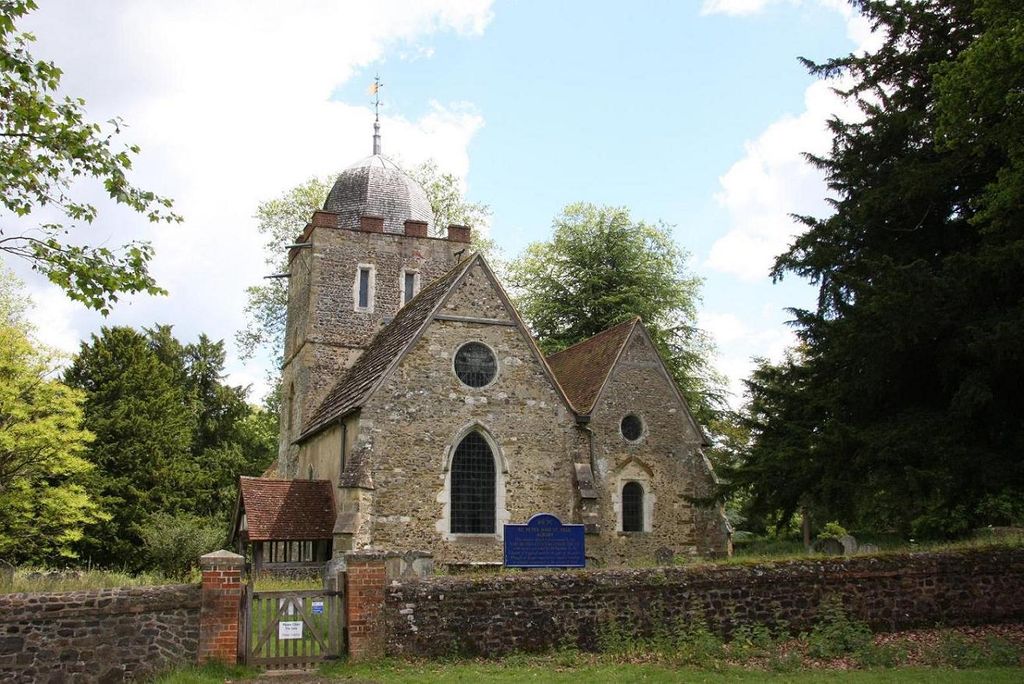
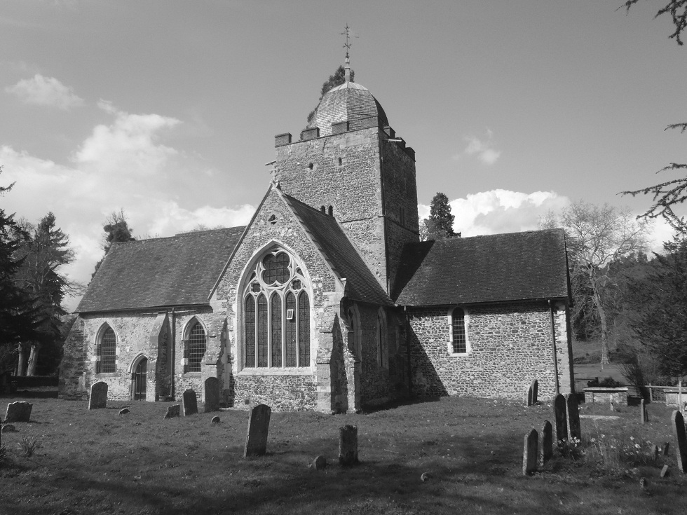
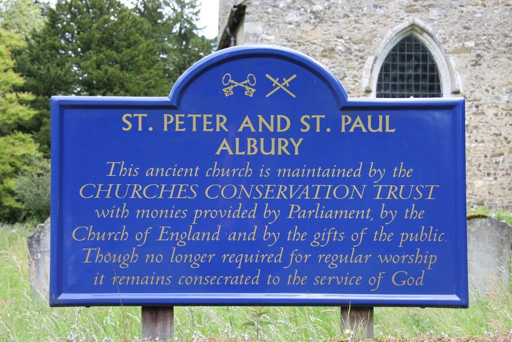
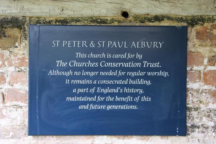
| Description | : | The old parish church of Albury stands on its own in the peaceful valley of the Tillingbourne, away from any sizeable community for which it could provide a focus of worship. For hundreds of years, from Saxon times and right up to the end of the 18th centry the village was known as Albury, or sometimes as Aldbury, but earlier it is referred to as Aldebury (14th cent.), Aldebur (13th cent.) and Eldeberie (11th cent.). The last form of the name, as found in the Domesday Survey, and meaning "the Old Bury", was taken from the name given by the... Read More |
frequently asked questions (FAQ):
-
Where is Old St Peter and St Paul Churchyard?
Old St Peter and St Paul Churchyard is located at Albury, Guildford Borough ,Surrey ,England.
-
Old St Peter and St Paul Churchyard cemetery's updated grave count on graveviews.com?
0 memorials
-
Where are the coordinates of the Old St Peter and St Paul Churchyard?
Latitude: 51.2199300
Longitude: -0.4788890
Nearby Cemetories:
1. St. James' Churchyard
Shere, Guildford Borough, England
Coordinate: 51.2191210, -0.4634830
2. St Peter and St Paul Churchyard
Albury, Guildford Borough, England
Coordinate: 51.2181500, -0.4974400
3. St Martha-on-the-Hill Churchyard
Chilworth, Guildford Borough, England
Coordinate: 51.2246400, -0.5290440
4. St. Peter & St. Paul's Churchyard
West Clandon, Guildford Borough, England
Coordinate: 51.2507990, -0.5053760
5. Ss Peter & Paul Church Cemetery
West Clandon, Guildford Borough, England
Coordinate: 51.2517500, -0.5045400
6. St John the Evangelist Churchyard
Merrow, Guildford Borough, England
Coordinate: 51.2459770, -0.5271350
7. Christ Church Churchyard
Shamley Green, Waverley Borough, England
Coordinate: 51.1807110, -0.5228360
8. St Mary Churchyard
West Horsley, Guildford Borough, England
Coordinate: 51.2622470, -0.4417370
9. St James Churchyard
Abinger, Mole Valley District, England
Coordinate: 51.2017820, -0.4056060
10. St. John the Baptist Churchyard
Wonersh, Waverley Borough, England
Coordinate: 51.1960610, -0.5493600
11. Felday Chapel
Holmbury St Mary, Mole Valley District, England
Coordinate: 51.1900360, -0.4129370
12. St Mary the Virgin Churchyard
Holmbury St Mary, Mole Valley District, England
Coordinate: 51.1882600, -0.4130600
13. St. Martin's Churchyard
East Horsley, Guildford Borough, England
Coordinate: 51.2638550, -0.4314040
14. St John the Evangelist Churchyard
Wotton, Mole Valley District, England
Coordinate: 51.2198770, -0.3895890
15. Bramley Cemetery
Bramley, Waverley Borough, England
Coordinate: 51.1894900, -0.5544700
16. Shalford Cemetery
Shalford, Guildford Borough, England
Coordinate: 51.2152000, -0.5687000
17. Oakfield Wood
Shamley Green, Waverley Borough, England
Coordinate: 51.1670718, -0.5115667
18. St Mary the Virgin Churchyard
Shalford, Guildford Borough, England
Coordinate: 51.2206700, -0.5705520
19. Holy Trinity Church
Guildford, Guildford Borough, England
Coordinate: 51.2357740, -0.5705540
20. Society of Friends Burial Ground (Defunct)
Guildford, Guildford Borough, England
Coordinate: 51.2364500, -0.5703050
21. St Edwards Churchyard
Guildford, Guildford Borough, England
Coordinate: 51.2339770, -0.5719760
22. Burpham Churchyard
Guildford, Guildford Borough, England
Coordinate: 51.2622640, -0.5497350
23. St Marys Churchyard
Guildford, Guildford Borough, England
Coordinate: 51.2346622, -0.5744170
24. Saint Nicolas Parish Church
Guildford, Guildford Borough, England
Coordinate: 51.2346980, -0.5776620