
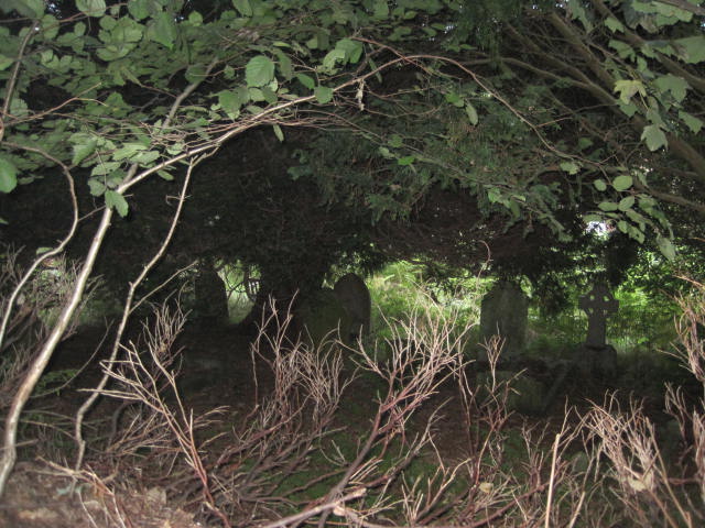
| Memorials | : | 0 |
| Location | : | Holmbury St Mary, Mole Valley District, England |
| Coordinate | : | 51.1900360, -0.4129370 |
| Description | : | The Parish of Holmbury St Mary lies in the heart of the Surrey Hills in South-east England. |
frequently asked questions (FAQ):
-
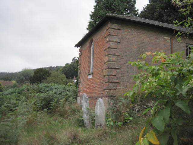
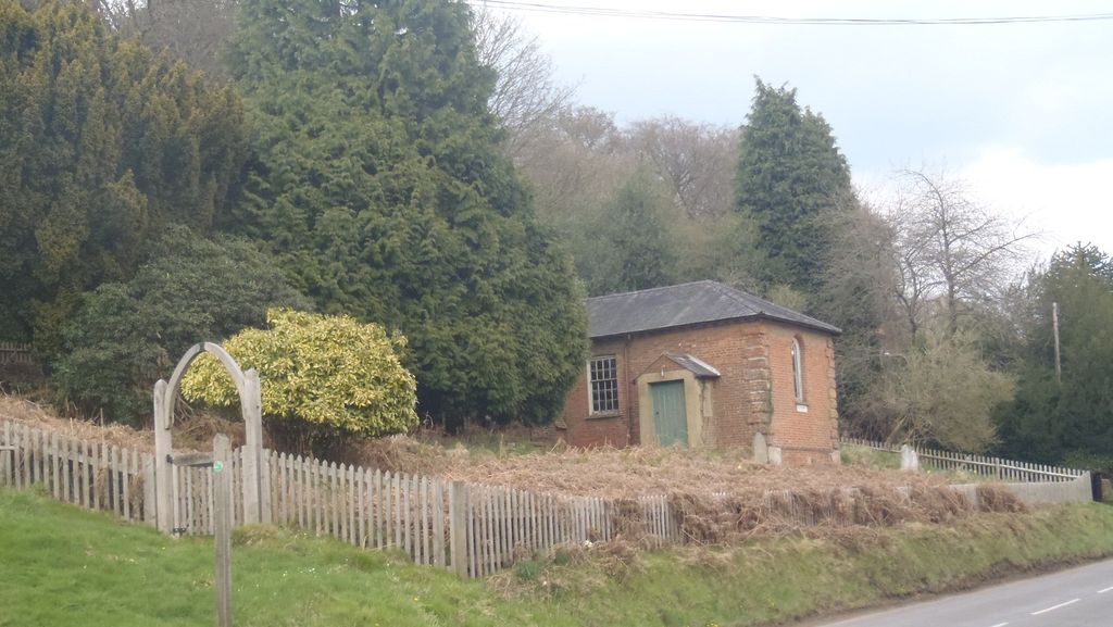
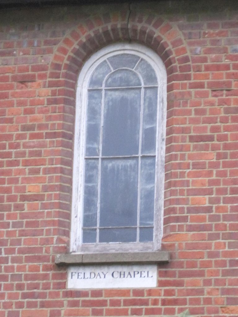
Where is Felday Chapel?
Felday Chapel is located at Holmbury St Mary, Mole Valley District ,Surrey ,England.
-
Felday Chapel cemetery's updated grave count on graveviews.com?
0 memorials
-
Where are the coordinates of the Felday Chapel?
Latitude: 51.1900360
Longitude: -0.4129370
Nearby Cemetories:
1. St Mary the Virgin Churchyard
Holmbury St Mary, Mole Valley District, England
Coordinate: 51.1882600, -0.4130600
2. St James Churchyard
Abinger, Mole Valley District, England
Coordinate: 51.2017820, -0.4056060
3. St John the Evangelist Churchyard
Wotton, Mole Valley District, England
Coordinate: 51.2198770, -0.3895890
4. Christ Church Churchyard
Coldharbour, Mole Valley District, England
Coordinate: 51.1807050, -0.3576190
5. St Peter & St Paul Churchyard
Ewhurst, Waverley Borough, England
Coordinate: 51.1530910, -0.4409600
6. St. James' Churchyard
Shere, Guildford Borough, England
Coordinate: 51.2191210, -0.4634830
7. Holy Trinity Churchyard, Westcott
Dorking, Mole Valley District, England
Coordinate: 51.2236075, -0.3694870
8. Old St Peter and St Paul Churchyard
Albury, Guildford Borough, England
Coordinate: 51.2199300, -0.4788890
9. Ockley Cemetery
Ockley, Mole Valley District, England
Coordinate: 51.1473610, -0.3654400
10. St Margaret Churchyard
Ockley, Mole Valley District, England
Coordinate: 51.1534880, -0.3473790
11. St Mary Magdalene Churchyard
South Holmwood, Mole Valley District, England
Coordinate: 51.1904660, -0.3243540
12. St Peter and St Paul Churchyard
Albury, Guildford Borough, England
Coordinate: 51.2181500, -0.4974400
13. St John the Baptist Churchyard
Oakwoodhill, Mole Valley District, England
Coordinate: 51.1304600, -0.3895700
14. Okewood St John the Baptist Churchyard
Ewhurst, Waverley Borough, England
Coordinate: 51.1303800, -0.3895000
15. St. Barnabas Churchyard
Ranmore Common, Mole Valley District, England
Coordinate: 51.2419730, -0.3602730
16. Cranleigh Cemetery
Cranleigh, Waverley Borough, England
Coordinate: 51.1432100, -0.4845330
17. Oakfield Wood
Shamley Green, Waverley Borough, England
Coordinate: 51.1670718, -0.5115667
18. St Martin Churchyard
Dorking, Mole Valley District, England
Coordinate: 51.2326360, -0.3320140
19. St Nicolas Churchyard
Cranleigh, Waverley Borough, England
Coordinate: 51.1408830, -0.4860670
20. St. John the Baptist Churchyard
Capel, Mole Valley District, England
Coordinate: 51.1539730, -0.3201980
21. Capel Friends Burial Ground #2
Capel, Mole Valley District, England
Coordinate: 51.1513970, -0.3219210
22. Christ Church Churchyard
Shamley Green, Waverley Borough, England
Coordinate: 51.1807110, -0.5228360
23. Deepdene Mausoleum
Dorking, Mole Valley District, England
Coordinate: 51.2307590, -0.3206630
24. Polesden Lacey Estate
Great Bookham, Mole Valley District, England
Coordinate: 51.2591310, -0.3718630