
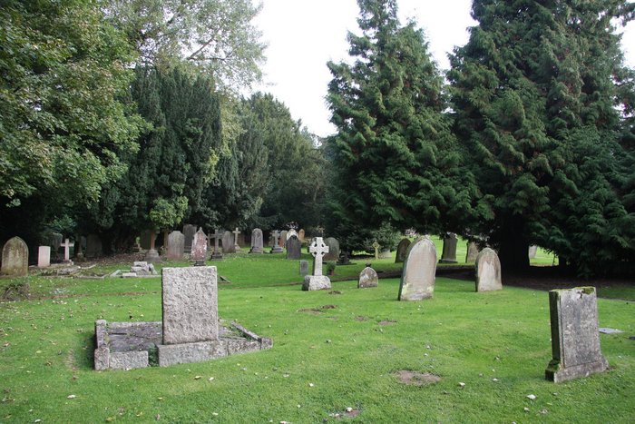
| Memorials | : | 1 |
| Location | : | Shere, Guildford Borough, England |
| Website | : | www.parishofshere.com |
| Coordinate | : | 51.2191210, -0.4634830 |
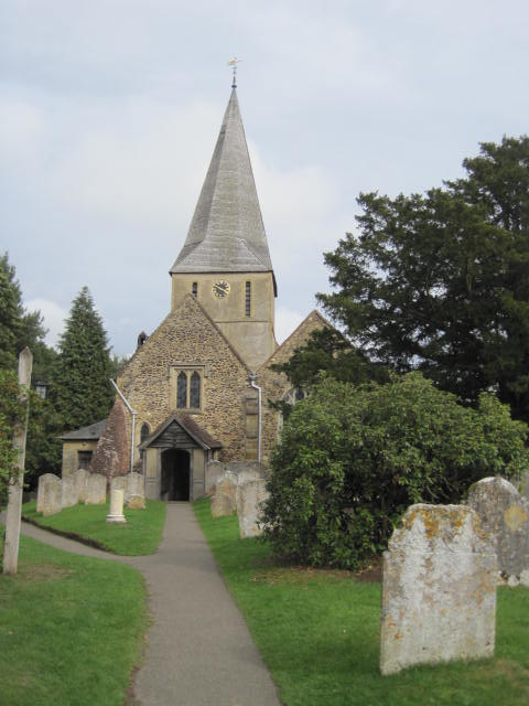
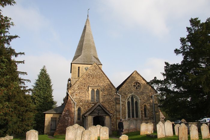
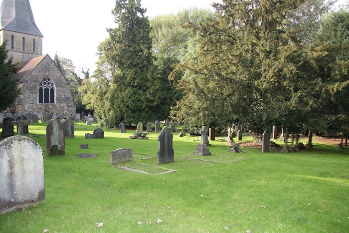
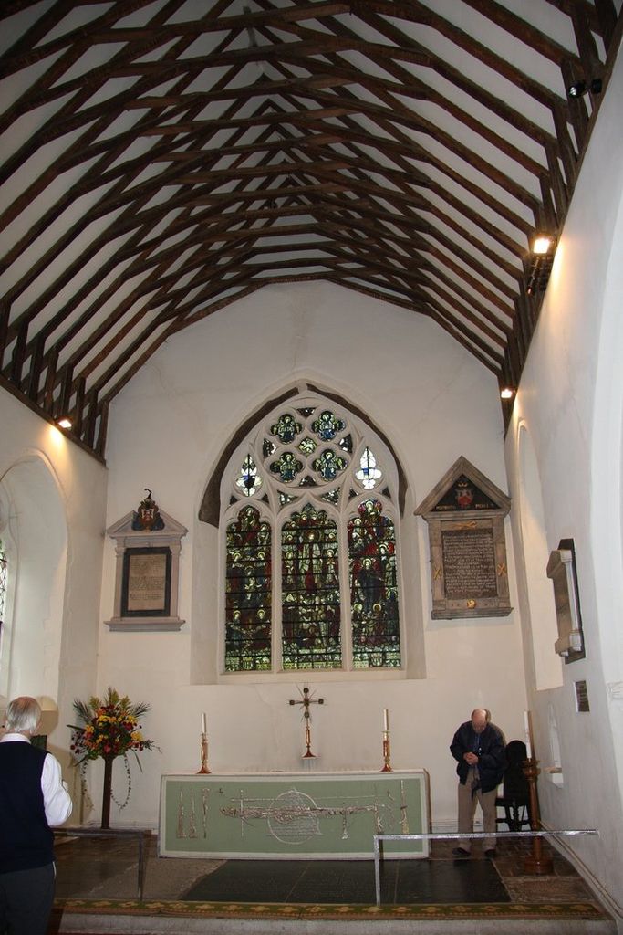
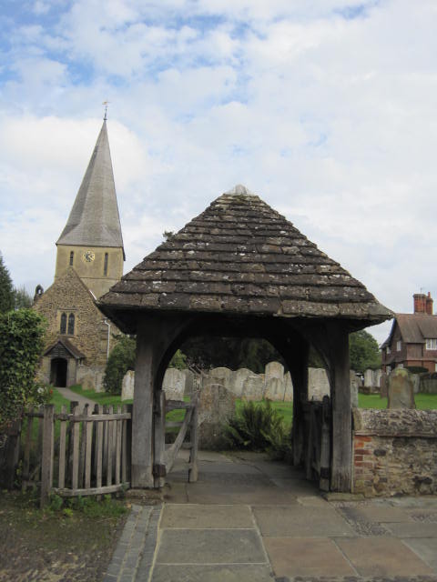
| Description | : | The village Church of St James dates from the 12th century and was tastefully restored in the 1950s. Among its many noteworthy features are the 13th-century Purbeck marble font, the St Nicholas Chapel, and an unusual hermit's cell built in the 14th century for a local woman who asked to be confined there for life. The churchyard is entered through an impressive lych gate designed by Lutyens. |
frequently asked questions (FAQ):
-
Where is St. James' Churchyard?
St. James' Churchyard is located at Church Lane Shere, Guildford Borough ,Surrey ,England.
-
St. James' Churchyard cemetery's updated grave count on graveviews.com?
1 memorials
-
Where are the coordinates of the St. James' Churchyard?
Latitude: 51.2191210
Longitude: -0.4634830


Nearby Cemetories:
1. Old St Peter and St Paul Churchyard
Albury, Guildford Borough, England
Coordinate: 51.2199300, -0.4788890
2. St Peter and St Paul Churchyard
Albury, Guildford Borough, England
Coordinate: 51.2181500, -0.4974400
3. St James Churchyard
Abinger, Mole Valley District, England
Coordinate: 51.2017820, -0.4056060
4. St. Peter & St. Paul's Churchyard
West Clandon, Guildford Borough, England
Coordinate: 51.2507990, -0.5053760
5. St Martha-on-the-Hill Churchyard
Chilworth, Guildford Borough, England
Coordinate: 51.2246400, -0.5290440
6. Ss Peter & Paul Church Cemetery
West Clandon, Guildford Borough, England
Coordinate: 51.2517500, -0.5045400
7. Felday Chapel
Holmbury St Mary, Mole Valley District, England
Coordinate: 51.1900360, -0.4129370
8. St Mary the Virgin Churchyard
Holmbury St Mary, Mole Valley District, England
Coordinate: 51.1882600, -0.4130600
9. St Mary Churchyard
West Horsley, Guildford Borough, England
Coordinate: 51.2622470, -0.4417370
10. St John the Evangelist Churchyard
Wotton, Mole Valley District, England
Coordinate: 51.2198770, -0.3895890
11. St John the Evangelist Churchyard
Merrow, Guildford Borough, England
Coordinate: 51.2459770, -0.5271350
12. St. Martin's Churchyard
East Horsley, Guildford Borough, England
Coordinate: 51.2638550, -0.4314040
13. Christ Church Churchyard
Shamley Green, Waverley Borough, England
Coordinate: 51.1807110, -0.5228360
14. St. John the Baptist Churchyard
Wonersh, Waverley Borough, England
Coordinate: 51.1960610, -0.5493600
15. Holy Trinity Churchyard, Westcott
Dorking, Mole Valley District, England
Coordinate: 51.2236075, -0.3694870
16. Oakfield Wood
Shamley Green, Waverley Borough, England
Coordinate: 51.1670718, -0.5115667
17. Bramley Cemetery
Bramley, Waverley Borough, England
Coordinate: 51.1894900, -0.5544700
18. Shalford Cemetery
Shalford, Guildford Borough, England
Coordinate: 51.2152000, -0.5687000
19. St Lawrence Churchyard
Effingham, Guildford Borough, England
Coordinate: 51.2712010, -0.3984180
20. St Mary the Virgin Churchyard
Shalford, Guildford Borough, England
Coordinate: 51.2206700, -0.5705520
21. St Peter & St Paul Churchyard
Ewhurst, Waverley Borough, England
Coordinate: 51.1530910, -0.4409600
22. St. Barnabas Churchyard
Ranmore Common, Mole Valley District, England
Coordinate: 51.2419730, -0.3602730
23. Holy Trinity Church
Guildford, Guildford Borough, England
Coordinate: 51.2357740, -0.5705540
24. Society of Friends Burial Ground (Defunct)
Guildford, Guildford Borough, England
Coordinate: 51.2364500, -0.5703050