
| Memorials | : | 0 |
| Location | : | Wales |
| Website | : | www.coflein.gov.uk/en/site/8419/details/welsh-baptist-chapel-pandyr-capel |
| Coordinate | : | 53.0432473, -3.3628675 |
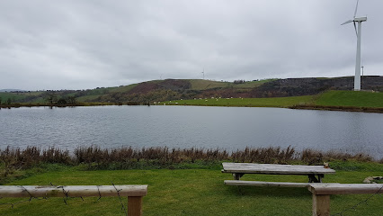
| Description | : | Chapel is now in private hands and no longer holds religious ceremonies. Formerly a Baptist Chapel built in 1826. Further information can be found at: https://www.coflein.gov.uk/en/site/8419/details/welsh-baptist-chapel-pandyr-capel |
frequently asked questions (FAQ):
-
Where is Pandyr Capel?
Pandyr Capel is located at A494 road between Bryn Saith Marchog and Pwllglas, Denbighshire Denbighshire , LL21 9SBWales.
-
Pandyr Capel cemetery's updated grave count on graveviews.com?
0 memorials
-
Where are the coordinates of the Pandyr Capel?
Latitude: 53.0432473
Longitude: -3.3628675
Nearby Cemetories:
1. St. Garmon's Churchyard
Wales
Coordinate: 53.0965000, -3.2100000
2. St Saeran's Church Cemetery
Wales
Coordinate: 53.1536000, -3.3425400
3. St James' Church Cemetery Prion
Wales
Coordinate: 53.1498340, -3.4175000
4. Pentrefoelas Parish Church
Wales
Coordinate: 53.0488440, -3.6826890
5. St. Paul's Churchyard Rhosesmor Caerfallwch
Wales
Coordinate: 53.2096200, -3.1775400
6. British Cemetery
Mar del Plata, Partido de General Pueyrredón, Argentina
Coordinate: 53.0386111, -3.0052778
7. St. Barnabas Churchyard
Hengoed, Shropshire Unitary Authority, England
Coordinate: 52.8883855, -3.0562708
8. Preeshenlle United Reformed Churchyard
Gobowen, Shropshire Unitary Authority, England
Coordinate: 52.8991040, -3.0356200
9. St Mary's Churchyard Dudleston
Ellesmere, Shropshire Unitary Authority, England
Coordinate: 52.9392780, -2.9745280
10. St. Mary's Churchyard
Dodleston, Cheshire West and Chester Unitary Authority, England
Coordinate: 53.1416500, -2.9553200
11. St. Mary's Churchyard
Pulford, Cheshire West and Chester Unitary Authority, England
Coordinate: 53.1223900, -2.9351000
12. St. Matthew's Churchyard
Ellesmere Rural, Shropshire Unitary Authority, England
Coordinate: 52.9240135, -2.9467180
13. St. Chad's Churchyard
Farndon, Cheshire West and Chester Unitary Authority, England
Coordinate: 53.0840000, -2.8774000
14. St. Michael's Churchyard
Shotwick Park, Cheshire West and Chester Unitary Authority, England
Coordinate: 53.2388600, -2.9947400
15. St Nicholas Churchyard
Burton, Cheshire West and Chester Unitary Authority, England
Coordinate: 53.2616430, -3.0251070
16. Saughall Churches of Christ Grove Chapel
Saughall, Cheshire West and Chester Unitary Authority, England
Coordinate: 53.2218900, -2.9583300
17. Saint Winefride Churchyard
Little Neston, Cheshire West and Chester Unitary Authority, England
Coordinate: 53.2849200, -3.0592100
18. Ebenezer Primitive Methodist Churchyard
Saughall, Cheshire West and Chester Unitary Authority, England
Coordinate: 53.2232500, -2.9574500
19. St Mary and St Helen Neston
Neston, Cheshire West and Chester Unitary Authority, England
Coordinate: 53.2892600, -3.0640600
20. All Saints Churchyard
Saughall, Cheshire West and Chester Unitary Authority, England
Coordinate: 53.2271271, -2.9550779
21. St. John The Baptist Churchyard
Aldford, Cheshire West and Chester Unitary Authority, England
Coordinate: 53.1285900, -2.8698900
22. St Edith Churchyard
Shocklach, Cheshire West and Chester Unitary Authority, England
Coordinate: 53.0457000, -2.8487100
23. Neston Cemetery
Neston, Cheshire West and Chester Unitary Authority, England
Coordinate: 53.2943100, -3.0571400
24. St Mary the Virgin Churchyard
Eccleston, Cheshire West and Chester Unitary Authority, England
Coordinate: 53.1570100, -2.8792600