
| Memorials | : | 4 |
| Location | : | Pilot Hill, El Dorado County, USA |
| Coordinate | : | 38.8301010, -121.0093307 |
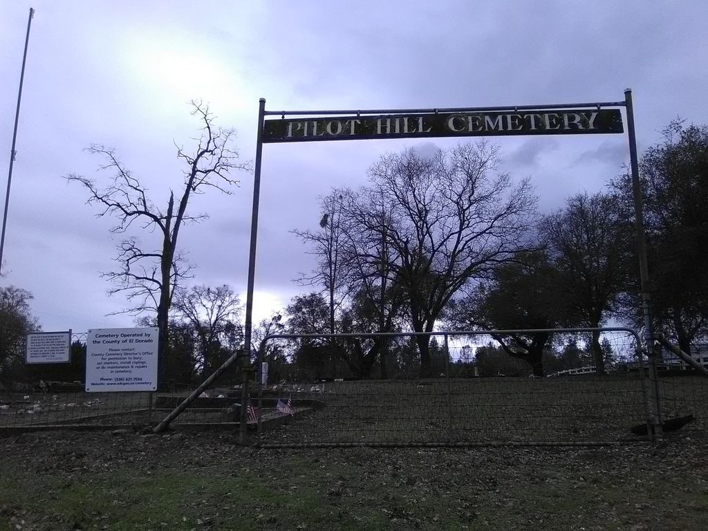
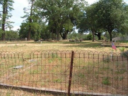
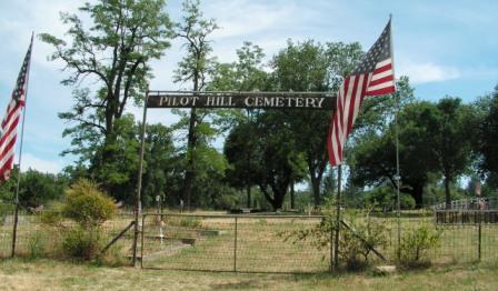
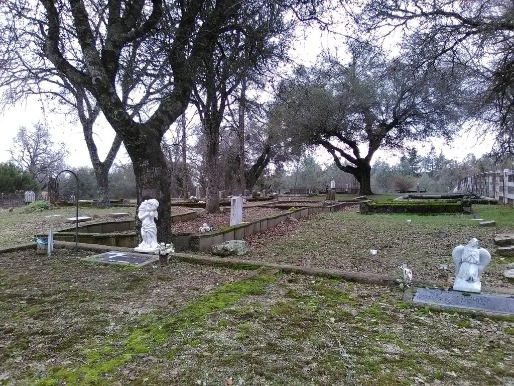
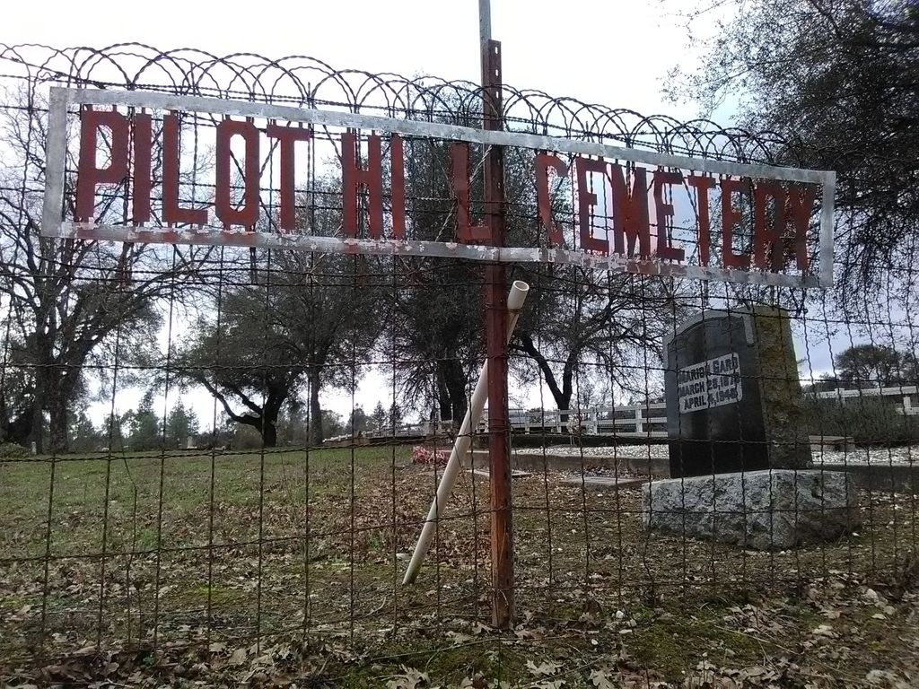
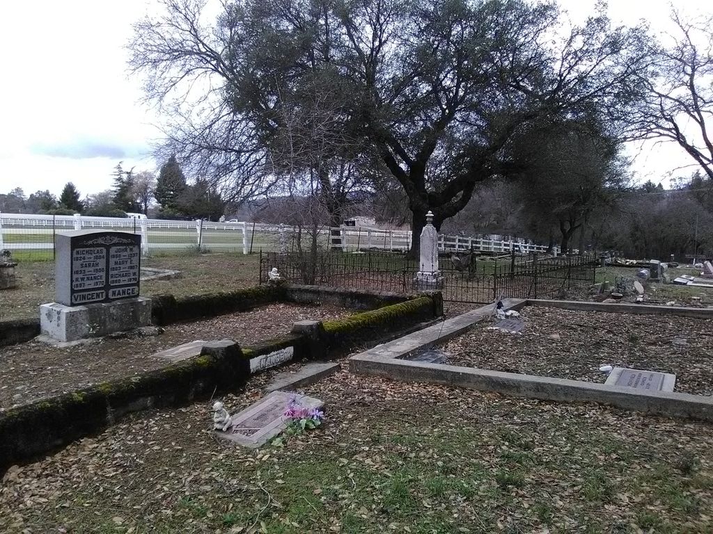
| Description | : | Pilot Hill Cemetery, also known as Centerville Cemetery, was established in 1850 for the community of Centerville located near in what is now known as the town of Pilot Hill. The Pilot Hill Cemetery was established during the beginning of the Gold Rush. There were many miners and growing communities in this region. While the first recorded burial was in 1850, it is possible that this area was used for burials before that time. In 2002, the property was deeded to El Dorado County and assumed maintenance and operations responsibility. There are two parts to this cemetery: The "old" cemetery has... Read More |
frequently asked questions (FAQ):
-
Where is Pilot Hill Cemetery?
Pilot Hill Cemetery is located at 4781 Pedro Hill Road Pilot Hill, El Dorado County ,California ,USA.
-
Pilot Hill Cemetery cemetery's updated grave count on graveviews.com?
3 memorials
-
Where are the coordinates of the Pilot Hill Cemetery?
Latitude: 38.8301010
Longitude: -121.0093307
Nearby Cemetories:
1. Bayley Family Cemetery
Pilot Hill, El Dorado County, USA
Coordinate: 38.8438800, -121.0148900
2. Rattlesnake Bar Graveyard
Auburn, Placer County, USA
Coordinate: 38.8163050, -121.0895100
3. Maidu Indian Burial Grounds
Auburn, Placer County, USA
Coordinate: 38.8744350, -121.0777290
4. Bethlehem Lutheran Church Columbarium
Auburn, Placer County, USA
Coordinate: 38.8932350, -121.0749690
5. Uniontown Cemetery
Lotus, El Dorado County, USA
Coordinate: 38.7994003, -120.9111023
6. Indian Creek Cemetery
Coloma, El Dorado County, USA
Coordinate: 38.7974230, -120.9104530
7. Clark Ashton Smith Gravesite
Auburn, Placer County, USA
Coordinate: 38.8952100, -121.0770500
8. Mansur Family Cemetery
Loomis, Placer County, USA
Coordinate: 38.8139600, -121.1214000
9. Placer County Hospital Cemetery
Auburn, Placer County, USA
Coordinate: 38.9045120, -121.0721320
10. Old Auburn Cemetery
Auburn, Placer County, USA
Coordinate: 38.9023720, -121.0812230
11. New Auburn Cemetery
Auburn, Placer County, USA
Coordinate: 38.9026900, -121.0870800
12. First Congregational Church Memorial Garden
Auburn, Placer County, USA
Coordinate: 38.9118660, -121.0711770
13. James Marshall Monument and Gravesite
Coloma, El Dorado County, USA
Coordinate: 38.7963104, -120.8953781
14. Prosser Family Cemetery
Loomis, Placer County, USA
Coordinate: 38.8071900, -121.1285600
15. Saint John's Catholic Churchyard
Coloma, El Dorado County, USA
Coordinate: 38.7975311, -120.8919678
16. Pioneer Cemetery
Coloma, El Dorado County, USA
Coordinate: 38.7943192, -120.8894577
17. Georgetown-Renke Cemetery Annex
Georgetown, El Dorado County, USA
Coordinate: 38.8964610, -120.9116240
18. Greenwood Pioneer Cemetery
Greenwood, El Dorado County, USA
Coordinate: 38.8985786, -120.9099274
19. Alabama Flat Cemetery
Garden Valley, El Dorado County, USA
Coordinate: 38.8413660, -120.8770510
20. Chinese Cemetery
Auburn, Placer County, USA
Coordinate: 38.9183502, -121.0802383
21. Jayhawk Cemetery
Rescue, El Dorado County, USA
Coordinate: 38.7308006, -120.9627991
22. Stewarts Flat Cemetery
Penryn, Placer County, USA
Coordinate: 38.8447360, -121.1507950
23. Ophir Cemetery
Placer County, USA
Coordinate: 38.8928870, -121.1273790
24. Newcastle Cemetery
Newcastle, Placer County, USA
Coordinate: 38.8708880, -121.1444060