
| Memorials | : | 963 |
| Location | : | Auburn, Placer County, USA |
| Coordinate | : | 38.9045120, -121.0721320 |
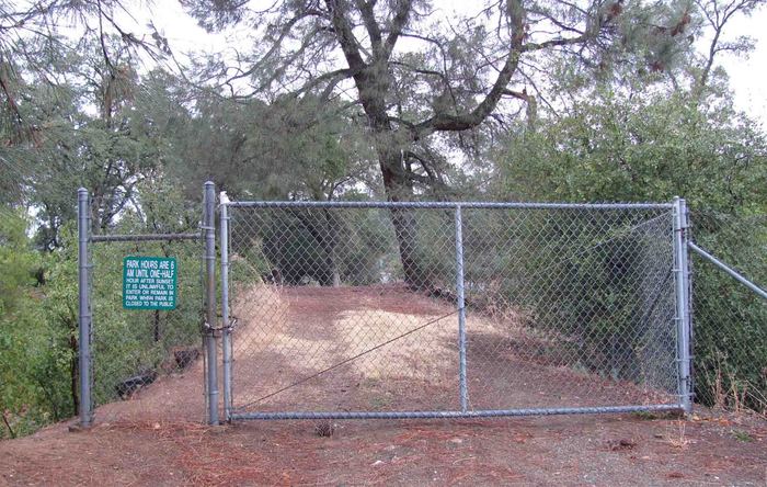
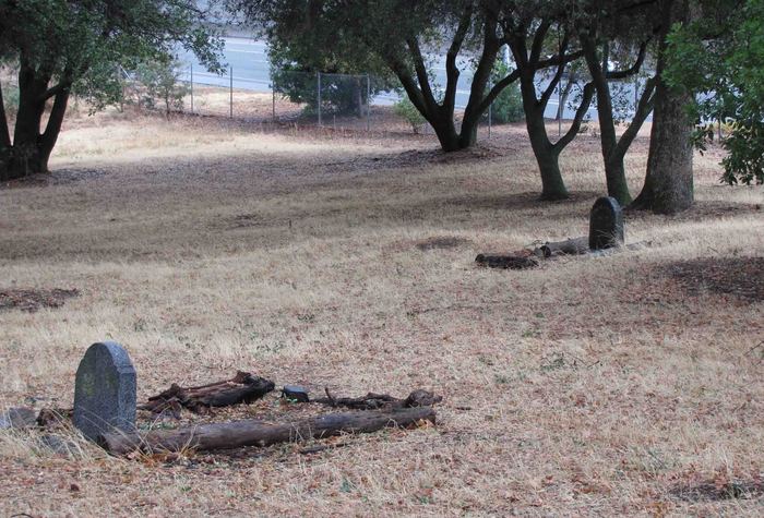
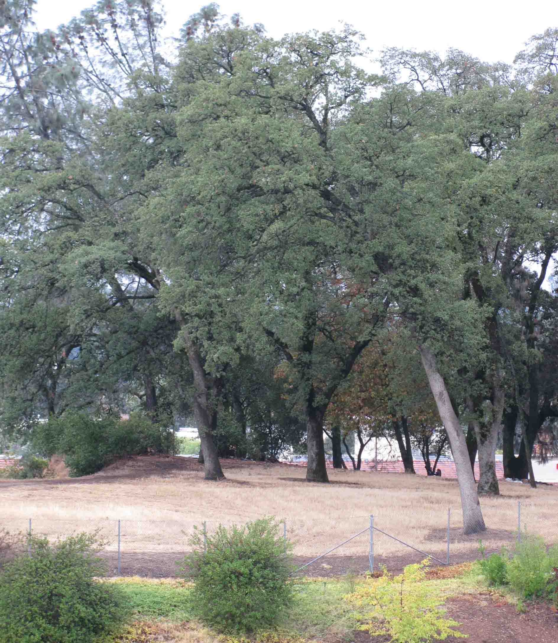
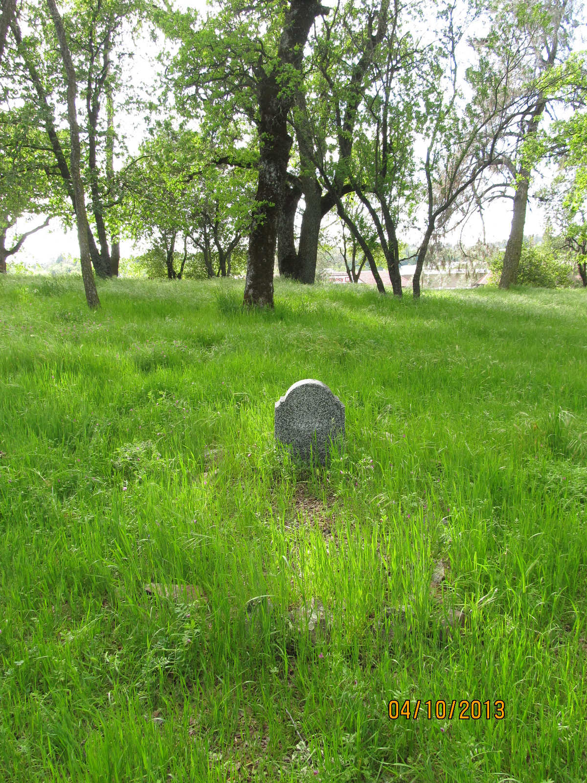
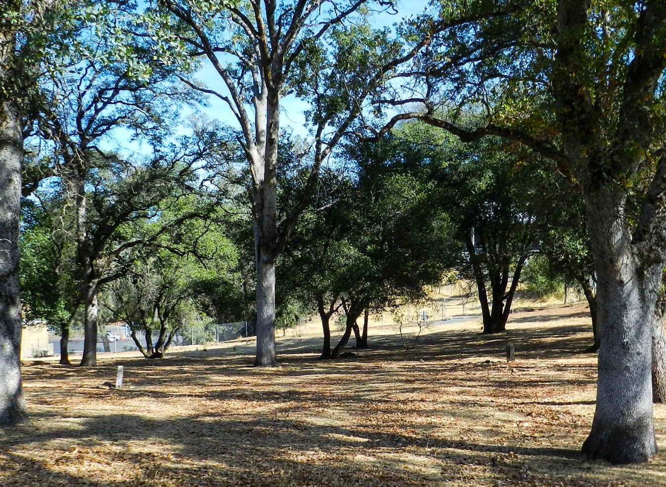
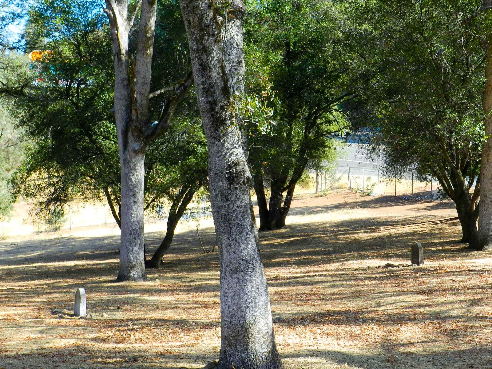
| Description | : | TWO HEADSTONES HAVE BEEN POSTED - ALL OTHERS UNMARKED No way to find a gravesites. Currently being worked on by local historian. This is not part of the Auburn Cemetery District. They have no records at their office. Not all who were interned at the cemetery were without funds or family. During the early days of Auburn, the transient nature of the patients before reaching the hospital made it difficult to trace relatives and turn over the decedent's personal property to the next of kin. This cemetery in the fields beyond the old hospital has not been used for almost 100 years. Indigents... Read More |
frequently asked questions (FAQ):
-
Where is Placer County Hospital Cemetery?
Placer County Hospital Cemetery is located at Elm Avenue & Highway 80 - Behind Wells Fargo Bank Auburn, Placer County ,California , 95602USA.
-
Placer County Hospital Cemetery cemetery's updated grave count on graveviews.com?
963 memorials
-
Where are the coordinates of the Placer County Hospital Cemetery?
Latitude: 38.9045120
Longitude: -121.0721320
Nearby Cemetories:
1. Old Auburn Cemetery
Auburn, Placer County, USA
Coordinate: 38.9023720, -121.0812230
2. First Congregational Church Memorial Garden
Auburn, Placer County, USA
Coordinate: 38.9118660, -121.0711770
3. Clark Ashton Smith Gravesite
Auburn, Placer County, USA
Coordinate: 38.8952100, -121.0770500
4. Bethlehem Lutheran Church Columbarium
Auburn, Placer County, USA
Coordinate: 38.8932350, -121.0749690
5. New Auburn Cemetery
Auburn, Placer County, USA
Coordinate: 38.9026900, -121.0870800
6. Chinese Cemetery
Auburn, Placer County, USA
Coordinate: 38.9183502, -121.0802383
7. Maidu Indian Burial Grounds
Auburn, Placer County, USA
Coordinate: 38.8744350, -121.0777290
8. Ophir Cemetery
Placer County, USA
Coordinate: 38.8928870, -121.1273790
9. Newcastle Cemetery
Newcastle, Placer County, USA
Coordinate: 38.8708880, -121.1444060
10. Wells Cemetery
Auburn, Placer County, USA
Coordinate: 38.9667000, -121.1054900
11. Bayley Family Cemetery
Pilot Hill, El Dorado County, USA
Coordinate: 38.8438800, -121.0148900
12. Clipper Gap Cemetery
Clipper Gap, Placer County, USA
Coordinate: 38.9784880, -121.0256590
13. Gold Hill Cemetery
Gold Hill, Placer County, USA
Coordinate: 38.9025000, -121.1802200
14. Stewarts Flat Cemetery
Penryn, Placer County, USA
Coordinate: 38.8447360, -121.1507950
15. Lone Star Cemetery
Placer County, USA
Coordinate: 38.9757996, -121.1380997
16. Pilot Hill Cemetery
Pilot Hill, El Dorado County, USA
Coordinate: 38.8301010, -121.0093307
17. Rattlesnake Bar Graveyard
Auburn, Placer County, USA
Coordinate: 38.8163050, -121.0895100
18. Mansur Family Cemetery
Loomis, Placer County, USA
Coordinate: 38.8139600, -121.1214000
19. Prosser Family Cemetery
Loomis, Placer County, USA
Coordinate: 38.8071900, -121.1285600
20. Esoteric Fraternity Cemetery
Applegate, Placer County, USA
Coordinate: 38.9946190, -120.9687490
21. Georgetown-Renke Cemetery Annex
Georgetown, El Dorado County, USA
Coordinate: 38.8964610, -120.9116240
22. Greenwood Pioneer Cemetery
Greenwood, El Dorado County, USA
Coordinate: 38.8985786, -120.9099274
23. Spanish Dry Diggings Cemetery
Greenwood, El Dorado County, USA
Coordinate: 38.9431600, -120.9158000
24. Weimar Sanatorium Cemetery
Weimar, Placer County, USA
Coordinate: 39.0350200, -120.9834400