
| Memorials | : | 0 |
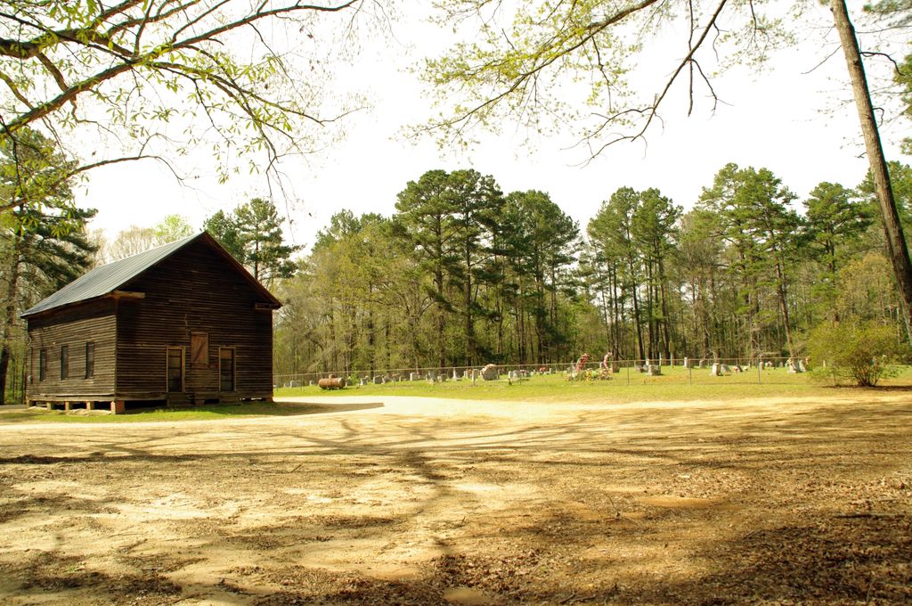
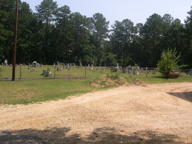
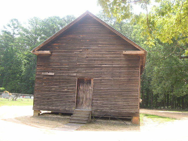
| Location | : | Polkville, Smith County, USA |
| Coordinate | : | 32.2161200, -89.6676300 |
| Description | : | From Polksville, MS proceed North on Mississippi Highway 13 (MS 13) for two tenths of a mile to the intersection of Smith County Road 538 (SCR 538.) Make a slight Right turn (Northeast) onto SCR 538 and continue 1.4 miles to the intersection of Smith County Road 538E (SCR 538E.) Turn Left (North) onto SCR 538E and proceed six tenths of a mile, cemetery is on the Right (East) side of road, specifically NW1/4 SE1/4, S3, T4N-R6E, Smith, Polkville Quadrangle map, USNG 16S BA 48591 67472. |
frequently asked questions (FAQ):
-
Where is Piney Grove Cemetery?
Piney Grove Cemetery is located at Smith County Road 538E Polkville, Smith County ,Mississippi , 39117USA.
-
Piney Grove Cemetery cemetery's updated grave count on graveviews.com?
0 memorials
-
Where are the coordinates of the Piney Grove Cemetery?
Latitude: 32.2161200
Longitude: -89.6676300
Nearby Cemetories:
1. Polkville Pentecostal Cemetery
Polkville, Smith County, USA
Coordinate: 32.2097100, -89.6709600
2. Jack Gray Family Cemetery
Polkville, Smith County, USA
Coordinate: 32.1933920, -89.6725290
3. Hailes Cemetery
Polkville, Smith County, USA
Coordinate: 32.1911011, -89.6605988
4. Polkville Baptist Church Cemetery
Polkville, Smith County, USA
Coordinate: 32.1917700, -89.6925200
5. Old Polkville Cemetery
Polkville, Smith County, USA
Coordinate: 32.1882500, -89.7028600
6. Old Stubbs Cemetery
Polkville, Smith County, USA
Coordinate: 32.1876900, -89.7033900
7. Oak Grove Church of God Cemetery
Raleigh, Smith County, USA
Coordinate: 32.1742210, -89.6655850
8. Cooperville Baptist Church Cemetery
Scott County, USA
Coordinate: 32.2403200, -89.7118450
9. Springfield Baptist Church Cemetery
Morton, Scott County, USA
Coordinate: 32.2680700, -89.6573100
10. Mount Olive Primitive Baptist Cemetery
Morton, Scott County, USA
Coordinate: 32.2680300, -89.6877200
11. Concord Cemetery
Pelahatchie, Rankin County, USA
Coordinate: 32.2206001, -89.7391968
12. Independence Methodist Church Cemetery
Independence, Scott County, USA
Coordinate: 32.2810500, -89.6555400
13. New Goodhope Baptist Cemetery
Pulaski, Scott County, USA
Coordinate: 32.2314030, -89.5920360
14. Searcy Cemetery
Pulaski, Scott County, USA
Coordinate: 32.2608200, -89.6004700
15. James Cemetery
Smith County, USA
Coordinate: 32.1516900, -89.7069400
16. Walters Grove Cemetery
Pelahatchie, Rankin County, USA
Coordinate: 32.1831300, -89.7467100
17. New Chapel Cemetery
Smith County, USA
Coordinate: 32.1710100, -89.5944800
18. Warrens Cemetery
Pulaski, Scott County, USA
Coordinate: 32.2570700, -89.5885500
19. Black Cemetery
Smith County, USA
Coordinate: 32.2098070, -89.5739170
20. Zion Cemetery
Smith County, USA
Coordinate: 32.1689700, -89.5918000
21. Pulaski Cemetery
Pulaski, Scott County, USA
Coordinate: 32.2744300, -89.6032100
22. New Prospect Cemetery
Brandon, Rankin County, USA
Coordinate: 32.1574900, -89.7320900
23. Lingle Cemetery
Lingle, Smith County, USA
Coordinate: 32.2091200, -89.5731800
24. Roberts Cemetery
Smith County, USA
Coordinate: 32.1968100, -89.5688000