
| Memorials | : | 0 |
| Location | : | Smith County, USA |
| Coordinate | : | 32.1968100, -89.5688000 |
| Description | : | From Raleigh, Mississippi take Highway 35 North 6.4 miles to the intersection of Highway 481 and turn left (West.) Continue on Hwy 481 8.7 miles to the intersection of Smith County Road 558 (SCR 558) and turn right (East.) Continue of SCR 558 1.5 miles to the intersection of Smith County Road 558-A (SCR 558-A.) Turn right (South East) onto SCR 558-A and proceed six tenths of a mile to the dirt driveway to the right (South) which serves as the Roberts cemetery entrance, specifically: SE1/4 SW1/4, S10, T4N-R7E, Smith, Homewood Quadrangle map, USNG: 16S BA 57856 65131. |
frequently asked questions (FAQ):
-
Where is Roberts Cemetery?
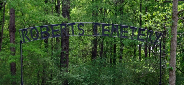
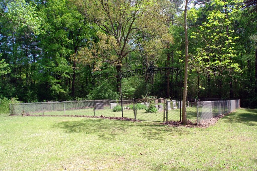
Roberts Cemetery is located at Smith County Road 558A Smith County ,Mississippi , 39152USA.
-
Roberts Cemetery cemetery's updated grave count on graveviews.com?
0 memorials
-
Where are the coordinates of the Roberts Cemetery?
Latitude: 32.1968100
Longitude: -89.5688000

Nearby Cemetories:
1. Lingle Cemetery
Lingle, Smith County, USA
Coordinate: 32.2091200, -89.5731800
2. Black Cemetery
Smith County, USA
Coordinate: 32.2098070, -89.5739170
3. Bethel Baptist Church Cemetery
Smith County, USA
Coordinate: 32.1830920, -89.5565660
4. Luther Chapel Lutheran Church Cemetery
Lingle, Smith County, USA
Coordinate: 32.2183500, -89.5443800
5. New Chapel Cemetery
Smith County, USA
Coordinate: 32.1710100, -89.5944800
6. Zion Cemetery
Smith County, USA
Coordinate: 32.1689700, -89.5918000
7. Gasque Chapel Cemetery
Smith County, USA
Coordinate: 32.1793540, -89.5297340
8. New Goodhope Baptist Cemetery
Pulaski, Scott County, USA
Coordinate: 32.2314030, -89.5920360
9. Good Hope Cemetery
Smith County, USA
Coordinate: 32.1613100, -89.5345100
10. Luther Chapel Cemetery
Pulaski, Scott County, USA
Coordinate: 32.2405100, -89.5511900
11. Derrick Cemetery
Smith County, USA
Coordinate: 32.1484800, -89.5742400
12. Lorena Baptist Church Extension Cemetery
Smith County, USA
Coordinate: 32.1976340, -89.5059530
13. Lorena Baptist Church Cemetery
Lorena, Smith County, USA
Coordinate: 32.1917890, -89.5061570
14. Warrens Cemetery
Pulaski, Scott County, USA
Coordinate: 32.2570700, -89.5885500
15. Providence Cemetery
Burns, Smith County, USA
Coordinate: 32.1357400, -89.5528600
16. Searcy Cemetery
Pulaski, Scott County, USA
Coordinate: 32.2608200, -89.6004700
17. Barber Cemetery
Raleigh, Smith County, USA
Coordinate: 32.1321810, -89.5385960
18. Burns Baptist Church Cemetery
Raleigh, Smith County, USA
Coordinate: 32.1321880, -89.5384430
19. Homewood Methodist Church Cemetery
Forest, Scott County, USA
Coordinate: 32.2410500, -89.5046000
20. Burns United Methodist Church Cemetery
Burns, Smith County, USA
Coordinate: 32.1310501, -89.5399399
21. Noblin Cemetery
Forest, Scott County, USA
Coordinate: 32.2310210, -89.4952380
22. Mount Mariah Missionary Baptist Church Cemetery
Pulaski, Scott County, USA
Coordinate: 32.2686700, -89.5760100
23. Union Grove Cemetery
Smith County, USA
Coordinate: 32.1888520, -89.4801290
24. Brassell Cemetery
Pulaski, Scott County, USA
Coordinate: 32.2728004, -89.5849991