
| Memorials | : | 0 |
| Location | : | Smith County, USA |
| Coordinate | : | 32.1710100, -89.5944800 |
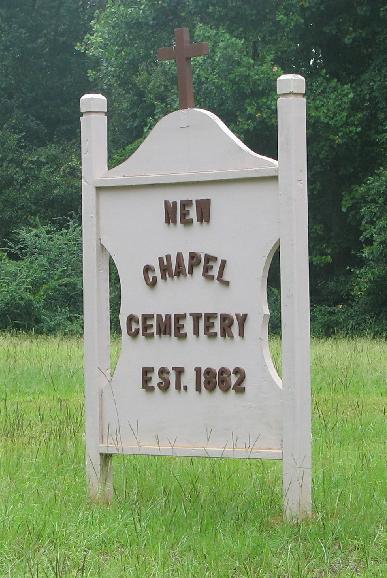
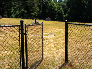
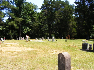
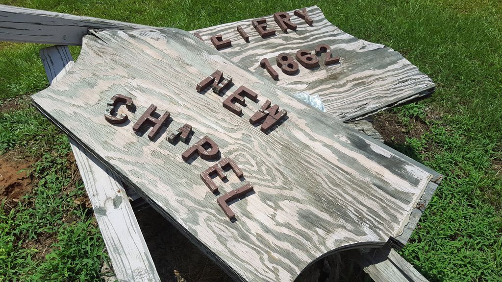
| Description | : | From Raleigh, MS proceed North on Mississippi Highway 35 (MS 35 aka Mimosa Drive 6.4 miles to the intersection of Mississippi Highway 481 (MS 481.) Turn Left (West) onto MS 481 and proceed 7 miles to the intersection of Smith County Road 559 (SCR 559.) Turn Right (East) onto SCR 559 and continue 1 mile, cemetery will be up a drive to the Left (North) specifically NE1/4 SE1/4, S20, T4N-R7E, Smith, Homewood Quadrangle map, USNG 16S BA 55311 62314. As of 10/14/2014 the wooden sign was no longer standing but the cemetery appeared to be maintained. |
frequently asked questions (FAQ):
-
Where is New Chapel Cemetery?
New Chapel Cemetery is located at 961 Smith County Road 559 Smith County ,Mississippi , 39152USA.
-
New Chapel Cemetery cemetery's updated grave count on graveviews.com?
0 memorials
-
Where are the coordinates of the New Chapel Cemetery?
Latitude: 32.1710100
Longitude: -89.5944800
Nearby Cemetories:
1. Zion Cemetery
Smith County, USA
Coordinate: 32.1689700, -89.5918000
2. Derrick Cemetery
Smith County, USA
Coordinate: 32.1484800, -89.5742400
3. Roberts Cemetery
Smith County, USA
Coordinate: 32.1968100, -89.5688000
4. Bethel Baptist Church Cemetery
Smith County, USA
Coordinate: 32.1830920, -89.5565660
5. Lingle Cemetery
Lingle, Smith County, USA
Coordinate: 32.2091200, -89.5731800
6. Black Cemetery
Smith County, USA
Coordinate: 32.2098070, -89.5739170
7. Moulder Cemetery
Smith County, USA
Coordinate: 32.1239014, -89.6007996
8. Providence Cemetery
Burns, Smith County, USA
Coordinate: 32.1357400, -89.5528600
9. Good Hope Cemetery
Smith County, USA
Coordinate: 32.1613100, -89.5345100
10. Gasque Chapel Cemetery
Smith County, USA
Coordinate: 32.1793540, -89.5297340
11. Hailes Cemetery
Polkville, Smith County, USA
Coordinate: 32.1911011, -89.6605988
12. Oak Grove Church of God Cemetery
Raleigh, Smith County, USA
Coordinate: 32.1742210, -89.6655850
13. New Goodhope Baptist Cemetery
Pulaski, Scott County, USA
Coordinate: 32.2314030, -89.5920360
14. Burns United Methodist Church Cemetery
Burns, Smith County, USA
Coordinate: 32.1310501, -89.5399399
15. Barber Cemetery
Raleigh, Smith County, USA
Coordinate: 32.1321810, -89.5385960
16. Burns Baptist Church Cemetery
Raleigh, Smith County, USA
Coordinate: 32.1321880, -89.5384430
17. Luther Chapel Lutheran Church Cemetery
Lingle, Smith County, USA
Coordinate: 32.2183500, -89.5443800
18. Moss Cemetery
Smith County, USA
Coordinate: 32.1063995, -89.5919037
19. Sardis Baptist Cemetery
Smith County, USA
Coordinate: 32.1202100, -89.6486300
20. Jack Gray Family Cemetery
Polkville, Smith County, USA
Coordinate: 32.1933920, -89.6725290
21. Steve Hughes Cemetery
Smith County, USA
Coordinate: 32.1073600, -89.6344000
22. Boykin Church Cemetery
Raleigh, Smith County, USA
Coordinate: 32.0985177, -89.5898151
23. Polkville Pentecostal Cemetery
Polkville, Smith County, USA
Coordinate: 32.2097100, -89.6709600
24. Gordan Cemetery
Raleigh, Smith County, USA
Coordinate: 32.0950012, -89.5935974