
| Memorials | : | 0 |
| Location | : | North Marston, Aylesbury Vale District, England |
| Coordinate | : | 51.8987110, -0.8828110 |
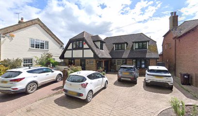
| Description | : | The church was opened on 7th Nov. 1839. It was converted into a private house in the early 1950, and renamed Chapel House. |
frequently asked questions (FAQ):
-
Where is Primitive Methodist Church Churchyard (Defunct)?
Primitive Methodist Church Churchyard (Defunct) is located at Quainton Road North Marston, Aylesbury Vale District ,Buckinghamshire , MK18 3PREngland.
-
Primitive Methodist Church Churchyard (Defunct) cemetery's updated grave count on graveviews.com?
0 memorials
-
Where are the coordinates of the Primitive Methodist Church Churchyard (Defunct)?
Latitude: 51.8987110
Longitude: -0.8828110
Nearby Cemetories:
1. St. Mary's Churchyard
North Marston, Aylesbury Vale District, England
Coordinate: 51.8971600, -0.8720400
2. All Saints Churchyard
Oving, Aylesbury Vale District, England
Coordinate: 51.8859230, -0.8644540
3. St John the Baptist Churchyard
Granborough, Aylesbury Vale District, England
Coordinate: 51.9180150, -0.8850860
4. St. Giles Churchyard
Pitchcott, Aylesbury Vale District, England
Coordinate: 51.8768733, -0.8750126
5. St. John the Baptist Churchyard
Hogshaw, Aylesbury Vale District, England
Coordinate: 51.8966960, -0.9297480
6. St. Mary and Holy Cross Churchyard
Quainton, Aylesbury Vale District, England
Coordinate: 51.8747440, -0.9116610
7. St. John the Evangelist Churchyard
Whitchurch, Aylesbury Vale District, England
Coordinate: 51.8806720, -0.8351220
8. St. Mary the Virgin Churchyard
East Claydon, Aylesbury Vale District, England
Coordinate: 51.9234470, -0.9254750
9. Holy Cross Churchyard
Hoggeston, Aylesbury Vale District, England
Coordinate: 51.9179220, -0.8260200
10. Swanbourne Cemetery
Swanbourne, Aylesbury Vale District, England
Coordinate: 51.9353700, -0.8349600
11. St Mary the Virgin with Weedon Churchyard
Hardwick, Aylesbury Vale District, England
Coordinate: 51.8636070, -0.8301330
12. St. Swithun's Churchyard
Swanbourne, Aylesbury Vale District, England
Coordinate: 51.9382920, -0.8362480
13. Middle Claydon Cemetery
Middle Claydon, Aylesbury Vale District, England
Coordinate: 51.9264680, -0.9504380
14. St Martin's churchyard
Dunton, Aylesbury Vale District, England
Coordinate: 51.9117610, -0.8038370
15. All Saints Churchyard
Middle Claydon, Aylesbury Vale District, England
Coordinate: 51.9214610, -0.9560130
16. St. Mary's Churchyard
Addington, Aylesbury Vale District, England
Coordinate: 51.9497100, -0.9206790
17. Weedon Methodist Chapelyard
Weedon, Aylesbury Vale District, England
Coordinate: 51.8554190, -0.8184970
18. St. Michael and All Angels Churchyard
Waddesdon, Aylesbury Vale District, England
Coordinate: 51.8464760, -0.9269500
19. St. Nicholas' Churchyard
Cublington, Aylesbury Vale District, England
Coordinate: 51.8918828, -0.7825741
20. Mursley Cemetery
Mursley, Aylesbury Vale District, England
Coordinate: 51.9483550, -0.8110360
21. St Mary the Virgin Churchyard
Mursley, Aylesbury Vale District, England
Coordinate: 51.9494170, -0.8125050
22. St. Michael Churchyard
Steeple Claydon, Aylesbury Vale District, England
Coordinate: 51.9345150, -0.9752060
23. St Marys Churchyard
Westcott, Aylesbury Vale District, England
Coordinate: 51.8482790, -0.9609600
24. Waddesdon Hill Strict Baptist Chapel Chapelyard
Waddesdon, Aylesbury Vale District, England
Coordinate: 51.8289880, -0.9083030