
| Memorials | : | 0 |
| Location | : | Waddesdon, Aylesbury Vale District, England |
| Coordinate | : | 51.8289880, -0.9083030 |
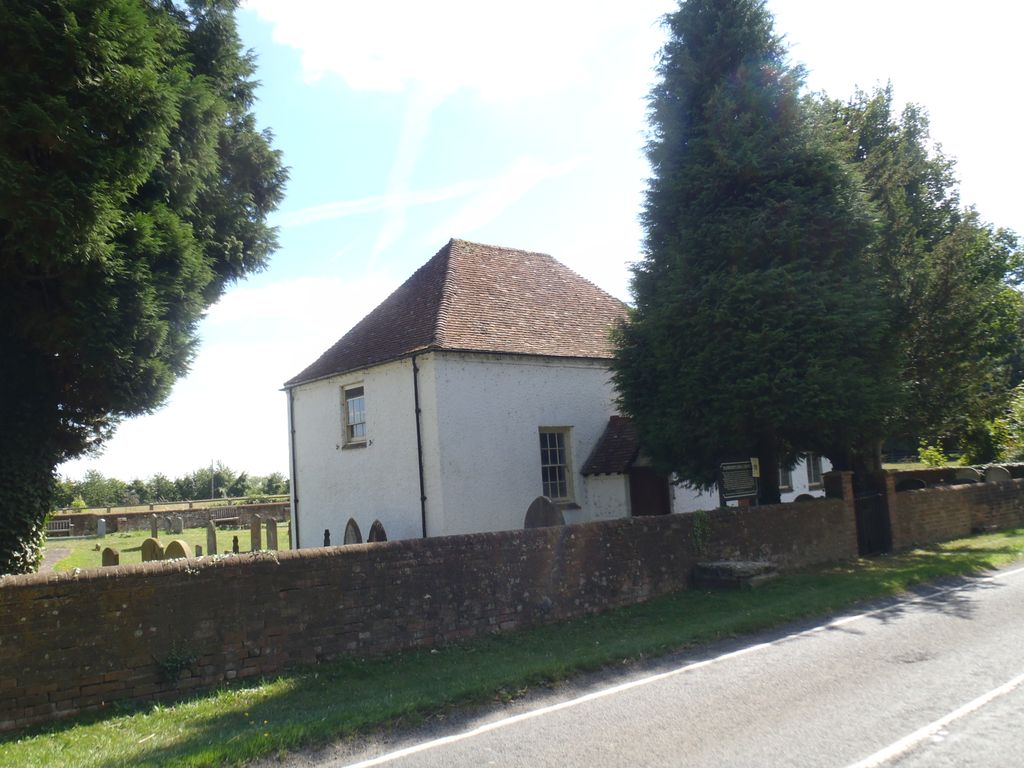
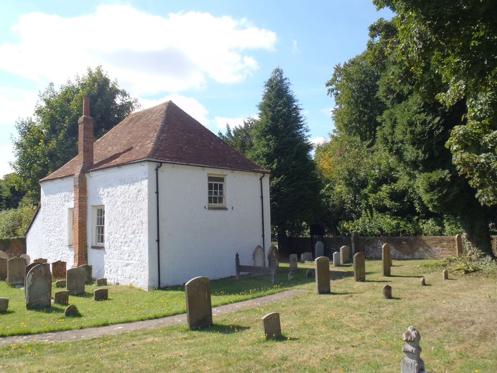
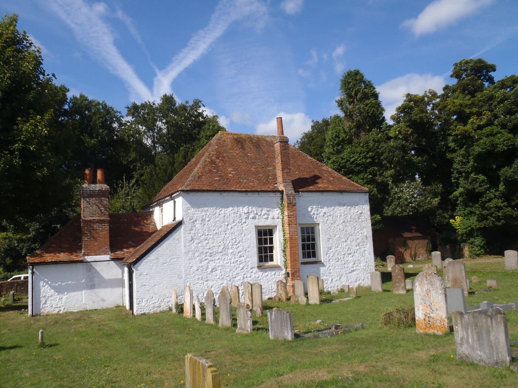
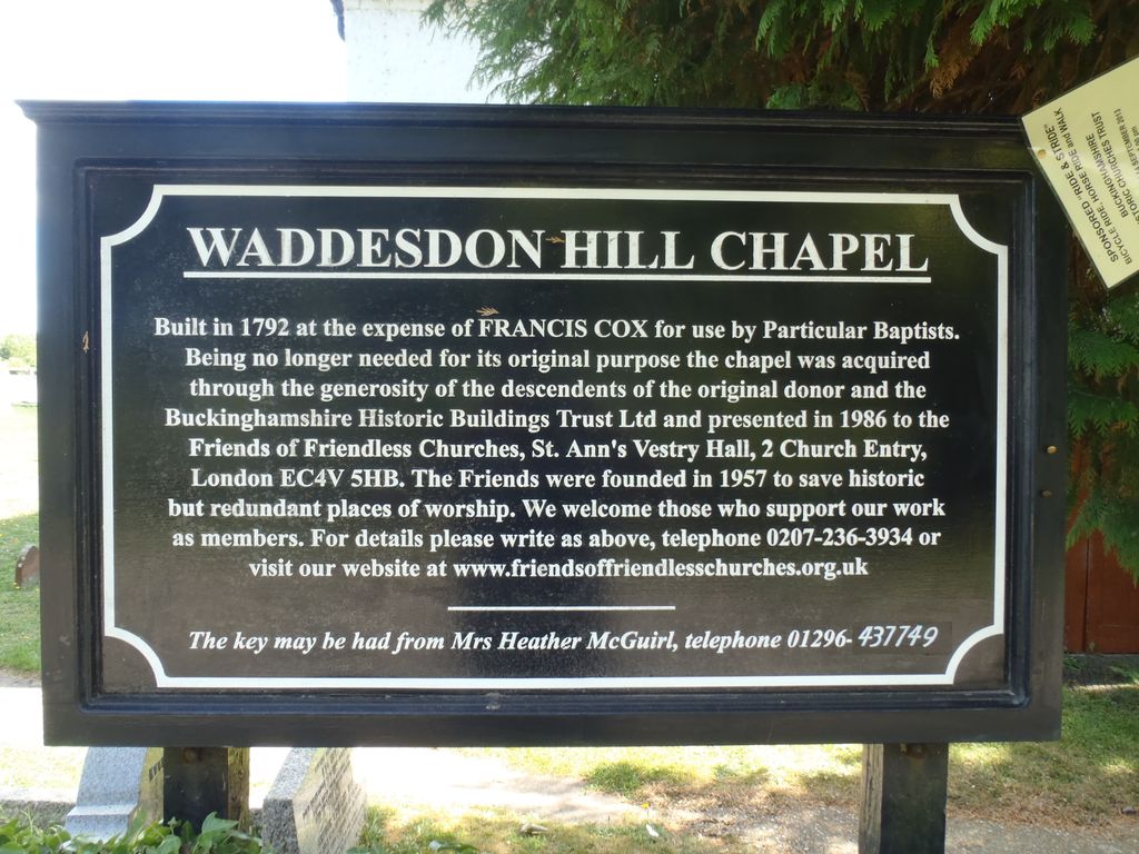
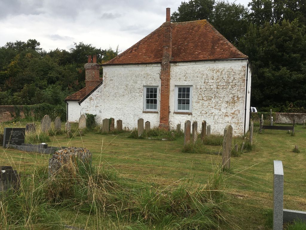
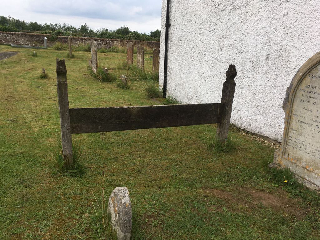
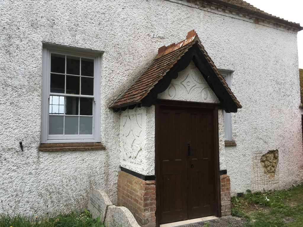
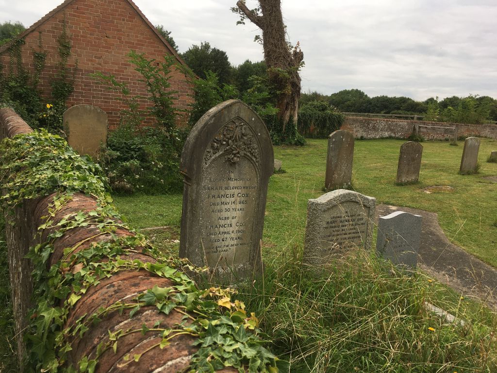
| Description | : | This is a former Strict Baptist chapel in Waddesdon Hill, near the village of Waddesdon, Buckinghamshire, England. The chapel was founded in 1792 by Francis Cox. A porch on the front of the chapel and an extension on the right side were added in the 19th century. It continued in use until it closed in 1976. It then came under the care of the charity the Friends of Friendless Churches. The charity holds its freehold dated 31 December 1986 |
frequently asked questions (FAQ):
-
Where is Waddesdon Hill Strict Baptist Chapel Chapelyard?
Waddesdon Hill Strict Baptist Chapel Chapelyard is located at Main Road Waddesdon, Aylesbury Vale District ,Buckinghamshire ,England.
-
Waddesdon Hill Strict Baptist Chapel Chapelyard cemetery's updated grave count on graveviews.com?
0 memorials
-
Where are the coordinates of the Waddesdon Hill Strict Baptist Chapel Chapelyard?
Latitude: 51.8289880
Longitude: -0.9083030
Nearby Cemetories:
1. St Mary Magdalene Churchyard
Upper Winchendon, Aylesbury Vale District, England
Coordinate: 51.8240620, -0.9192140
2. St. Michael and All Angels Churchyard
Waddesdon, Aylesbury Vale District, England
Coordinate: 51.8464760, -0.9269500
3. St. Peter's Churchyard
Quarrendon, Aylesbury Vale District, England
Coordinate: 51.8276630, -0.8616030
4. St. Nicholas' Churchyard
Nether Winchendon, Aylesbury Vale District, England
Coordinate: 51.8041000, -0.9388000
5. Eythrope Road Cemetery
Stone, Aylesbury Vale District, England
Coordinate: 51.8068250, -0.8652493
6. St. John the Baptist Churchyard
Stone, Aylesbury Vale District, England
Coordinate: 51.8034640, -0.8644200
7. Saint Peter and Saint Paul Churchyard
Dinton, Aylesbury Vale District, England
Coordinate: 51.7931690, -0.8901620
8. St. Nicholas Churchyard
Cuddington, Aylesbury Vale District, England
Coordinate: 51.7944300, -0.9320400
9. St Marys Churchyard
Westcott, Aylesbury Vale District, England
Coordinate: 51.8482790, -0.9609600
10. St Marys Churchyard
Ashendon, Aylesbury Vale District, England
Coordinate: 51.8221320, -0.9784380
11. St. Mary's Churchyard
Hartwell, Aylesbury Vale District, England
Coordinate: 51.8052662, -0.8484938
12. St. Mary and Holy Cross Churchyard
Quainton, Aylesbury Vale District, England
Coordinate: 51.8747440, -0.9116610
13. St Nicholas Churchyard
Chearsley, Aylesbury Vale District, England
Coordinate: 51.7868900, -0.9571600
14. St. Giles Churchyard
Pitchcott, Aylesbury Vale District, England
Coordinate: 51.8768733, -0.8750126
15. St Mary the Virgin Churchyard
Aylesbury, Aylesbury Vale District, England
Coordinate: 51.8178300, -0.8159800
16. Castle Street Chapel Burial Ground
Aylesbury, Aylesbury Vale District, England
Coordinate: 51.8165570, -0.8157510
17. White Friar's Church
Oxford, City of Oxford, England
Coordinate: 51.7710000, -0.9288600
18. St Mary the Virgin with Weedon Churchyard
Hardwick, Aylesbury Vale District, England
Coordinate: 51.8636070, -0.8301330
19. Haddenham Baptist Church Graveyard
Haddenham, Aylesbury Vale District, England
Coordinate: 51.7706830, -0.9274900
20. Aylesbury Vale Crematorium
Aylesbury Vale District, England
Coordinate: 51.8335320, -0.8115783
21. Weedon Methodist Chapelyard
Weedon, Aylesbury Vale District, England
Coordinate: 51.8554190, -0.8184970
22. All Saints Churchyard
Oving, Aylesbury Vale District, England
Coordinate: 51.8859230, -0.8644540
23. Aston Sandford St Michael and all Angels
Aston Sandford, Aylesbury Vale District, England
Coordinate: 51.7651962, -0.9024482
24. St. Mary the Virgin Churchyard
Haddenham, Aylesbury Vale District, England
Coordinate: 51.7658180, -0.9266980