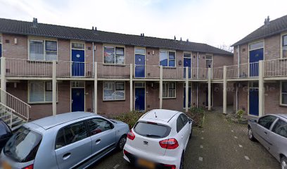
| Memorials | : | 0 |
| Location | : | Puiflijk, Druten Municipality, Netherlands |
| Coordinate | : | 51.8788800, 5.5890700 |
| Description | : | The hamlet of Puiflijk is 2 kilometres south-west of Druten and about 22 kilometres west of Nijmegen, which is the nearest convenient centre. The churchyard is in the centre of Puiflijk. Also, an alternative name for this cemtery (according to the Commonwealth Wat Graves Commission) is Druten Roman Catholic Churchyard. This is NOT the same as Druten Protestant Churchyard, which is a different cemetery. |
frequently asked questions (FAQ):
-
Where is Puiflijk Roman Catholic Cemetery?
Puiflijk Roman Catholic Cemetery is located at Kerkstraat 24 Puiflijk, Druten Municipality ,Gelderland ,Netherlands.
-
Puiflijk Roman Catholic Cemetery cemetery's updated grave count on graveviews.com?
0 memorials
-
Where are the coordinates of the Puiflijk Roman Catholic Cemetery?
Latitude: 51.8788800
Longitude: 5.5890700
Nearby Cemetories:
1. Dodewaard General Cemetery
Dodewaard, Neder-Betuwe Municipality, Netherlands
Coordinate: 51.9103800, 5.6538200
2. Bergharen Protestant Churchyard
Bergharen, Wijchen Municipality, Netherlands
Coordinate: 51.8480900, 5.6642300
3. Kloosterkerkhof Zusters Clarissen
Megen, Oss Municipality, Netherlands
Coordinate: 51.8232334, 5.5618619
4. Opheusden General Cemetery
Opheusden, Neder-Betuwe Municipality, Netherlands
Coordinate: 51.9322600, 5.6339800
5. Batenburg Roman Catholic Cemetery
Batenburg, Wijchen Municipality, Netherlands
Coordinate: 51.8244800, 5.6324800
6. Demen Roman Catholic Cemetery
Demen, Oss Municipality, Netherlands
Coordinate: 51.8162920, 5.6306450
7. Militair Ereveld Grebbeberg
Rhenen, Rhenen Municipality, Netherlands
Coordinate: 51.9556300, 5.6004200
8. Rhenen General Cemetery
Rhenen, Rhenen Municipality, Netherlands
Coordinate: 51.9614700, 5.5752200
9. Lienden General Cemetery
Lienden, Buren Municipality, Netherlands
Coordinate: 51.9513900, 5.5209200
10. Joodse Begraafplaats
Rhenen Municipality, Netherlands
Coordinate: 51.9660400, 5.5721300
11. Andelst Kerkhof
Andelst, Overbetuwe Municipality, Netherlands
Coordinate: 51.9057800, 5.7278200
12. Ravenstein Roman Catholic Cemetery
Ravenstein, Oss Municipality, Netherlands
Coordinate: 51.7963700, 5.6497700
13. Begraafplaats Vluchtheuvelkerk Protestant
Zetten, Overbetuwe Municipality, Netherlands
Coordinate: 51.9315860, 5.7141320
14. Joodse Begraafplaats
Tiel Municipality, Netherlands
Coordinate: 51.8907220, 5.4324720
15. Tiel Roman Catholic Cemetery
Tiel, Tiel Municipality, Netherlands
Coordinate: 51.8919400, 5.4298300
16. Begraafplaats Ter Navolging
Tiel, Tiel Municipality, Netherlands
Coordinate: 51.8904900, 5.4273700
17. Joodse Begraafplaats
Wageningen Municipality, Netherlands
Coordinate: 51.9668606, 5.6695901
18. Gemeentelijke Begraafplaats
Berghem, Oss Municipality, Netherlands
Coordinate: 51.7697675, 5.5708365
19. Wijchen Roman Catholic Cemetery
Wijchen, Wijchen Municipality, Netherlands
Coordinate: 51.8057800, 5.7257300
20. Rooms Katholieke Begraafplaats Don Bosco
Oss, Oss Municipality, Netherlands
Coordinate: 51.7689660, 5.5423880
21. Oss Eikenboomgaard Begraafplaats
Oss, Oss Municipality, Netherlands
Coordinate: 51.7708500, 5.5265200
22. Lith Rooms Katholiek Kerkhof
Lith, Oss Municipality, Netherlands
Coordinate: 51.8066300, 5.4383900
23. Elst General Cemetery
Elst, Rhenen Municipality, Netherlands
Coordinate: 51.9843400, 5.4978800
24. Begraafplaats de Leeuwerenk
Wageningen, Wageningen Municipality, Netherlands
Coordinate: 51.9849600, 5.6806900

