
| Memorials | : | 0 |
| Location | : | Zetten, Overbetuwe Municipality, Netherlands |
| Coordinate | : | 51.9315860, 5.7141320 |
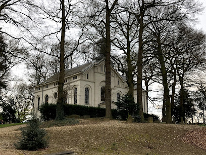
| Description | : | Dutch Reformed Church Cemetery - Zetten, Netherlands |
frequently asked questions (FAQ):
-
Where is Begraafplaats Vluchtheuvelkerk Protestant?
Begraafplaats Vluchtheuvelkerk Protestant is located at Bakkerstraat Zetten, Overbetuwe Municipality ,Gelderland , 6671 DNNetherlands.
-
Begraafplaats Vluchtheuvelkerk Protestant cemetery's updated grave count on graveviews.com?
0 memorials
-
Where are the coordinates of the Begraafplaats Vluchtheuvelkerk Protestant?
Latitude: 51.9315860
Longitude: 5.7141320
Nearby Cemetories:
1. Andelst Kerkhof
Andelst, Overbetuwe Municipality, Netherlands
Coordinate: 51.9057800, 5.7278200
2. Heteren General Cemetery
Heteren, Overbetuwe Municipality, Netherlands
Coordinate: 51.9530900, 5.7574100
3. Onder de Bomen Cemetery
Renkum, Renkum Municipality, Netherlands
Coordinate: 51.9714500, 5.7205500
4. Dodewaard General Cemetery
Dodewaard, Neder-Betuwe Municipality, Netherlands
Coordinate: 51.9103800, 5.6538200
5. Joodse Begraafplaats
Wageningen Municipality, Netherlands
Coordinate: 51.9668606, 5.6695901
6. Renkum Roman Catholic Cemetery
Renkum, Renkum Municipality, Netherlands
Coordinate: 51.9752800, 5.7375200
7. Opheusden General Cemetery
Opheusden, Neder-Betuwe Municipality, Netherlands
Coordinate: 51.9322600, 5.6339800
8. Begraafplaats de Leeuwerenk
Wageningen, Wageningen Municipality, Netherlands
Coordinate: 51.9849600, 5.6806900
9. Slijk-Ewijk General Cemetery
Slijk-Ewijk, Overbetuwe Municipality, Netherlands
Coordinate: 51.8839100, 5.7854400
10. Driel Protestant Churchyard
Driel, Overbetuwe Municipality, Netherlands
Coordinate: 51.9619700, 5.8113700
11. Bennekom Algemene Begraafplaats
Bennekom, Ede Municipality, Netherlands
Coordinate: 51.9983500, 5.6775500
12. Doorwerth Roman Catholic Cemetery
Doorwerth, Renkum Municipality, Netherlands
Coordinate: 51.9783200, 5.8058900
13. Militair Ereveld Grebbeberg
Rhenen, Rhenen Municipality, Netherlands
Coordinate: 51.9556300, 5.6004200
14. Haaghove
Beuningen, Beuningen Municipality, Netherlands
Coordinate: 51.8666649, 5.7850499
15. Bergharen Protestant Churchyard
Bergharen, Wijchen Municipality, Netherlands
Coordinate: 51.8480900, 5.6642300
16. Rhenen General Cemetery
Rhenen, Rhenen Municipality, Netherlands
Coordinate: 51.9614700, 5.5752200
17. Puiflijk Roman Catholic Cemetery
Puiflijk, Druten Municipality, Netherlands
Coordinate: 51.8788800, 5.5890700
18. Joodse Begraafplaats
Rhenen Municipality, Netherlands
Coordinate: 51.9660400, 5.5721300
19. Oude Algemene Begraafplaats
Oosterbeek, Renkum Municipality, Netherlands
Coordinate: 51.9832100, 5.8434700
20. Oosterbeek General Cemetery
Oosterbeek, Renkum Municipality, Netherlands
Coordinate: 51.9920100, 5.8490100
21. Arnhem War Cemetery
Oosterbeek, Renkum Municipality, Netherlands
Coordinate: 51.9931800, 5.8481900
22. Paasberg Mausoleum
Ede, Ede Municipality, Netherlands
Coordinate: 52.0437800, 5.6786500
23. Neerbosch Cemetery
Nijmegen, Nijmegen Municipality, Netherlands
Coordinate: 51.8353200, 5.8192130
24. Batenburg Roman Catholic Cemetery
Batenburg, Wijchen Municipality, Netherlands
Coordinate: 51.8244800, 5.6324800