
| Memorials | : | 0 |
| Location | : | Binstead, Isle of Wight Unitary Authority, England |
| Phone | : | 01983 882420 |
| Website | : | www.quarrabbey.org/ |
| Coordinate | : | 50.7311862, -1.2034333 |
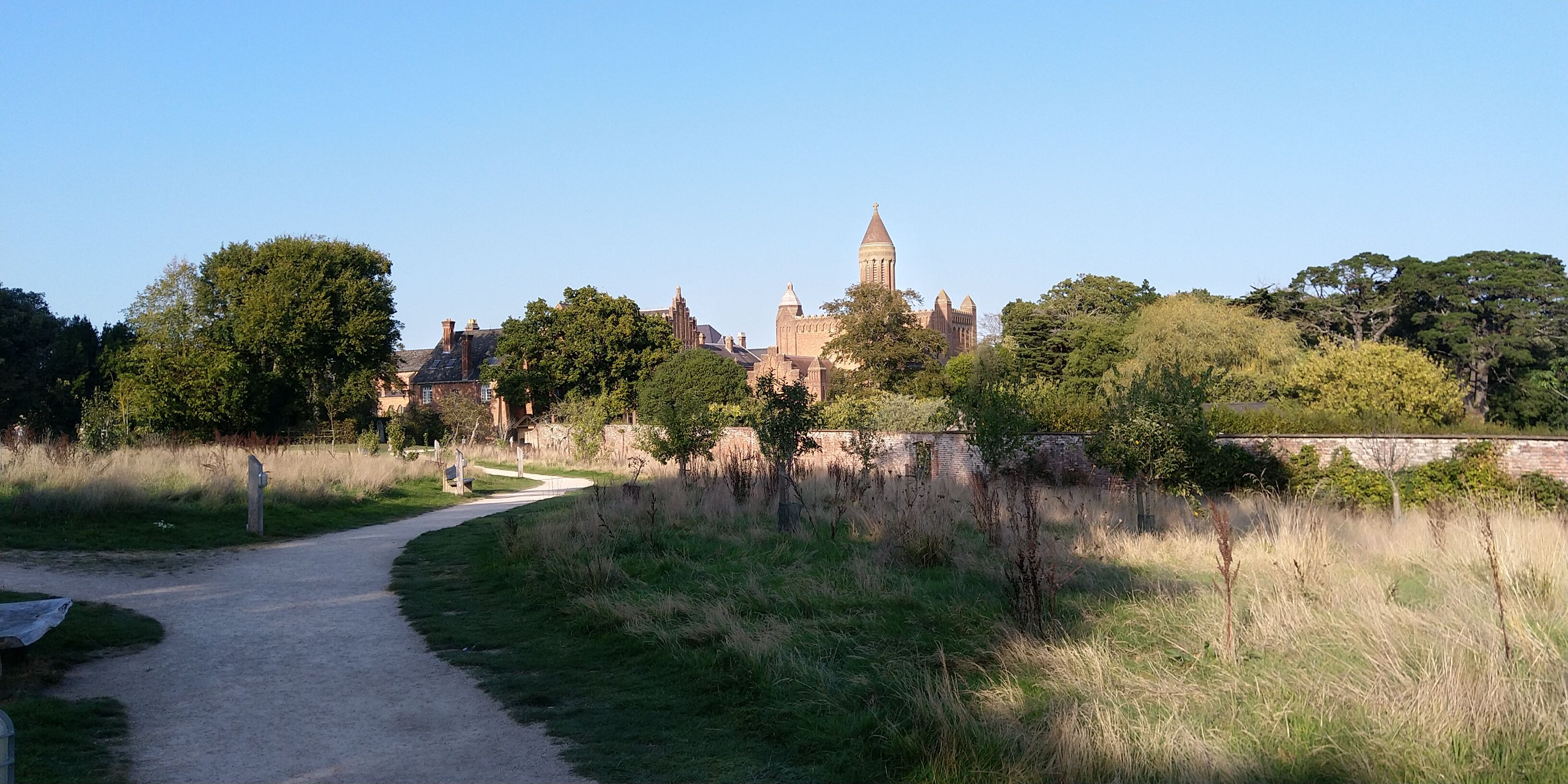
| Description | : | Quarr Abbey is a working monastery belonging to the Catholic Order of St Benedict, situated between the villages of Binstead and Fishbourne, near Ryde on the Isle of Wight. It was founded in 1907 and completed and consecrated in 1921. There is a small burial ground near the eastern corner of the abbey building. NB not to be confused with Quarr Old Abbey, the ruins of a medieval Cistercian monastery, which was dissolved in the 16th century. All burials prior to the 20th century should be recorded here: https://www.findagrave.com/cemetery/2259393/quarr-old-abbey |
frequently asked questions (FAQ):
-
Where is Quarr Abbey?
Quarr Abbey is located at Quarr Road, Ryde Binstead, Isle of Wight Unitary Authority ,Isle of Wight , PO33 4ESEngland.
-
Quarr Abbey cemetery's updated grave count on graveviews.com?
0 memorials
-
Where are the coordinates of the Quarr Abbey?
Latitude: 50.7311862
Longitude: -1.2034333
Nearby Cemetories:
1. Quarr Old Abbey
Ryde, Isle of Wight Unitary Authority, England
Coordinate: 50.7310000, -1.1996000
2. Holy Cross Churchyard
Binstead, Isle of Wight Unitary Authority, England
Coordinate: 50.7320080, -1.1863070
3. Binstead Cemetery
Binstead, Isle of Wight Unitary Authority, England
Coordinate: 50.7264610, -1.1866180
4. St. Edmund's Churchyard
Wootton, Isle of Wight Unitary Authority, England
Coordinate: 50.7308220, -1.2344490
5. St Peter's
Havenstreet, Isle of Wight Unitary Authority, England
Coordinate: 50.7095580, -1.2063290
6. Ryde Cemetery
Ryde, Isle of Wight Unitary Authority, England
Coordinate: 50.7249730, -1.1668550
7. St Thomas Churchyard
Ryde, Isle of Wight Unitary Authority, England
Coordinate: 50.7305600, -1.1632540
8. Isle of Wight Crematorium
Whippingham, Isle of Wight Unitary Authority, England
Coordinate: 50.7217910, -1.2573910
9. St Cecilia's Abbey
Ryde, Isle of Wight Unitary Authority, England
Coordinate: 50.7279800, -1.1463120
10. St. Johns Churchyard
Ryde, Isle of Wight Unitary Authority, England
Coordinate: 50.7149770, -1.1482370
11. St. Mildred's Churchyard
Whippingham, Isle of Wight Unitary Authority, England
Coordinate: 50.7398230, -1.2768350
12. St Paul's Cemetery
Newport, Isle of Wight Unitary Authority, England
Coordinate: 50.7072300, -1.2827400
13. East Cowes Cemetery
East Cowes, Isle of Wight Unitary Authority, England
Coordinate: 50.7502300, -1.2876600
14. St James Churchyard
East Cowes, Isle of Wight Unitary Authority, England
Coordinate: 50.7579430, -1.2861300
15. Newport Cemetery
Newport, Isle of Wight Unitary Authority, England
Coordinate: 50.7041360, -1.2887540
16. St Mary the Virgin Churchyard
Brading, Isle of Wight Unitary Authority, England
Coordinate: 50.6824400, -1.1429600
17. St John the Baptist Church
Northwood, Isle of Wight Unitary Authority, England
Coordinate: 50.7340380, -1.3023130
18. Isle of Wight Workhouse Burial Ground
Carisbrooke, Isle of Wight Unitary Authority, England
Coordinate: 50.7112150, -1.2979810
19. St. Mark's Churchyard
Alverstoke, Gosport Borough, England
Coordinate: 50.7826800, -1.1436100
20. Northwood Cemetery
Cowes, Isle of Wight Unitary Authority, England
Coordinate: 50.7513700, -1.3003600
21. St Mary Churchyard
Alverstoke, Gosport Borough, England
Coordinate: 50.7856760, -1.1480810
22. St Thomas Church
Newport, Isle of Wight Unitary Authority, England
Coordinate: 50.6997610, -1.2940130
23. Clayhall Naval Cemetery
Gosport, Gosport Borough, England
Coordinate: 50.7833862, -1.1373420
24. Turkish Naval Cemetery
Gosport, Gosport Borough, England
Coordinate: 50.7840710, -1.1383980