
| Memorials | : | 0 |
| Location | : | Binstead, Isle of Wight Unitary Authority, England |
| Coordinate | : | 50.7264610, -1.1866180 |
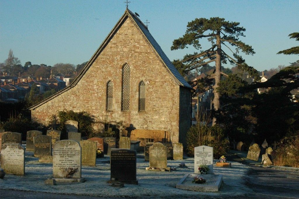
| Description | : | Binstead Cemetery is located in Cemetery Road, Binstead, a small village to the west of Ryde. The cemetery opened in 1857. |
frequently asked questions (FAQ):
-
Where is Binstead Cemetery?
Binstead Cemetery is located at Binstead, Isle of Wight Unitary Authority ,Isle of Wight ,England.
-
Binstead Cemetery cemetery's updated grave count on graveviews.com?
0 memorials
-
Where are the coordinates of the Binstead Cemetery?
Latitude: 50.7264610
Longitude: -1.1866180
Nearby Cemetories:
1. Holy Cross Churchyard
Binstead, Isle of Wight Unitary Authority, England
Coordinate: 50.7320080, -1.1863070
2. Quarr Old Abbey
Ryde, Isle of Wight Unitary Authority, England
Coordinate: 50.7310000, -1.1996000
3. Quarr Abbey
Binstead, Isle of Wight Unitary Authority, England
Coordinate: 50.7311862, -1.2034333
4. Ryde Cemetery
Ryde, Isle of Wight Unitary Authority, England
Coordinate: 50.7249730, -1.1668550
5. St Thomas Churchyard
Ryde, Isle of Wight Unitary Authority, England
Coordinate: 50.7305600, -1.1632540
6. St Peter's
Havenstreet, Isle of Wight Unitary Authority, England
Coordinate: 50.7095580, -1.2063290
7. St Cecilia's Abbey
Ryde, Isle of Wight Unitary Authority, England
Coordinate: 50.7279800, -1.1463120
8. St. Johns Churchyard
Ryde, Isle of Wight Unitary Authority, England
Coordinate: 50.7149770, -1.1482370
9. St. Edmund's Churchyard
Wootton, Isle of Wight Unitary Authority, England
Coordinate: 50.7308220, -1.2344490
10. Isle of Wight Crematorium
Whippingham, Isle of Wight Unitary Authority, England
Coordinate: 50.7217910, -1.2573910
11. St Mary the Virgin Churchyard
Brading, Isle of Wight Unitary Authority, England
Coordinate: 50.6824400, -1.1429600
12. St. Mildred's Churchyard
Whippingham, Isle of Wight Unitary Authority, England
Coordinate: 50.7398230, -1.2768350
13. St. Mark's Churchyard
Alverstoke, Gosport Borough, England
Coordinate: 50.7826800, -1.1436100
14. St Paul's Cemetery
Newport, Isle of Wight Unitary Authority, England
Coordinate: 50.7072300, -1.2827400
15. St Mary Churchyard
Alverstoke, Gosport Borough, England
Coordinate: 50.7856760, -1.1480810
16. Clayhall Naval Cemetery
Gosport, Gosport Borough, England
Coordinate: 50.7833862, -1.1373420
17. Turkish Naval Cemetery
Gosport, Gosport Borough, England
Coordinate: 50.7840710, -1.1383980
18. East Cowes Cemetery
East Cowes, Isle of Wight Unitary Authority, England
Coordinate: 50.7502300, -1.2876600
19. Newport Cemetery
Newport, Isle of Wight Unitary Authority, England
Coordinate: 50.7041360, -1.2887540
20. St James Churchyard
East Cowes, Isle of Wight Unitary Authority, England
Coordinate: 50.7579430, -1.2861300
21. Isle of Wight Workhouse Burial Ground
Carisbrooke, Isle of Wight Unitary Authority, England
Coordinate: 50.7112150, -1.2979810
22. St Thomas Church
Newport, Isle of Wight Unitary Authority, England
Coordinate: 50.6997610, -1.2940130
23. St John the Baptist Church
Northwood, Isle of Wight Unitary Authority, England
Coordinate: 50.7340380, -1.3023130
24. Ann's Hill Cemetery
Gosport, Gosport Borough, England
Coordinate: 50.7982670, -1.1549450