
| Memorials | : | 0 |
| Location | : | Garrigill, Eden District, England |
| Coordinate | : | 54.7702390, -2.4071080 |
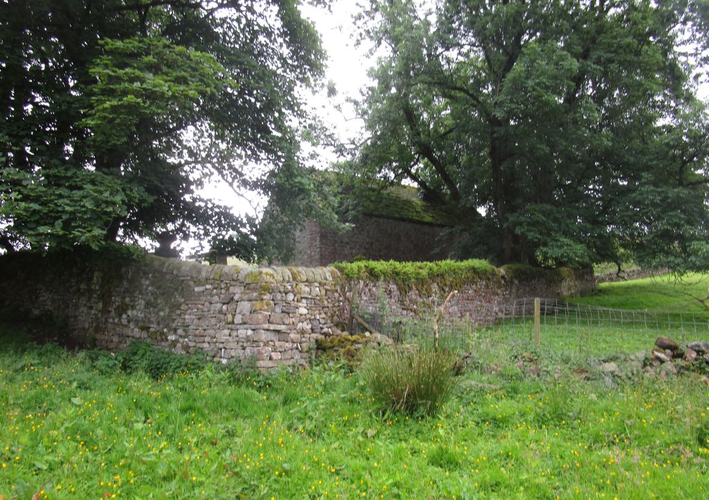
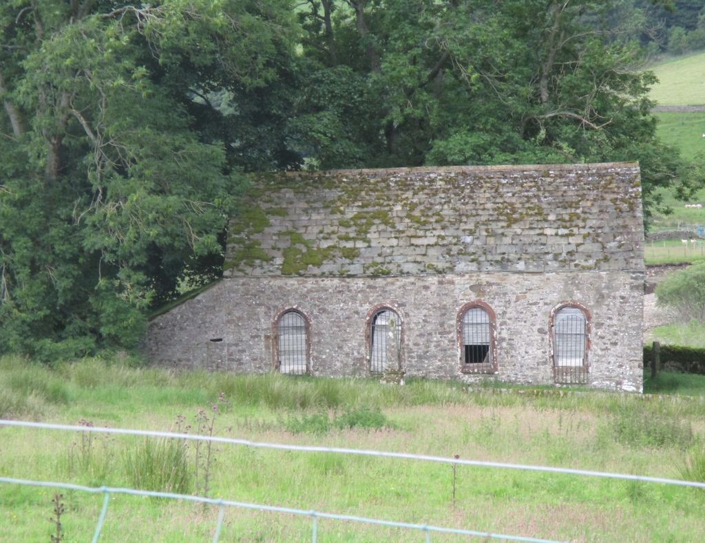
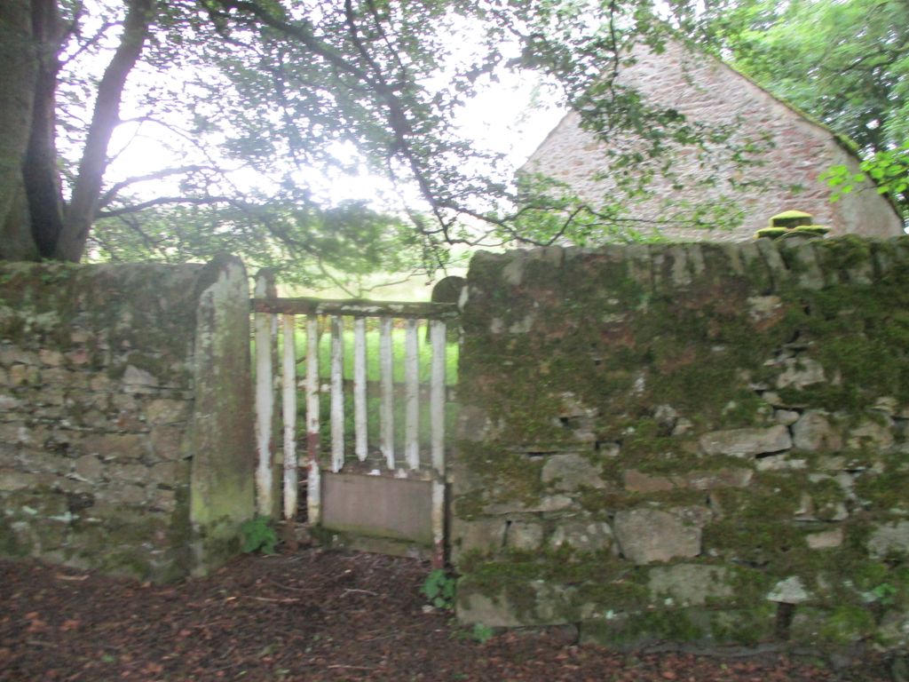
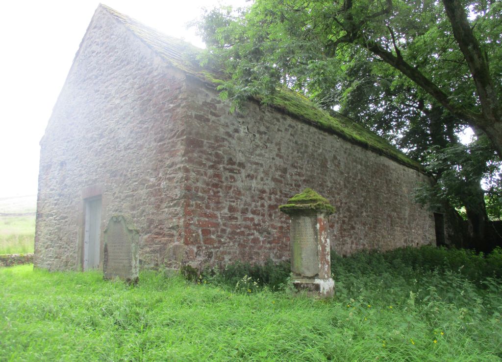
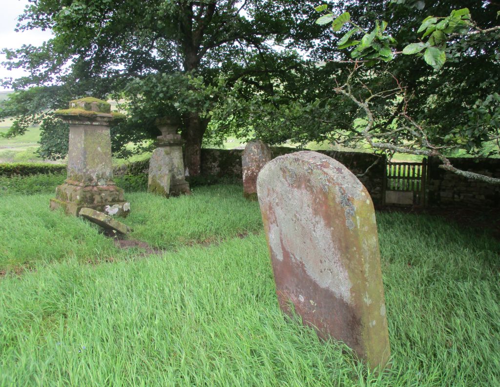
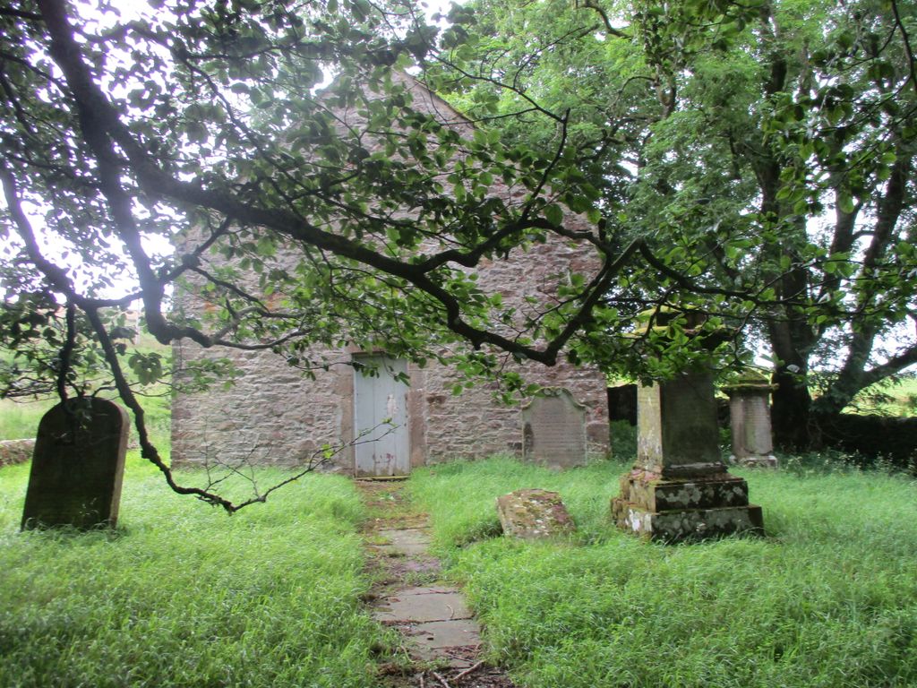
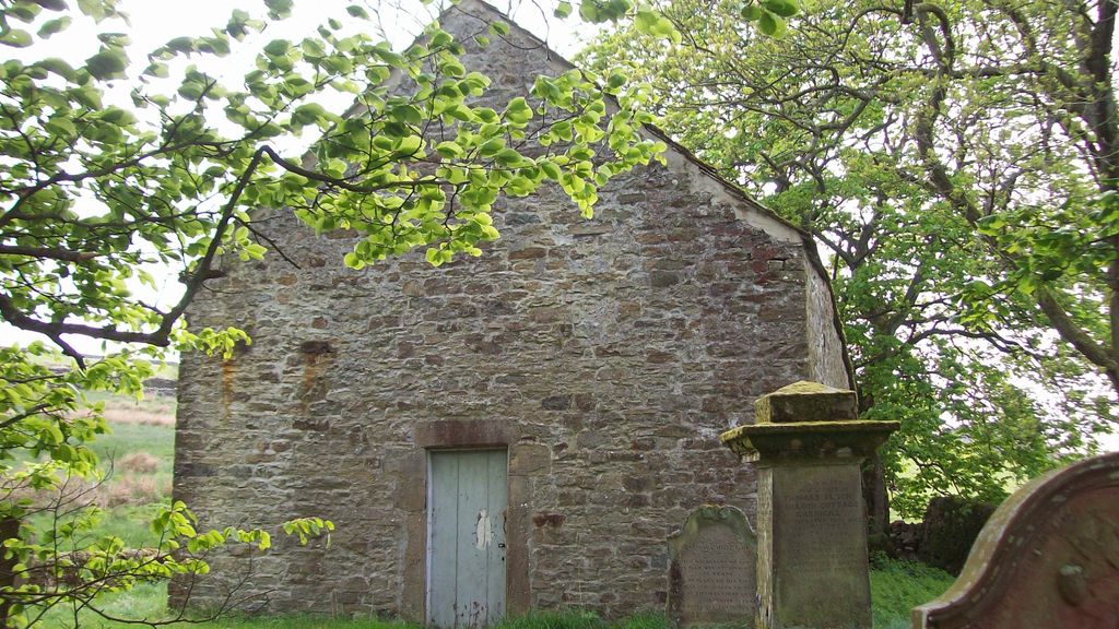
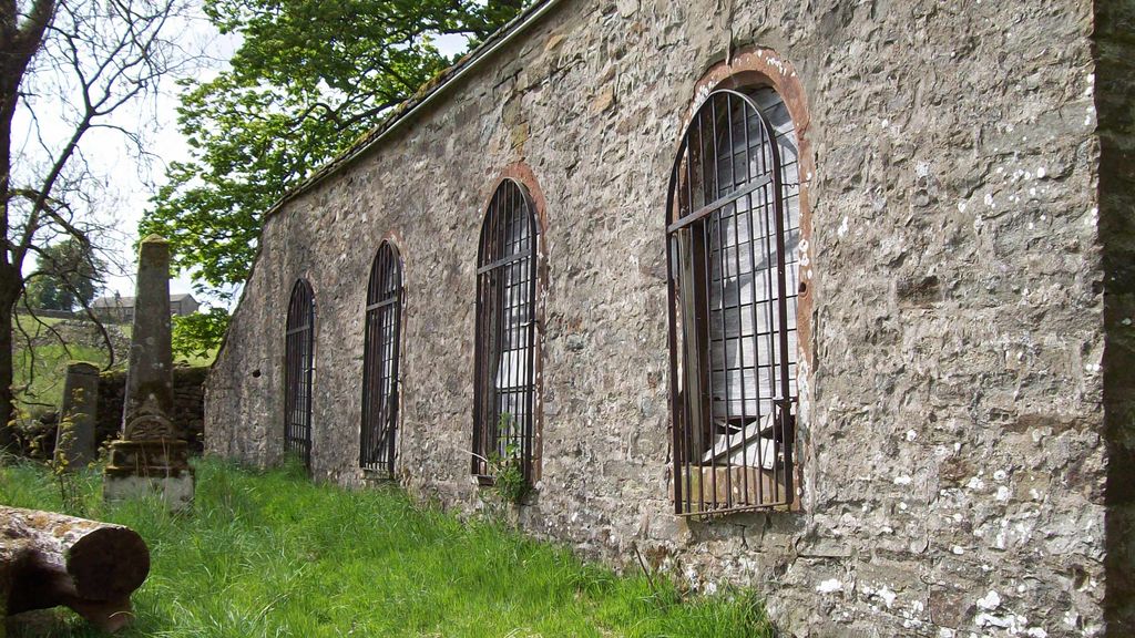
| Description | : | Redwing Chapel is situated in a field about a quarter of a mile outside the village of Garrigill. It was built in 1756 and continued in use until 1977. There is no path to the gate. |
frequently asked questions (FAQ):
-
Where is Redwing Chapel Churchyard?
Redwing Chapel Churchyard is located at Garrigill, Eden District ,Cumbria ,England.
-
Redwing Chapel Churchyard cemetery's updated grave count on graveviews.com?
0 memorials
-
Where are the coordinates of the Redwing Chapel Churchyard?
Latitude: 54.7702390
Longitude: -2.4071080
Nearby Cemetories:
1. St John the Evangelist Churchyard
Garrigill, Eden District, England
Coordinate: 54.7677610, -2.3977800
2. Nenthead Cemetery
Nenthead, Eden District, England
Coordinate: 54.7947260, -2.3536210
3. St John's Churchyard
Nenthead, Eden District, England
Coordinate: 54.7903000, -2.3434180
4. Alston Cemetery
Alston, Eden District, England
Coordinate: 54.8083540, -2.4416430
5. St Augustine Churchyard
Alston, Eden District, England
Coordinate: 54.8128980, -2.4397250
6. Holy Paraclete Churchyard
Kirkhaugh, Northumberland Unitary Authority, England
Coordinate: 54.8385700, -2.4695550
7. Carrshield Anglican Churchyard
Allendale, Northumberland Unitary Authority, England
Coordinate: 54.8229010, -2.3083050
8. Limestone Brae, Wesleyan Methodist Chapel
Allendale, Northumberland Unitary Authority, England
Coordinate: 54.8425890, -2.3207386
9. Limestone Brae Burial Ground
Allendale, Northumberland Unitary Authority, England
Coordinate: 54.8441180, -2.3233520
10. Copt Hill Churchyard
Cowshill, Durham Unitary Authority, England
Coordinate: 54.7626700, -2.2320470
11. Burtree Ford Cemetery
Cowshill, Durham Unitary Authority, England
Coordinate: 54.7587910, -2.2286680
12. Saint Thomas Heatherycleugh
Cowshill, Durham Unitary Authority, England
Coordinate: 54.7601700, -2.2264200
13. St Peter in the Forest
Allendale, Northumberland Unitary Authority, England
Coordinate: 54.8313100, -2.2350600
14. St. Lawrence Churchyard
Kirkland, Eden District, England
Coordinate: 54.6864180, -2.5505640
15. St John the Baptist Churchyard
Melmerby, Eden District, England
Coordinate: 54.7304650, -2.6051700
16. High House Methodist Chapel Graveyard
Allendale, Northumberland Unitary Authority, England
Coordinate: 54.8844090, -2.3285218
17. St Jude's Churchyard
Knarsdale, Northumberland Unitary Authority, England
Coordinate: 54.8817960, -2.5024290
18. All Saints Churchyard
Renwick, Eden District, England
Coordinate: 54.7859060, -2.6282720
19. St John the Evangelist Churchyard
Skirwith, Eden District, England
Coordinate: 54.6869000, -2.5944870
20. Saint Cuthbert’s Churchyard
Milburn, Eden District, England
Coordinate: 54.6554800, -2.5404800
21. St James the Less Churchyard
Forest in Teesdale, Durham Unitary Authority, England
Coordinate: 54.6719700, -2.2264200
22. Keenley Methodist Chapel Graveyard
Allendale, Northumberland Unitary Authority, England
Coordinate: 54.9053170, -2.3075580
23. St. Cuthbert's Churchyard
Dufton, Eden District, England
Coordinate: 54.6299140, -2.4897870
24. Allendale Woodland Cemetery
Allendale, Northumberland Unitary Authority, England
Coordinate: 54.8932624, -2.2618136