
| Memorials | : | 0 |
| Location | : | Chesterfield, Chesterfield County, USA |
| Coordinate | : | 34.7433100, -80.0484090 |
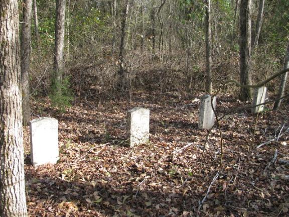
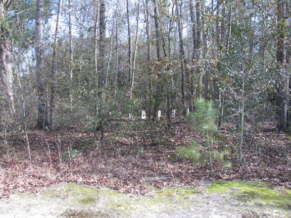
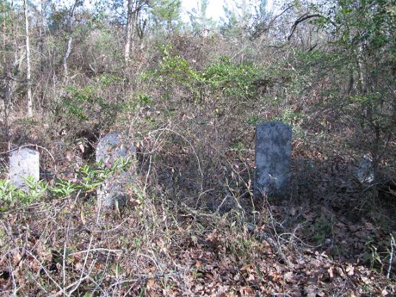
| Description | : | From Chesterfield, S.C. take Highway 9 East. Cross Thompson Creek Bridge and turn left on Zoar Road. Turn left at Pine Grove Baptist Church on Jackson Road. There will be a row of white pines between two houses on the right. There will be a drive beside the house on this side of the pines. Go down this drive past the house on the right. When the woods start the cemetery will be in the woods in the right corner of the clearing. Note: There are four graves in a row and then about fifty feet behind them are the... Read More |
frequently asked questions (FAQ):
-
Where is Rivers Cemetery?
Rivers Cemetery is located at Jackson Road Chesterfield, Chesterfield County ,South Carolina , 29709USA.
-
Rivers Cemetery cemetery's updated grave count on graveviews.com?
0 memorials
-
Where are the coordinates of the Rivers Cemetery?
Latitude: 34.7433100
Longitude: -80.0484090
Nearby Cemetories:
1. Pine Grove Baptist Church Cemetery
Chesterfield County, USA
Coordinate: 34.7366982, -80.0500031
2. Rivers Family Cemetery
Chesterfield, Chesterfield County, USA
Coordinate: 34.7484950, -80.0539370
3. Davis Family Cemetery
Chesterfield, Chesterfield County, USA
Coordinate: 34.7402992, -80.0605774
4. Confederate Soldier Burial Ground
Chesterfield, Chesterfield County, USA
Coordinate: 34.7300670, -80.0416230
5. Teal Family Cemetery
Chesterfield, Chesterfield County, USA
Coordinate: 34.7583530, -80.0463330
6. Davis Cemetery
Chesterfield, Chesterfield County, USA
Coordinate: 34.7676600, -80.0456570
7. Southern Grace Church
Chesterfield, Chesterfield County, USA
Coordinate: 34.7234820, -80.0300720
8. Pleasant Grove AME Zion Church Cemetery
Chesterfield, Chesterfield County, USA
Coordinate: 34.7587490, -80.0172040
9. Bittle Family Cemetery
Chesterfield, Chesterfield County, USA
Coordinate: 34.7535050, -80.0828380
10. Zoar United Methodist Church Cemetery
Brocks Mill, Chesterfield County, USA
Coordinate: 34.7648277, -80.0217819
11. Craig Family Cemetery
Chesterfield County, USA
Coordinate: 34.7349520, -80.0847960
12. Privett Family Cemetery
Chesterfield, Chesterfield County, USA
Coordinate: 34.7658230, -80.0220910
13. Chesterfield Community Cemetery
Chesterfield, Chesterfield County, USA
Coordinate: 34.7245210, -80.0822480
14. Pitts Cemetery
Chesterfield, Chesterfield County, USA
Coordinate: 34.7145640, -80.0730480
15. Chesterfield Cemetery
Chesterfield, Chesterfield County, USA
Coordinate: 34.7338982, -80.0911026
16. Friendship United Methodist Church Cemetery
Chesterfield, Chesterfield County, USA
Coordinate: 34.7655983, -80.0883026
17. Evans Family Cemetery
Chesterfield, Chesterfield County, USA
Coordinate: 34.7031340, -80.0369290
18. Sowell Cemetery
Chesterfield, Chesterfield County, USA
Coordinate: 34.7654220, -80.0933680
19. Sellers Cemetery
Brocks Mill, Chesterfield County, USA
Coordinate: 34.7604070, -79.9992870
20. Chesterfield County Memorial Garden
Chesterfield, Chesterfield County, USA
Coordinate: 34.7189250, -80.0960830
21. Dred Cemetery
Chesterfield, Chesterfield County, USA
Coordinate: 34.7821920, -80.0837230
22. Brocks Mill Baptist Church Cemetery Annex
Brocks Mill, Chesterfield County, USA
Coordinate: 34.7578990, -79.9919590
23. Brocks Mill Baptist Church Cemetery
Chesterfield, Chesterfield County, USA
Coordinate: 34.7582730, -79.9917660
24. Brock Family Cemetery
Brocks Mill, Chesterfield County, USA
Coordinate: 34.7627750, -79.9916350