
| Memorials | : | 0 |
| Location | : | Chesterfield, Chesterfield County, USA |
| Coordinate | : | 34.7821920, -80.0837230 |
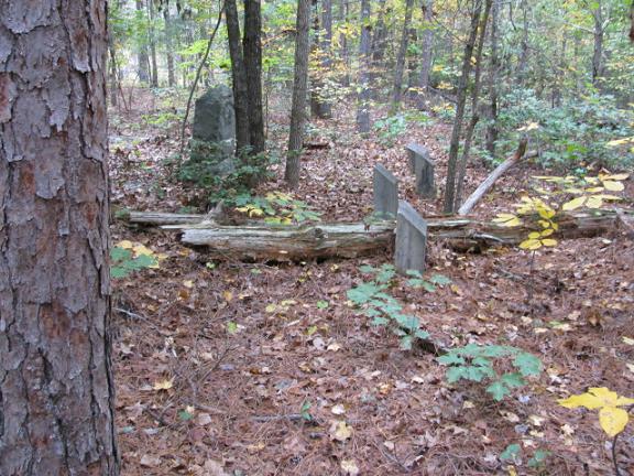
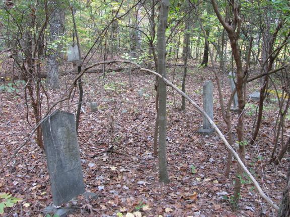
| Description | : | Take Highway 145 north from Chesterfield, S.C. When the road forks take the left fork Highway 742. Go through the intersection of Jackson Road. Go past one pasture on the right. There will be another pasture between two houses on the right. The cemetery will be in the woods about 100 yards behind this pasture. There is a gate at the road and at the back. This cemetery is on private land. Please get permission. This cemetery has been abandoned. This cemetery was vandalized in the past and a lot of the stones were destroyed or removed. Note: This cemetery was... Read More |
frequently asked questions (FAQ):
-
Where is Dred Cemetery?
Dred Cemetery is located at Highway 742 North Chesterfield, Chesterfield County ,South Carolina , 29709USA.
-
Dred Cemetery cemetery's updated grave count on graveviews.com?
0 memorials
-
Where are the coordinates of the Dred Cemetery?
Latitude: 34.7821920
Longitude: -80.0837230
Nearby Cemetories:
1. Stroud Family Cemetery
Chesterfield, Chesterfield County, USA
Coordinate: 34.7919380, -80.0813360
2. Davids Grove Baptist Church Cemetery
Chesterfield, Chesterfield County, USA
Coordinate: 34.7928009, -80.0903015
3. Friendship United Methodist Church Cemetery
Chesterfield, Chesterfield County, USA
Coordinate: 34.7655983, -80.0883026
4. Sowell Cemetery
Chesterfield, Chesterfield County, USA
Coordinate: 34.7654220, -80.0933680
5. Mount Level Baptist Church Cemetery
Chesterfield, Chesterfield County, USA
Coordinate: 34.7990910, -80.0970350
6. Griggs Family Cemetery
Chesterfield, Chesterfield County, USA
Coordinate: 34.8042150, -80.0732200
7. Bittle Family Cemetery
Chesterfield, Chesterfield County, USA
Coordinate: 34.7535050, -80.0828380
8. Adams Family Cemetery
Chesterfield, Chesterfield County, USA
Coordinate: 34.8073080, -80.1096060
9. Smith Cemetery
Chesterfield, Chesterfield County, USA
Coordinate: 34.7974840, -80.0480710
10. Davis Cemetery
Chesterfield, Chesterfield County, USA
Coordinate: 34.7676600, -80.0456570
11. Teal Family Cemetery
Chesterfield, Chesterfield County, USA
Coordinate: 34.7583530, -80.0463330
12. Hurst Cemetery
Chesterfield, Chesterfield County, USA
Coordinate: 34.7552910, -80.1179504
13. Campbell Family Cemetery
Chesterfield, Chesterfield County, USA
Coordinate: 34.8048360, -80.0441280
14. Rickets Cemetery
Wadesboro, Anson County, USA
Coordinate: 34.8186700, -80.1066000
15. Vaughn-Campbell Cemetery
Cason Old Field, Anson County, USA
Coordinate: 34.8187140, -80.1066880
16. Hurst Family Cemetery
Chesterfield, Chesterfield County, USA
Coordinate: 34.7704190, -80.1322070
17. Rivers Family Cemetery
Chesterfield, Chesterfield County, USA
Coordinate: 34.7484950, -80.0539370
18. Griggs Cemetery
Chesterfield, Chesterfield County, USA
Coordinate: 34.7757988, -80.1382980
19. Williams Cemetery
Cason Old Field, Anson County, USA
Coordinate: 34.8237430, -80.1060340
20. Davis Family Cemetery
Chesterfield, Chesterfield County, USA
Coordinate: 34.7402992, -80.0605774
21. Ebenezer United Methodist Church Cemetery
Chesterfield, Chesterfield County, USA
Coordinate: 34.7602997, -80.1343994
22. Craig Family Cemetery
Chesterfield County, USA
Coordinate: 34.7349520, -80.0847960
23. Rivers Cemetery
Chesterfield, Chesterfield County, USA
Coordinate: 34.7433100, -80.0484090
24. Chesterfield Cemetery
Chesterfield, Chesterfield County, USA
Coordinate: 34.7338982, -80.0911026