
| Memorials | : | 0 |
| Location | : | Brocks Mill, Chesterfield County, USA |
| Coordinate | : | 34.7604070, -79.9992870 |
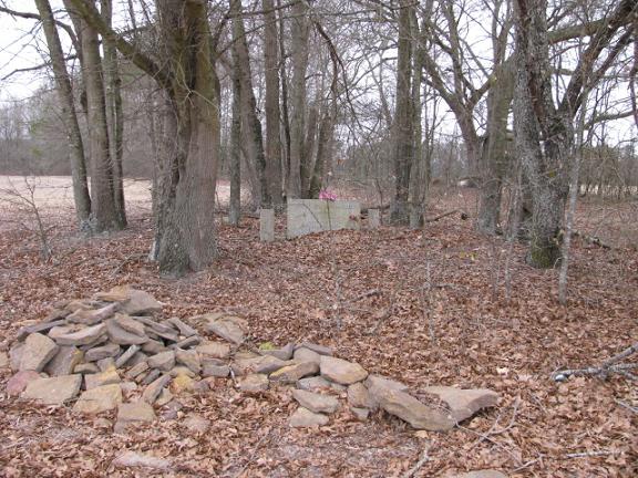
| Description | : | From Chesterfield, S.C. take Highway 9 East. Turn left on Zoar Road. Turn right on Brocks Mill Road. Turn left on Orchard Road. Cemetery will be about one quarter mile on the left at the edge of a field. There will be a tree line coming all the way out to Orchard Road. Follow that tree line on the left side. There is only one marked grave and you can see it from the road. |
frequently asked questions (FAQ):
-
Where is Sellers Cemetery?
Sellers Cemetery is located at Orchard Road Brocks Mill, Chesterfield County ,South Carolina ,USA.
-
Sellers Cemetery cemetery's updated grave count on graveviews.com?
0 memorials
-
Where are the coordinates of the Sellers Cemetery?
Latitude: 34.7604070
Longitude: -79.9992870
Nearby Cemetories:
1. Brocks Mill Baptist Church Cemetery Annex
Brocks Mill, Chesterfield County, USA
Coordinate: 34.7578990, -79.9919590
2. Brocks Mill Baptist Church Cemetery
Chesterfield, Chesterfield County, USA
Coordinate: 34.7582730, -79.9917660
3. Brock Family Cemetery
Brocks Mill, Chesterfield County, USA
Coordinate: 34.7627750, -79.9916350
4. Brock Cemetery
Brocks Mill, Chesterfield County, USA
Coordinate: 34.7503930, -79.9863370
5. Pleasant Grove AME Zion Church Cemetery
Chesterfield, Chesterfield County, USA
Coordinate: 34.7587490, -80.0172040
6. Zoar United Methodist Church Cemetery
Brocks Mill, Chesterfield County, USA
Coordinate: 34.7648277, -80.0217819
7. Privett Family Cemetery
Chesterfield, Chesterfield County, USA
Coordinate: 34.7658230, -80.0220910
8. McClain Grove Missionary Baptist Church Cemetery
Cheraw, Chesterfield County, USA
Coordinate: 34.7873270, -80.0011380
9. Westfield Creek Baptist Church Cemetery
Chesterfield County, USA
Coordinate: 34.7888985, -80.0108032
10. Short Family Cemetery
Chesterfield County, USA
Coordinate: 34.7931670, -80.0118550
11. Teal Family Cemetery
Chesterfield, Chesterfield County, USA
Coordinate: 34.7583530, -80.0463330
12. Davis Cemetery
Chesterfield, Chesterfield County, USA
Coordinate: 34.7676600, -80.0456570
13. Jones-Hinson Family Cemetery
Chesterfield, Chesterfield County, USA
Coordinate: 34.7989860, -79.9805010
14. Rivers Cemetery
Chesterfield, Chesterfield County, USA
Coordinate: 34.7433100, -80.0484090
15. Southern Grace Church
Chesterfield, Chesterfield County, USA
Coordinate: 34.7234820, -80.0300720
16. Midway Baptist Church Cemetery
Cheraw, Chesterfield County, USA
Coordinate: 34.7170570, -79.9826580
17. Confederate Soldier Burial Ground
Chesterfield, Chesterfield County, USA
Coordinate: 34.7300670, -80.0416230
18. Rivers Family Cemetery
Chesterfield, Chesterfield County, USA
Coordinate: 34.7484950, -80.0539370
19. Mount Zion United Methodist Church Cemetery
Cheraw, Chesterfield County, USA
Coordinate: 34.7972880, -79.9647960
20. Pine Grove Baptist Church Cemetery
Chesterfield County, USA
Coordinate: 34.7366982, -80.0500031
21. Saint Josephs Cemetery
Cheraw, Chesterfield County, USA
Coordinate: 34.7175410, -79.9702010
22. Saint Paul Missionary Baptist Church
Cheraw, Chesterfield County, USA
Coordinate: 34.7109260, -79.9745410
23. Davis Family Cemetery
Chesterfield, Chesterfield County, USA
Coordinate: 34.7402992, -80.0605774
24. Smith Cemetery
Chesterfield, Chesterfield County, USA
Coordinate: 34.7974840, -80.0480710