
| Memorials | : | 0 |
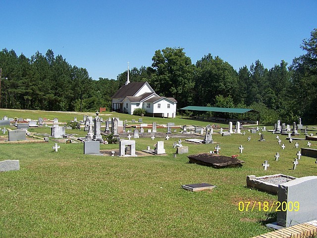
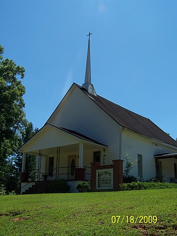
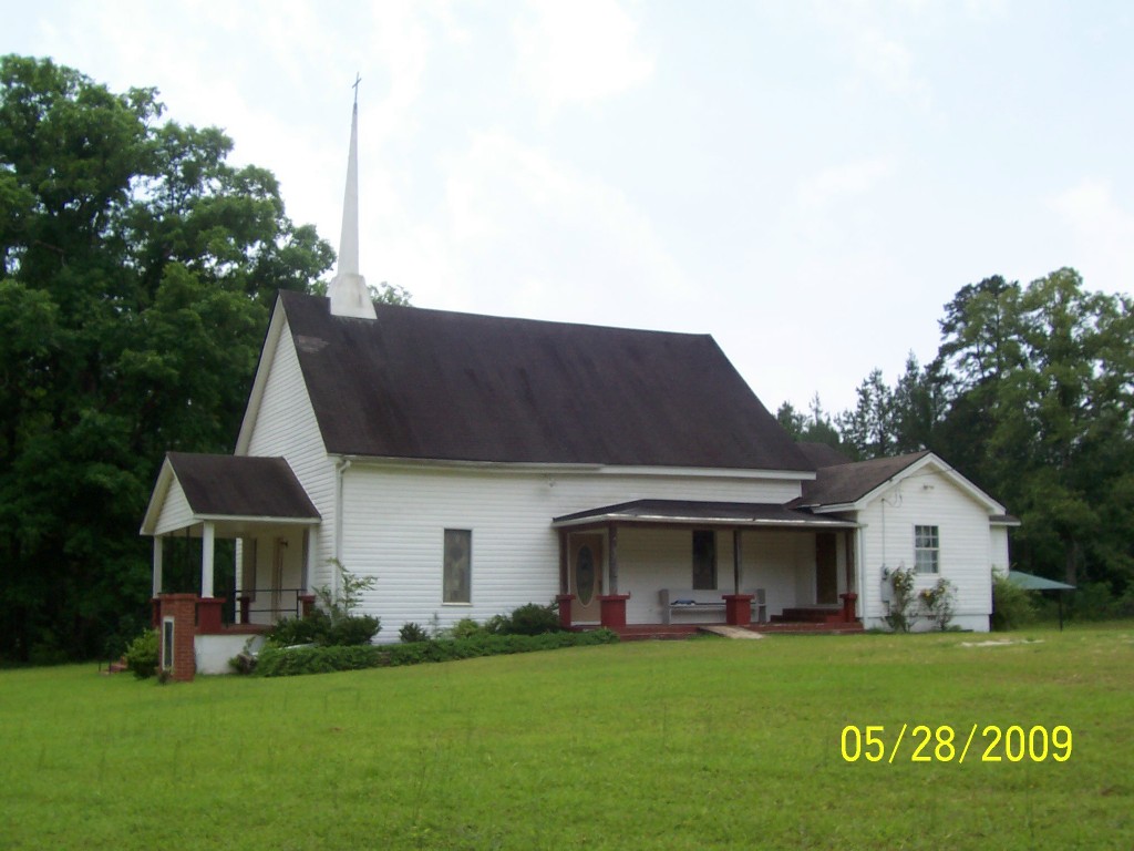
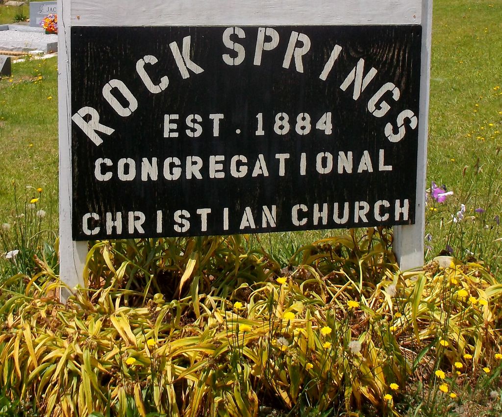
| Location | : | Roanoke, Randolph County, USA |
| Coordinate | : | 33.2221800, -85.4563210 |
| Description | : | Township 21, Range 11, Section 1 From State Highway 431 in the Rock Stand area, take County Road 65 south about 1 mile. Take the first right onto County Road 815 (a dirt road) for approximately 4 miles to intersection with County Road 820 (a dirt road). |
frequently asked questions (FAQ):
-
Where is Rock Springs Cemetery?
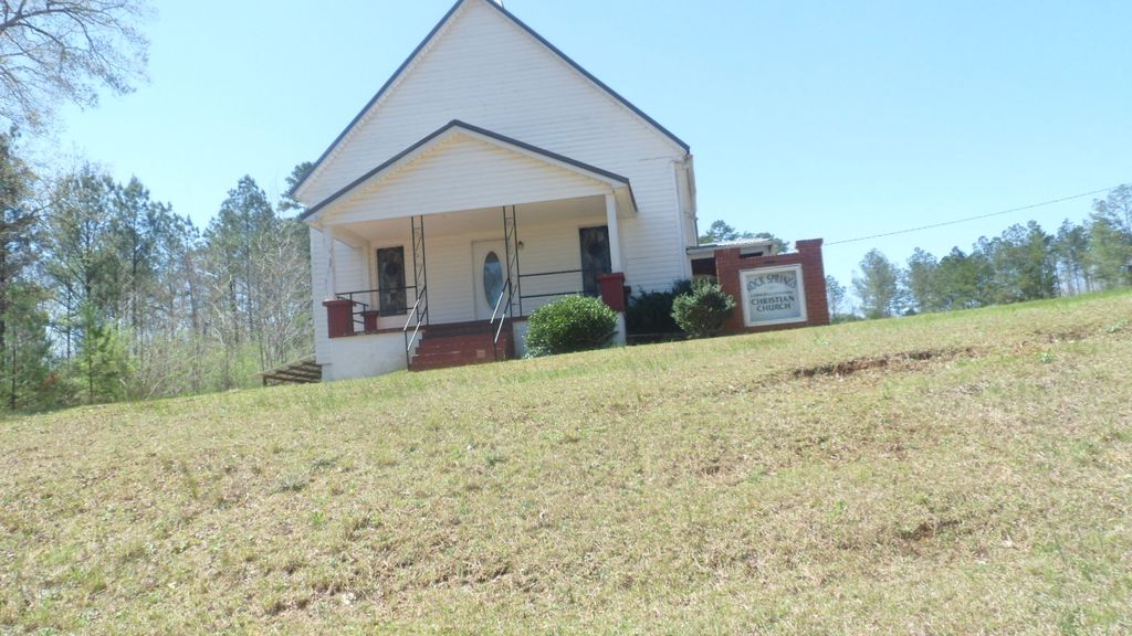
Rock Springs Cemetery is located at Roanoke, Randolph County ,Alabama ,USA.
-
Rock Springs Cemetery cemetery's updated grave count on graveviews.com?
0 memorials
-
Where are the coordinates of the Rock Springs Cemetery?
Latitude: 33.2221800
Longitude: -85.4563210
Nearby Cemetories:
1. Kidd Family Cemetery
Randolph County, USA
Coordinate: 33.2061610, -85.4902840
2. Rocky Mount United Methodist Church Cemetery
Roanoke, Randolph County, USA
Coordinate: 33.1880480, -85.4416230
3. Rock Stand Congregational Christian Church Cemeter
Roanoke, Randolph County, USA
Coordinate: 33.2242350, -85.4084310
4. Pleasant Grove Baptist Church Cemetery
Broughton, Randolph County, USA
Coordinate: 33.1826700, -85.4420100
5. Friendship Christian Cemetery
Roanoke, Randolph County, USA
Coordinate: 33.2585810, -85.4187610
6. Mount Pisgah Methodist Church Cemetery
Randolph County, USA
Coordinate: 33.2616997, -85.4942017
7. Union Hill Baptist Church Cemetery
Roanoke, Randolph County, USA
Coordinate: 33.1893010, -85.4031770
8. Macedonia Baptist Church Cemetery
Forester Chapel, Randolph County, USA
Coordinate: 33.1847770, -85.5173410
9. Bethlehem Primitive Baptist Church Cemetery
Level Road, Randolph County, USA
Coordinate: 33.1957300, -85.5278830
10. Zion's Rest Primitive Baptist Church Cemetery
Roanoke, Randolph County, USA
Coordinate: 33.2024250, -85.3797090
11. Gay Cemetery
Randolph County, USA
Coordinate: 33.2192001, -85.5421982
12. Greens Chapel Methodist Church Cemetery
Randolph County, USA
Coordinate: 33.2949510, -85.4256740
13. Radneys Chapel Cemetery
Peavy, Randolph County, USA
Coordinate: 33.1410590, -85.4559300
14. Mount Pisgah Baptist Church Cemetery
Roanoke, Randolph County, USA
Coordinate: 33.1592510, -85.3901760
15. Knight Cemetery
Malone, Randolph County, USA
Coordinate: 33.2097015, -85.5599976
16. Mount Zion Christian Church Cemetery
Randolph County, USA
Coordinate: 33.1361850, -85.4246100
17. Forresters Chapel Church Cemetery
Randolph County, USA
Coordinate: 33.1620160, -85.5383900
18. Hearn Gravesite
Randolph County, USA
Coordinate: 33.3098200, -85.4873080
19. Lebanon Christian Church Cemetery
Springfield, Randolph County, USA
Coordinate: 33.1897400, -85.3500700
20. Corinth Congregational Christian Church Cemetery
Corinth (Wadley North), Randolph County, USA
Coordinate: 33.1739300, -85.5556000
21. Macedonia Cemetery
Roanoke, Randolph County, USA
Coordinate: 33.1802040, -85.3505050
22. High Pine Baptist Church Cemetery
Roanoke, Randolph County, USA
Coordinate: 33.1243210, -85.4435370
23. Haywood Cemetery
Haywood, Randolph County, USA
Coordinate: 33.3039700, -85.3899100
24. Roanoke Baptist Church Cemetery
Roanoke, Randolph County, USA
Coordinate: 33.1506600, -85.3730260