
| Memorials | : | 0 |
| Location | : | Randolph County, USA |
| Coordinate | : | 33.2616997, -85.4942017 |
frequently asked questions (FAQ):
-
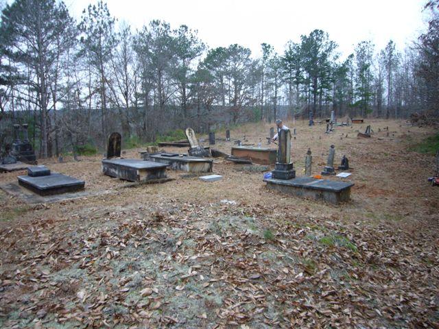
Where is Mount Pisgah Methodist Church Cemetery?
Mount Pisgah Methodist Church Cemetery is located at Randolph County ,Alabama ,USA.
-
Mount Pisgah Methodist Church Cemetery cemetery's updated grave count on graveviews.com?
0 memorials
-
Where are the coordinates of the Mount Pisgah Methodist Church Cemetery?
Latitude: 33.2616997
Longitude: -85.4942017

Nearby Cemetories:
1. Hearn Gravesite
Randolph County, USA
Coordinate: 33.3098200, -85.4873080
2. Rock Springs Cemetery
Roanoke, Randolph County, USA
Coordinate: 33.2221800, -85.4563210
3. Kidd Family Cemetery
Randolph County, USA
Coordinate: 33.2061610, -85.4902840
4. Gay Cemetery
Randolph County, USA
Coordinate: 33.2192001, -85.5421982
5. Friendship Christian Cemetery
Roanoke, Randolph County, USA
Coordinate: 33.2585810, -85.4187610
6. Greens Chapel Methodist Church Cemetery
Randolph County, USA
Coordinate: 33.2949510, -85.4256740
7. Bethlehem Primitive Baptist Church Cemetery
Level Road, Randolph County, USA
Coordinate: 33.1957300, -85.5278830
8. Knight Cemetery
Malone, Randolph County, USA
Coordinate: 33.2097015, -85.5599976
9. Macedonia Baptist Church Cemetery
Forester Chapel, Randolph County, USA
Coordinate: 33.1847770, -85.5173410
10. Rock Stand Congregational Christian Church Cemeter
Roanoke, Randolph County, USA
Coordinate: 33.2242350, -85.4084310
11. Rocky Mount United Methodist Church Cemetery
Roanoke, Randolph County, USA
Coordinate: 33.1880480, -85.4416230
12. Noon Day Congregational Christian Church Cemetery
New Hope, Randolph County, USA
Coordinate: 33.3265800, -85.4250400
13. Pleasant Grove Baptist Church Cemetery
Broughton, Randolph County, USA
Coordinate: 33.1826700, -85.4420100
14. Haywood Cemetery
Haywood, Randolph County, USA
Coordinate: 33.3039700, -85.3899100
15. Old Rocky Branch Cemetery
New Hope, Randolph County, USA
Coordinate: 33.3171997, -85.3977966
16. Rocky Branch Baptist Church Cemetery
New Hope, Randolph County, USA
Coordinate: 33.3217087, -85.3998795
17. Corinth Congregational Christian Church Cemetery
Corinth (Wadley North), Randolph County, USA
Coordinate: 33.1739300, -85.5556000
18. Union Hill Baptist Church Cemetery
Roanoke, Randolph County, USA
Coordinate: 33.1893010, -85.4031770
19. Forresters Chapel Church Cemetery
Randolph County, USA
Coordinate: 33.1620160, -85.5383900
20. Liberty Grove Church Cemetery
Randolph County, USA
Coordinate: 33.3569020, -85.4286910
21. Pine Grove Cemetery
Randolph County, USA
Coordinate: 33.1857986, -85.5914001
22. Zion's Rest Primitive Baptist Church Cemetery
Roanoke, Randolph County, USA
Coordinate: 33.2024250, -85.3797090
23. Levens Baptist Church Cemetery
Randolph County, USA
Coordinate: 33.3785000, -85.4836900
24. Highway First Congregational Cemetery
Roanoke, Randolph County, USA
Coordinate: 33.2768000, -85.3539700