
| Memorials | : | 1 |
| Location | : | Great Haseley, South Oxfordshire District, England |
| Coordinate | : | 51.7366100, -1.0355370 |
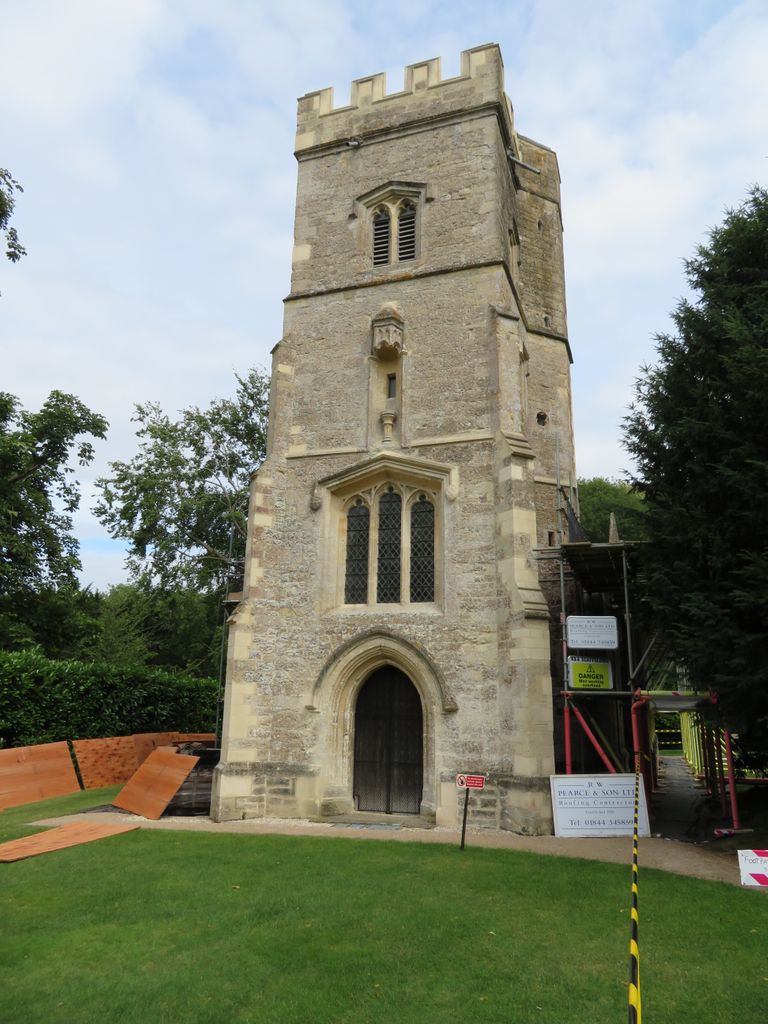
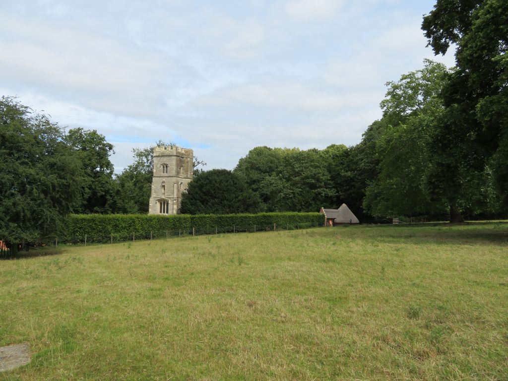
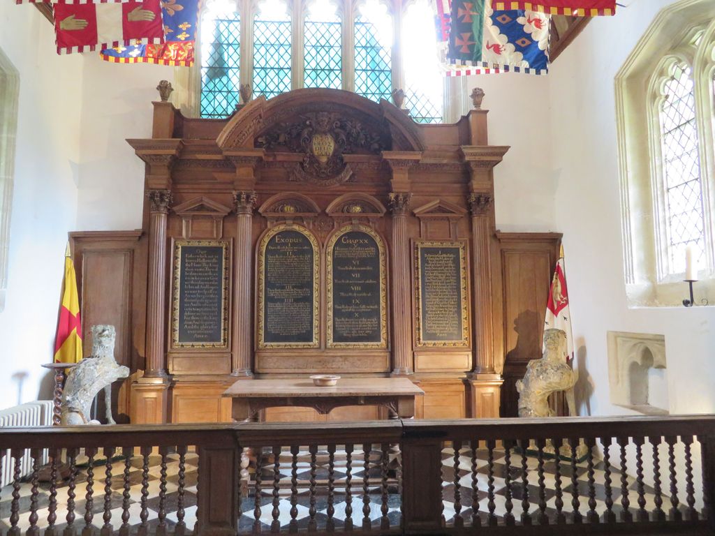
| Description | : | A 15th century private chapel featuring superbly carved and painted original woodwork. The chapel was built in 1449 by Richard Quatremayne, close aide to Richard, Duke of York, and later, to Edward IV. It was to serve as a private chapel for Ryecote Palace, now sadly destroyed. The chapel features a musician's gallery and a beautifully carved rood screen. The font is 12th century, salvaged from an earlier church on this site. Rycote, Oxfordshire, England, OX9 2PE |
frequently asked questions (FAQ):
-
Where is Rycote Chapel?
Rycote Chapel is located at Great Haseley, South Oxfordshire District ,Oxfordshire , OX9 2PEEngland.
-
Rycote Chapel cemetery's updated grave count on graveviews.com?
1 memorials
-
Where are the coordinates of the Rycote Chapel?
Latitude: 51.7366100
Longitude: -1.0355370
Nearby Cemetories:
1. St Helen Churchyard
Albury, South Oxfordshire District, England
Coordinate: 51.7406280, -1.0519520
2. North Weston Chapel
Thame, South Oxfordshire District, England
Coordinate: 51.7433420, -1.0153490
3. St. Mary Magdalene Churchyard
Shabbington, Aylesbury Vale District, England
Coordinate: 51.7554420, -1.0357510
4. Saint Leonard's Churchyard
Waterstock, South Oxfordshire District, England
Coordinate: 51.7451800, -1.0807500
5. St. Nicholas' Churchyard
Ickford, Aylesbury Vale District, England
Coordinate: 51.7614648, -1.0656459
6. St Giles Churchyard
Tetsworth, South Oxfordshire District, England
Coordinate: 51.7085800, -1.0086700
7. St Peter Churchyard
Great Haseley, South Oxfordshire District, England
Coordinate: 51.7102600, -1.0693200
8. Saint Mary The Virgin Churchyard
Thame, South Oxfordshire District, England
Coordinate: 51.7511750, -0.9819190
9. St Mary's Churchyard
Waterperry, South Oxfordshire District, England
Coordinate: 51.7521000, -1.0894000
10. Thame War Memorial
Thame, South Oxfordshire District, England
Coordinate: 51.7452570, -0.9743330
11. St Mary the Virgin Churchyard
Great Milton, South Oxfordshire District, England
Coordinate: 51.7170320, -1.0921100
12. Thame Park Chapel
Thame, South Oxfordshire District, England
Coordinate: 51.7290130, -0.9650540
13. Baptist Chapel Burial Ground
Long Crendon, Aylesbury Vale District, England
Coordinate: 51.7730713, -0.9929426
14. St Mary the Virgin Churchyard
Long Crendon, Aylesbury Vale District, England
Coordinate: 51.7758380, -0.9890670
15. St. Mary Magdalene
Stoke Talmage, South Oxfordshire District, England
Coordinate: 51.6878240, -1.0183240
16. St. Andrew's Churchyard
Wheatfield, South Oxfordshire District, England
Coordinate: 51.6879720, -1.0050930
17. St. Mary's Churchyard
Adwell, South Oxfordshire District, England
Coordinate: 51.6906560, -0.9938380
18. St James Churchyard
Little Milton, South Oxfordshire District, England
Coordinate: 51.7019280, -1.1072800
19. St Bartholomew Churchyard
Holton, South Oxfordshire District, England
Coordinate: 51.7529490, -1.1246510
20. All Saints Churchyard
Cuddesdon, South Oxfordshire District, England
Coordinate: 51.7230140, -1.1316130
21. St. Catherine Churchyard
Towersey, South Oxfordshire District, England
Coordinate: 51.7411700, -0.9360300
22. St Mary the Virgin Churchyard
Wheatley, South Oxfordshire District, England
Coordinate: 51.7476020, -1.1366080
23. St Mary's Churchyard
Sydenham, South Oxfordshire District, England
Coordinate: 51.7112360, -0.9398460
24. Wheatley War Memorial
Wheatley, South Oxfordshire District, England
Coordinate: 51.7468630, -1.1388780