
| Memorials | : | 0 |
| Location | : | Tetsworth, South Oxfordshire District, England |
| Coordinate | : | 51.7085800, -1.0086700 |
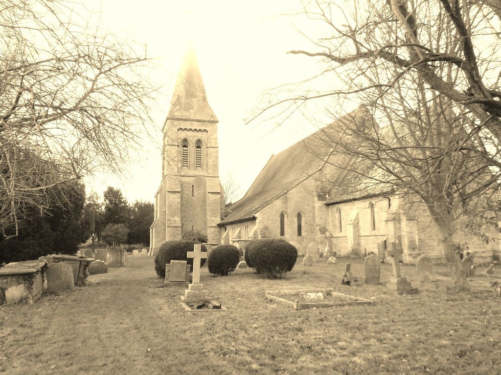
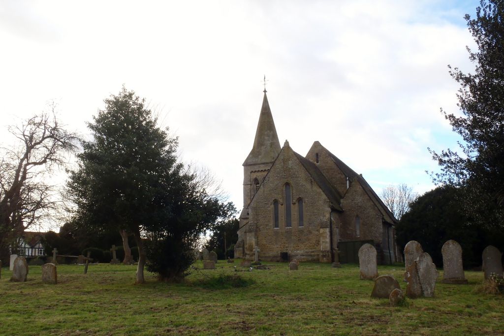
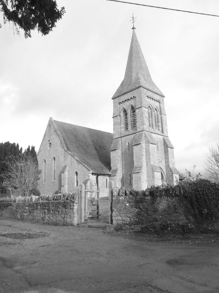
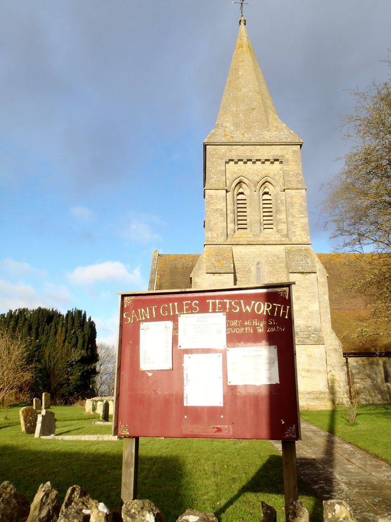
| Description | : | Tetsworth is a village and civil parish about 3 miles (5 km) south of Thame in Oxfordshire. The Church of England parish church of Saint Giles was originally Saxon. It was largely rebuilt in the 12th century in the Norman, with some fine features including the tympanum over the south door.The chancel was rebuilt in the 13th century, and in the 15th century new Perpendicular Gothic windows were inserted in the nave. St. Giles was a prebendal chapel of the parish of Thame until 1841, when Tetsworth was made a separate ecclesiastical parish. The first incumbent of the new parish... Read More |
frequently asked questions (FAQ):
-
Where is St Giles Churchyard?
St Giles Churchyard is located at Chiltern Veiw Tetsworth, South Oxfordshire District ,Oxfordshire , OX9 7ALEngland.
-
St Giles Churchyard cemetery's updated grave count on graveviews.com?
0 memorials
-
Where are the coordinates of the St Giles Churchyard?
Latitude: 51.7085800
Longitude: -1.0086700
Nearby Cemetories:
1. St. Mary's Churchyard
Adwell, South Oxfordshire District, England
Coordinate: 51.6906560, -0.9938380
2. St. Andrew's Churchyard
Wheatfield, South Oxfordshire District, England
Coordinate: 51.6879720, -1.0050930
3. St. Mary Magdalene
Stoke Talmage, South Oxfordshire District, England
Coordinate: 51.6878240, -1.0183240
4. Rycote Chapel
Great Haseley, South Oxfordshire District, England
Coordinate: 51.7366100, -1.0355370
5. Thame Park Chapel
Thame, South Oxfordshire District, England
Coordinate: 51.7290130, -0.9650540
6. North Weston Chapel
Thame, South Oxfordshire District, England
Coordinate: 51.7433420, -1.0153490
7. St Peter Churchyard
Great Haseley, South Oxfordshire District, England
Coordinate: 51.7102600, -1.0693200
8. St Helen Churchyard
Albury, South Oxfordshire District, England
Coordinate: 51.7406280, -1.0519520
9. Thame War Memorial
Thame, South Oxfordshire District, England
Coordinate: 51.7452570, -0.9743330
10. St Mary's Churchyard
Sydenham, South Oxfordshire District, England
Coordinate: 51.7112360, -0.9398460
11. St. Peter and St. Paul's Church Cemetery
Aston Rowant, South Oxfordshire District, England
Coordinate: 51.6851100, -0.9502900
12. St Margarets Churchyard
Lewknor, South Oxfordshire District, England
Coordinate: 51.6730340, -0.9663030
13. Saint Mary The Virgin Churchyard
Thame, South Oxfordshire District, England
Coordinate: 51.7511750, -0.9819190
14. St Peter Churchyard
Easington, South Oxfordshire District, England
Coordinate: 51.6684300, -1.0443070
15. St. Mary Magdalene Churchyard
Shabbington, Aylesbury Vale District, England
Coordinate: 51.7554420, -1.0357510
16. All Saints Churchyard
Shirburn, South Oxfordshire District, England
Coordinate: 51.6577000, -0.9945000
17. St Mary the Virgin Churchyard
Great Milton, South Oxfordshire District, England
Coordinate: 51.7170320, -1.0921100
18. St Mary Churchyard
Pyrton, South Oxfordshire District, England
Coordinate: 51.6558520, -1.0076830
19. Nativity of the Blessed Virgin Mary Churchyard
Crowell, South Oxfordshire District, England
Coordinate: 51.6921610, -0.9268631
20. St. Catherine Churchyard
Towersey, South Oxfordshire District, England
Coordinate: 51.7411700, -0.9360300
21. Saint Leonard's Churchyard
Waterstock, South Oxfordshire District, England
Coordinate: 51.7451800, -1.0807500
22. Holy Rood Churchyard
Cuxham, South Oxfordshire District, England
Coordinate: 51.6516250, -1.0376070
23. St. Leonard's Churchyard
Watlington, South Oxfordshire District, England
Coordinate: 51.6474030, -1.0117420
24. St James Churchyard
Little Milton, South Oxfordshire District, England
Coordinate: 51.7019280, -1.1072800