
| Memorials | : | 0 |
| Location | : | Stanstead Abbotts, East Hertfordshire District, England |
| Coordinate | : | 51.7806920, 0.0275950 |
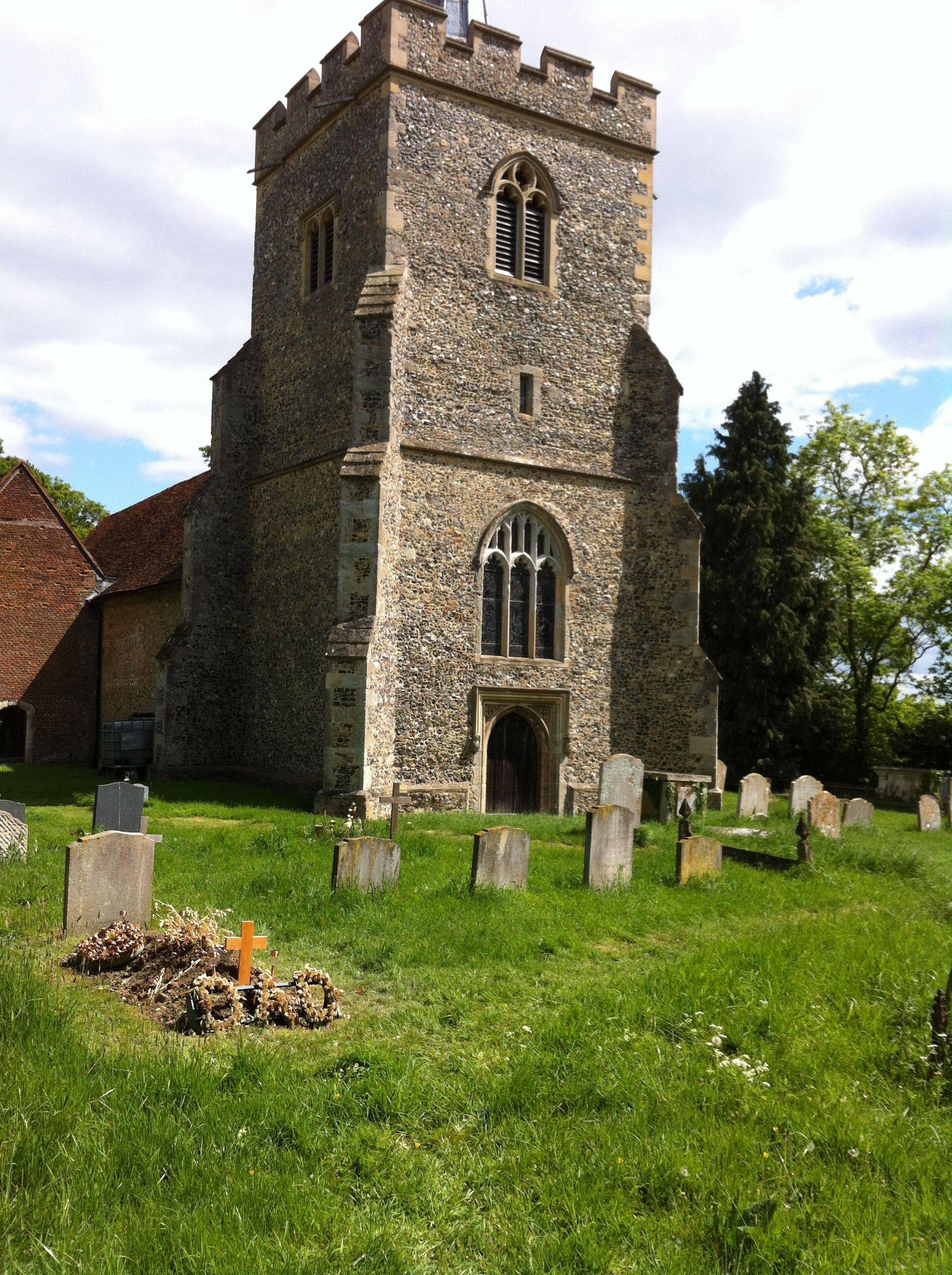
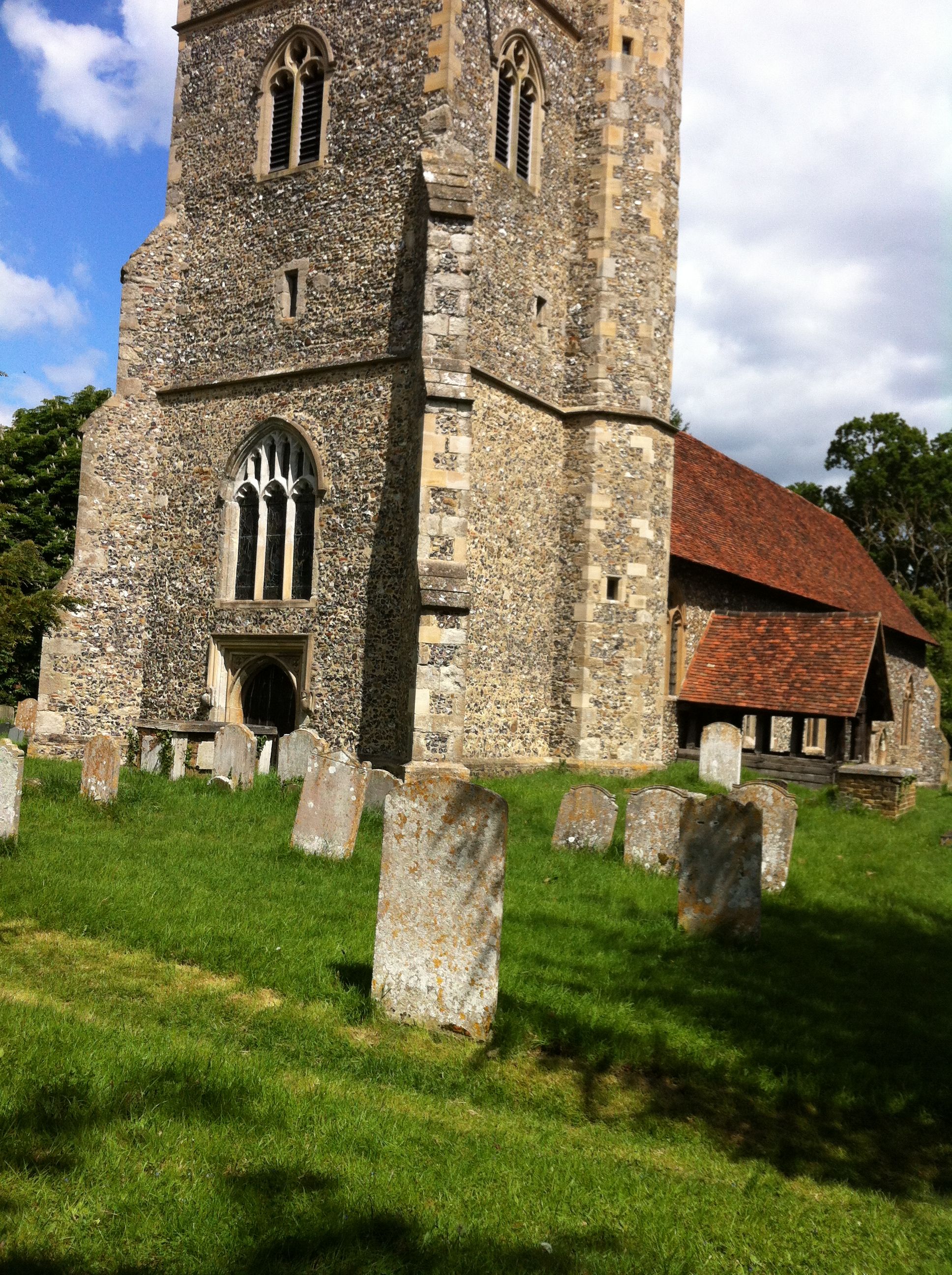
| Description | : | Sited a mile away from its village, St James' was the parish church for at least 700 years until St Andrew's, nearer the centre, replaced it in 1882. Picturesque on its hilltop and largely ignored by the Victorians, it is a marvellously atmospheric church. The building dates from the 12th to the 16th centuries and the 15th century timbered porch is notable. Inside are unusually high Georgian box pews, a three-decker pulpit, texts, hatchments, old glass and monuments of many periods. Opening hours: Open Jun - Sep, Sun 2.30-5pm. Parking facilities: No Toilet facilities: No Accessibility issues: A step This church is no... Read More |
frequently asked questions (FAQ):
-
Where is St James' Churchyard?
St James' Churchyard is located at Roydon Road (B181) Stanstead Abbotts, East Hertfordshire District ,Hertfordshire , SG128JZEngland.
-
St James' Churchyard cemetery's updated grave count on graveviews.com?
0 memorials
-
Where are the coordinates of the St James' Churchyard?
Latitude: 51.7806920
Longitude: 0.0275950
Nearby Cemetories:
1. Roydon United Reform Churchyard
Roydon, Epping Forest District, England
Coordinate: 51.7714050, 0.0460240
2. St. Margaret's Parish Churchyard
Stanstead St Margarets, East Hertfordshire District, England
Coordinate: 51.7857570, -0.0002631
3. St. Dunstan Churchyard
Hunsdon, East Hertfordshire District, England
Coordinate: 51.7951000, 0.0548190
4. St John the Baptist Churchyard
Great Amwell, East Hertfordshire District, England
Coordinate: 51.7944320, -0.0123740
5. Hoddesdon Cemetery
Hoddesdon, Broxbourne Borough, England
Coordinate: 51.7711490, -0.0156822
6. St Catherine and St Paul's Churchyard
Hoddesdon, Broxbourne Borough, England
Coordinate: 51.7625830, -0.0120670
7. St Botolph Church
Eastwick, East Hertfordshire District, England
Coordinate: 51.7851000, 0.0776000
8. Quaker Burial Ground, Hoddesdon, Hertfordshire
Hoddesdon, Broxbourne Borough, England
Coordinate: 51.7610213, -0.0139560
9. St. Mary's Churchyard
Little Parndon, Harlow District, England
Coordinate: 51.7792683, 0.0840760
10. St Mary the Virgin Churchyard
Great Parndon, Harlow District, England
Coordinate: 51.7605100, 0.0739860
11. Woollensbrook Crematorium
Hoddesdon, Broxbourne Borough, England
Coordinate: 51.7681805, -0.0280669
12. All Saints Churchyard
Nazeing, Epping Forest District, England
Coordinate: 51.7436140, 0.0464100
13. Holy Trinity Churchyard
Wareside, East Hertfordshire District, England
Coordinate: 51.8212430, 0.0221440
14. St Mary's Churchyard
Gilston, East Hertfordshire District, England
Coordinate: 51.8016340, 0.0855550
15. St. John the Baptist Churchyard
Widford, East Hertfordshire District, England
Coordinate: 51.8228370, 0.0491000
16. Holy Trinity Churchyard
Hertford Heath, East Hertfordshire District, England
Coordinate: 51.7865300, -0.0433980
17. Saint Augustine's Churchyard
Broxbourne, Broxbourne Borough, England
Coordinate: 51.7445150, -0.0147810
18. Saint Mary's Churchyard
Ware, East Hertfordshire District, England
Coordinate: 51.8120500, -0.0331800
19. St Andrew Churchyard
Netteswell, Harlow District, England
Coordinate: 51.7640460, 0.1085500
20. Parndon Wood Crematorium and Cemetery
Harlow, Harlow District, England
Coordinate: 51.7430160, 0.0898420
21. Ware Cemetery Old
Ware, East Hertfordshire District, England
Coordinate: 51.8170650, -0.0433230
22. St Mary-at-Latton Churchyard
Latton, Harlow District, England
Coordinate: 51.7774500, 0.1206750
23. Ware Cemetery New
Ware, East Hertfordshire District, England
Coordinate: 51.8181400, -0.0438590
24. St. Laurence Churchyard
Wormley, Broxbourne Borough, England
Coordinate: 51.7352050, -0.0389350