
| Memorials | : | 0 |
| Location | : | Long Lane, Derbyshire Dales District, England |
| Phone | : | 01335 330297 |
| Coordinate | : | 52.9391990, -1.6264140 |
frequently asked questions (FAQ):
-
Where is Christ Church Cemetery?
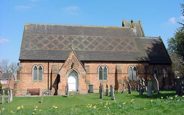
Christ Church Cemetery is located at Long Lane Village Dalbury Lees Ashbourne Derbshire Long Lane, Derbyshire Dales District ,Derbyshire , DE6 5BJEngland.
-
Christ Church Cemetery cemetery's updated grave count on graveviews.com?
0 memorials
-
Where are the coordinates of the Christ Church Cemetery?
Latitude: 52.9391990
Longitude: -1.6264140
Nearby Cemetories:
1. All Saints Churchyard
Trusley, South Derbyshire District, England
Coordinate: 52.9166300, -1.6243670
2. All Saints Churchyard
Brailsford, Derbyshire Dales District, England
Coordinate: 52.9683200, -1.6367880
3. Brailsford Cemetery
Brailsford, Derbyshire Dales District, England
Coordinate: 52.9687740, -1.6365260
4. St Michaels Churchyard
Kirk Langley, Amber Valley Borough, England
Coordinate: 52.9463000, -1.5747000
5. St. Chad Churchyard
Longford, Derbyshire Dales District, England
Coordinate: 52.9419000, -1.6818000
6. All Saints Churchyard
Dalbury Lees, South Derbyshire District, England
Coordinate: 52.9053450, -1.6096710
7. St Andrews Churchyard
Radbourne, South Derbyshire District, England
Coordinate: 52.9207000, -1.5759800
8. St Michael Churchyard
Sutton-on-the-Hill, South Derbyshire District, England
Coordinate: 52.9050080, -1.6484320
9. St. Michael's Churchyard
Shirley, Derbyshire Dales District, England
Coordinate: 52.9718160, -1.6755680
10. All Saints Churchyard
Mugginton, Amber Valley Borough, England
Coordinate: 52.9824770, -1.5794840
11. Etwall Cemetery
Etwall, South Derbyshire District, England
Coordinate: 52.8856100, -1.6025100
12. Saint Helen's Churchyard
Etwall, South Derbyshire District, England
Coordinate: 52.8847700, -1.6017500
13. St Michael and All Angels Churchyard
Church Broughton, South Derbyshire District, England
Coordinate: 52.9009460, -1.6962610
14. All Saints Churchyard
Kedleston, Amber Valley Borough, England
Coordinate: 52.9592000, -1.5367000
15. St. John's Churchyard
Alkmonton, Derbyshire Dales District, England
Coordinate: 52.9438800, -1.7229970
16. All Saints Churchyard
Mickleover, Derby Unitary Authority, England
Coordinate: 52.9043630, -1.5476790
17. All Saints Churchyard
Mackworth, Amber Valley Borough, England
Coordinate: 52.9362637, -1.5249797
18. Yeaveley Cemetery
Yeaveley, Derbyshire Dales District, England
Coordinate: 52.9552050, -1.7250170
19. Markeaton Crematorium
Derby, Derby Unitary Authority, England
Coordinate: 52.9338110, -1.5172230
20. St. John the Baptist Churchyard
Boylestone, Derbyshire Dales District, England
Coordinate: 52.9195410, -1.7313190
21. St. Martin Churchyard
Osmaston, Derbyshire Dales District, England
Coordinate: 52.9930270, -1.7042370
22. Old Chapel
Quarndon, Amber Valley Borough, England
Coordinate: 52.9575000, -1.5063000
23. All Saints Churchyard
Bradley, Derbyshire Dales District, England
Coordinate: 53.0105800, -1.6682420
24. St. James' Churchyard
Edlaston, Derbyshire Dales District, England
Coordinate: 52.9811080, -1.7316130