| Memorials | : | 0 |
| Location | : | Lode, East Cambridgeshire District, England |
| Coordinate | : | 52.2408700, 0.2447000 |
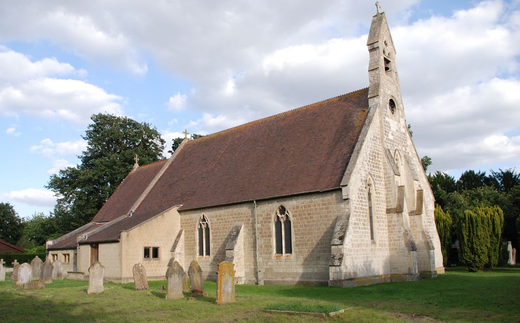
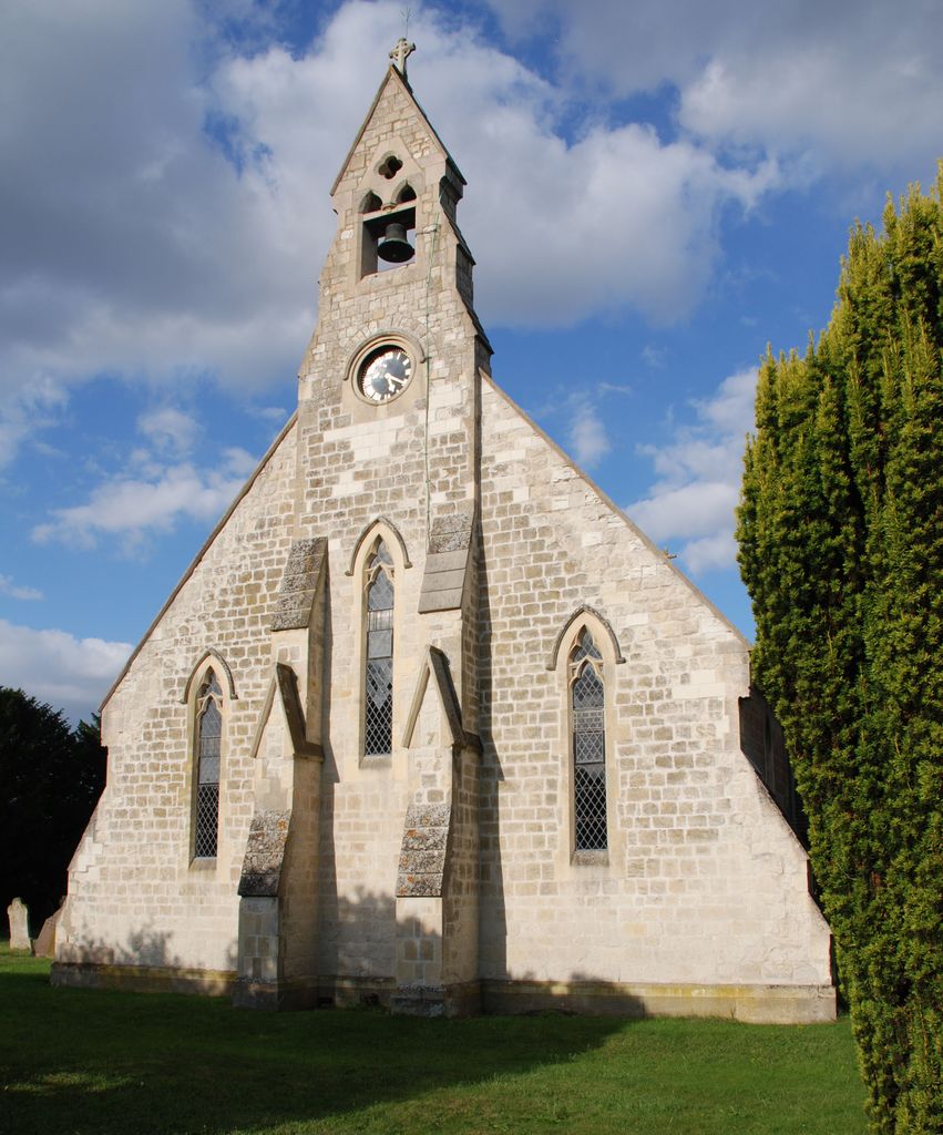
| Description | : | The Reveverend Hailstone owned and lived in Anglesey Abbey and was the Vicar of Bottisham in the 1800's. He felt strongly that Lode should have its own Church and built St James' to the designs of Rhode Hawkins. The ecclesiastical parish of St. James was formed May 1, 1863; the church, erected and consecrated in 1853, is a building of stone in the Gothic style. |
frequently asked questions (FAQ):
-
Where is Saint James Churchyard?
Saint James Churchyard is located at High Street Lode, East Cambridgeshire District ,Cambridgeshire , CB25 9EWEngland.
-
Saint James Churchyard cemetery's updated grave count on graveviews.com?
0 memorials
-
Where are the coordinates of the Saint James Churchyard?
Latitude: 52.2408700
Longitude: 0.2447000
Nearby Cemetories:
1. Lode Baptist Chapel
Lode, East Cambridgeshire District, England
Coordinate: 52.2409600, 0.2436900
2. St Mary Churchyard
Swaffham Bulbeck, East Cambridgeshire District, England
Coordinate: 52.2363700, 0.2762500
3. Swaffham Bulbeck Cemetery
Swaffham Bulbeck, East Cambridgeshire District, England
Coordinate: 52.2404330, 0.2794270
4. Bottisham Cemetery
Bottisham, East Cambridgeshire District, England
Coordinate: 52.2217100, 0.2620800
5. Holy Trinity Churchyard
Bottisham, East Cambridgeshire District, England
Coordinate: 52.2207558, 0.2609813
6. Swaffham Prior Cemetery
Swaffham Prior, East Cambridgeshire District, England
Coordinate: 52.2506740, 0.2962160
7. St. Mary the Virgin Churchyard
Swaffham Prior, East Cambridgeshire District, England
Coordinate: 52.2510981, 0.2962463
8. St. Peter Churchyard
Horningsea, South Cambridgeshire District, England
Coordinate: 52.2418000, 0.1846800
9. Horningsea Cemetery
Horningsea, South Cambridgeshire District, England
Coordinate: 52.2358100, 0.1832900
10. Waterbeach Baptist Church
Waterbeach, South Cambridgeshire District, England
Coordinate: 52.2652204, 0.1913064
11. St. Mary's Churchyard
Lakenheath, Forest Heath District, England
Coordinate: 52.2457189, 0.3143020
12. St Nicholas Churchyard
Great Wilbraham, South Cambridgeshire District, England
Coordinate: 52.1963890, 0.2638060
13. Waterbeach Cemetery
Waterbeach, South Cambridgeshire District, England
Coordinate: 52.2735800, 0.1888600
14. All Saints Churchyard
Milton, South Cambridgeshire District, England
Coordinate: 52.2443800, 0.1665600
15. Fen Ditton Cemetery
Fen Ditton, South Cambridgeshire District, England
Coordinate: 52.2233300, 0.1696700
16. St. Mary the Virgin Churchyard
Fen Ditton, South Cambridgeshire District, England
Coordinate: 52.2215560, 0.1691510
17. All Saints Churchyard
Teversham, South Cambridgeshire District, England
Coordinate: 52.2046650, 0.1880510
18. All Saints Churchyard Extension
Milton, South Cambridgeshire District, England
Coordinate: 52.2502700, 0.1641900
19. Cambridge City Cemetery
Cambridge, City of Cambridge, England
Coordinate: 52.2124080, 0.1665440
20. All Saints Churchyard
Landbeach, South Cambridgeshire District, England
Coordinate: 52.2664100, 0.1623000
21. St Mary the Virgin Churchyard
Burwell, East Cambridgeshire District, England
Coordinate: 52.2697130, 0.3280880
22. St Vigor & All Saints Churchyard
Fulbourn, South Cambridgeshire District, England
Coordinate: 52.1832222, 0.2231111
23. Fulbourn United Reformed Church
Fulbourn, South Cambridgeshire District, England
Coordinate: 52.1793500, 0.2232800
24. St Andrew Churchyard
Cherry Hinton, City of Cambridge, England
Coordinate: 52.1919170, 0.1779000


