
| Memorials | : | 13 |
| Location | : | Cross Creek Township, Jefferson County, USA |
| Coordinate | : | 40.3211700, -80.7563400 |
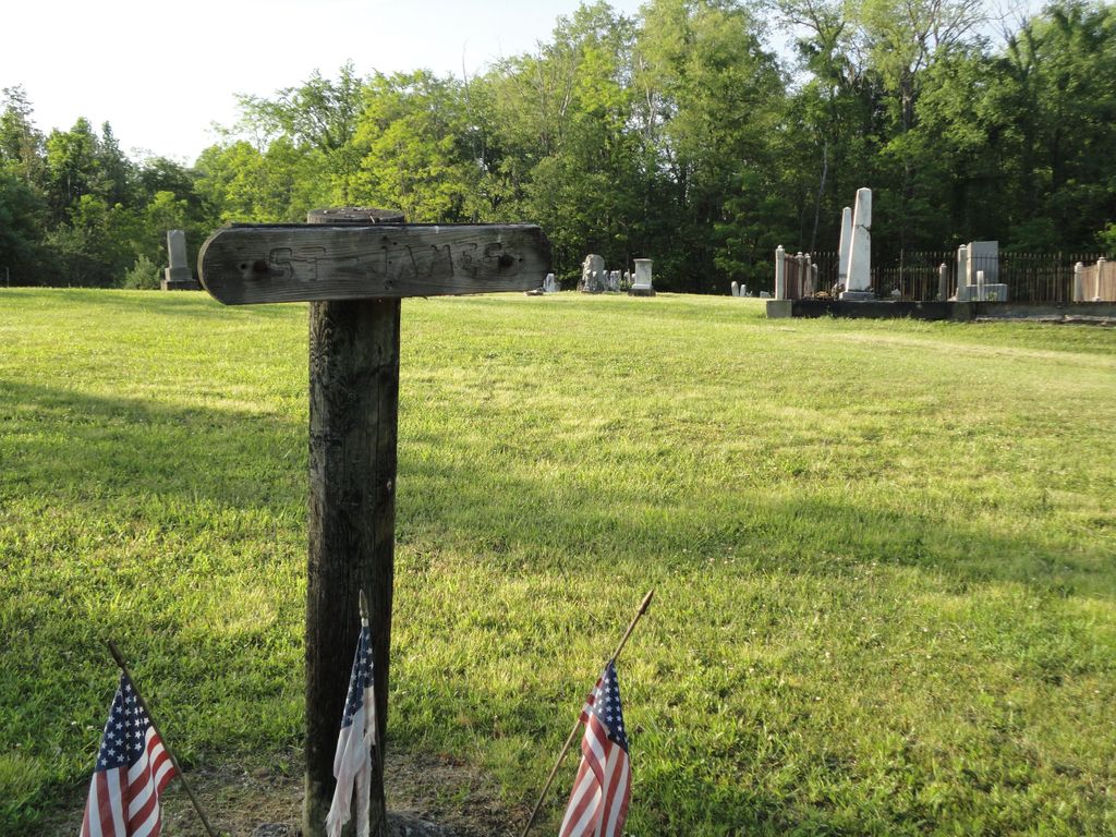
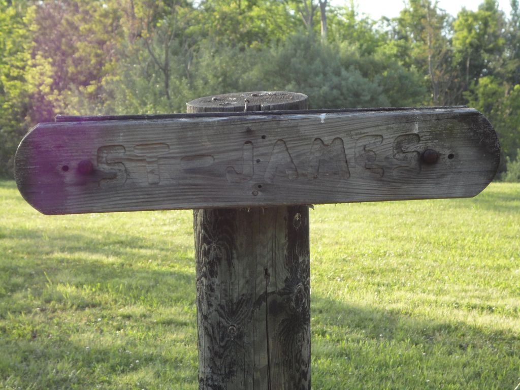
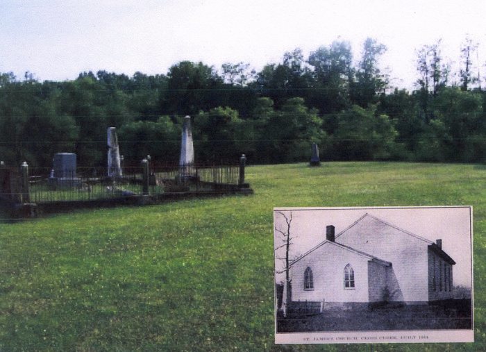
| Description | : | The cemetery is located on the north side of Fernwood Bloomingdale Road (County Road 26) about 0.6 miles west of its intersection with Lake Betsy Road (Township Road 189). The cemetery is located in Cross Creek Township, Jefferson County, Ohio, and is # 6013 (Saint James Episcopal Cemetery) in “Ohio Cemeteries 1803-2003”, compiled by the Ohio Genealogical Society. The cemetery is registered with the Ohio Division of Real Estate and Professional Licensing (ODRE) as Saint James Cemetery with registration license number CGR.0000982395. The U.S. Geological Survey (USGS) Geographic Names Information System (GNIS) feature ID for the cemetery is... Read More |
frequently asked questions (FAQ):
-
Where is Saint James Episcopal Cemetery?
Saint James Episcopal Cemetery is located at Fernwood Bloomingdale Road (County Road 26) Cross Creek Township, Jefferson County ,Ohio , 43953USA.
-
Saint James Episcopal Cemetery cemetery's updated grave count on graveviews.com?
9 memorials
-
Where are the coordinates of the Saint James Episcopal Cemetery?
Latitude: 40.3211700
Longitude: -80.7563400
Nearby Cemetories:
1. Longs Methodist Episcopal Cemetery
Jefferson County, USA
Coordinate: 40.3203400, -80.7400100
2. Shaffer Chapel McIntyre AME Church Cemetery
Bloomingdale, Jefferson County, USA
Coordinate: 40.3050688, -80.7809165
3. McIntyre African Methodist Episcopal Cemetery
Smithfield, Jefferson County, USA
Coordinate: 40.3050688, -80.7809165
4. Mount Moriah Cemetery
Bloomingdale, Jefferson County, USA
Coordinate: 40.3047640, -80.8137800
5. Tent Church Cemetery
New Alexandria, Jefferson County, USA
Coordinate: 40.2832985, -80.7202988
6. Bloomingdale Cemetery
Bloomingdale, Jefferson County, USA
Coordinate: 40.3418110, -80.8134230
7. Northern Cemetery
Smithfield, Jefferson County, USA
Coordinate: 40.2736805, -80.7817502
8. Smithfield Quaker Cemetery
Smithfield, Jefferson County, USA
Coordinate: 40.2670010, -80.7844370
9. Cross Creek Cemetery
Wintersville, Jefferson County, USA
Coordinate: 40.3492928, -80.6872635
10. Oliver Cemetery
Wells Township, Jefferson County, USA
Coordinate: 40.2644005, -80.7217026
11. New Alexandria Cemetery
New Alexandria, Jefferson County, USA
Coordinate: 40.2949982, -80.6781006
12. Wintersville United Methodist Church Cemetery
Wintersville, Jefferson County, USA
Coordinate: 40.3755360, -80.7064440
13. Fort Steuben Burial Estates
Wintersville, Jefferson County, USA
Coordinate: 40.3891983, -80.7236023
14. Queen of All Saints Cemetery
Bloomingdale, Jefferson County, USA
Coordinate: 40.3841050, -80.8094450
15. Two Ridges Cemetery
Wintersville, Jefferson County, USA
Coordinate: 40.3944016, -80.7328033
16. Pine Run Cemetery
Unionport, Jefferson County, USA
Coordinate: 40.3703003, -80.8407974
17. Holy Family Hermitage Cemetery
Bloomingdale, Jefferson County, USA
Coordinate: 40.3840650, -80.8243020
18. Wheeler Cemetery
Smithfield, Jefferson County, USA
Coordinate: 40.2453003, -80.7996979
19. Buckingham Cemetery
Wells Township, Jefferson County, USA
Coordinate: 40.2739230, -80.6662180
20. Jefferson County Infirmary Cemetery
Steubenville, Jefferson County, USA
Coordinate: 40.3748880, -80.6725990
21. Unionport Cemetery
Unionport, Jefferson County, USA
Coordinate: 40.3650440, -80.8496090
22. Carne Cemetery
Salem Township, Jefferson County, USA
Coordinate: 40.4089012, -80.7667007
23. Coulter Cemetery
Wintersville, Jefferson County, USA
Coordinate: 40.4000970, -80.7014690
24. Ferguson Cemetery
Hopedale, Harrison County, USA
Coordinate: 40.3311005, -80.8741989