
| Memorials | : | 0 |
| Location | : | Knutsford, Cheshire East Unitary Authority, England |
| Coordinate | : | 53.3030630, -2.3728940 |
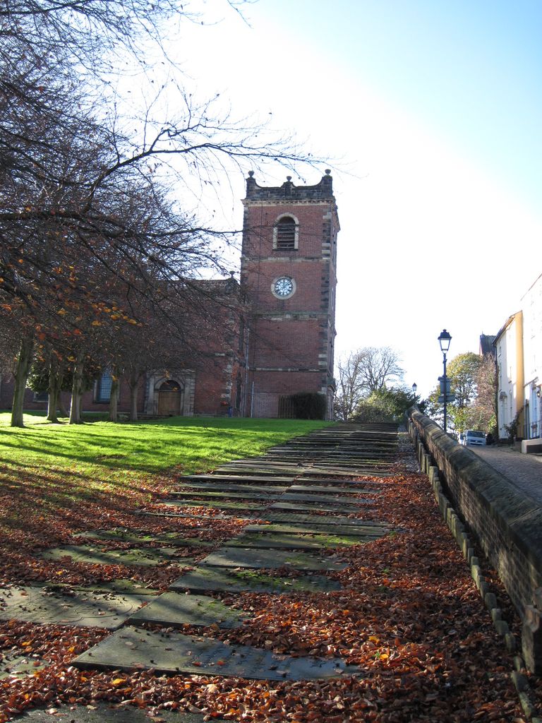
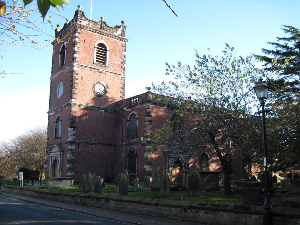
| Description | : | Knutsford was a chapel of ease in the parish of St Mary's Church, Rostherne, until the 18th century. In 1741 an Act of Parliament was obtained for it to become a distinct parish. The church was built between 1741 and 1744 at a cost of £4,000 (£650,000 as of 2012), the architect being J. Garlive. In 1879 the apsidal chancel was extended and reordered by Alfred Darbyshire. (from wikipedia article) |
frequently asked questions (FAQ):
-
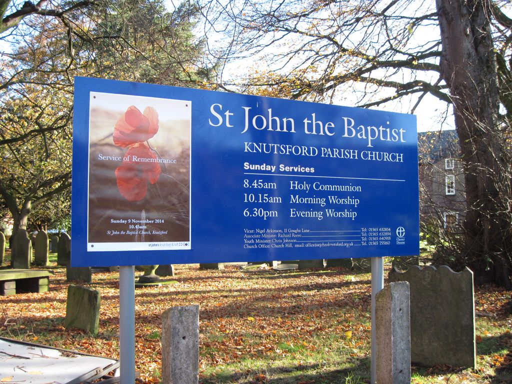
Where is Saint John the Baptist Churchyard?
Saint John the Baptist Churchyard is located at Church Hill Knutsford, Cheshire East Unitary Authority ,Cheshire , WA16 6DHEngland.
-
Saint John the Baptist Churchyard cemetery's updated grave count on graveviews.com?
0 memorials
-
Where are the coordinates of the Saint John the Baptist Churchyard?
Latitude: 53.3030630
Longitude: -2.3728940
Nearby Cemetories:
1. Brook Street Unitarian Chapel
Knutsford, Cheshire East Unitary Authority, England
Coordinate: 53.3016610, -2.3701670
2. Saint Cross Churchyard
Knutsford, Cheshire East Unitary Authority, England
Coordinate: 53.3034000, -2.3670000
3. Saint Helena Chapel Burial Ground
Knutsford, Cheshire East Unitary Authority, England
Coordinate: 53.3055380, -2.3531060
4. Tabley Hill Cemetery
Knutsford, Cheshire East Unitary Authority, England
Coordinate: 53.3118420, -2.3972480
5. St John's Churchyard
Toft, Cheshire East Unitary Authority, England
Coordinate: 53.2863740, -2.3626430
6. St Wilfrid Churchyard
Mobberley, Cheshire East Unitary Authority, England
Coordinate: 53.3181500, -2.3161790
7. St. Oswald's Churchyard
Lower Peover, Cheshire West and Chester Unitary Authority, England
Coordinate: 53.2638850, -2.3863890
8. St. Mary's Churchyard
Rostherne, Cheshire East Unitary Authority, England
Coordinate: 53.3494630, -2.3880170
9. St. Lawrence's Churchyard
Over Peover, Cheshire East Unitary Authority, England
Coordinate: 53.2582200, -2.3431600
10. All Saints Churchyard
Marthall, Cheshire East Unitary Authority, England
Coordinate: 53.2779100, -2.3021000
11. Quaker Burying Ground
Mobberley, Cheshire East Unitary Authority, England
Coordinate: 53.3174300, -2.2872500
12. Great Warford Baptist Chapel Graveyard
Alderley Edge, Cheshire East Unitary Authority, England
Coordinate: 53.2898500, -2.2769200
13. St John the Evangelist Churchyard
Lostock Gralam, Cheshire West and Chester Unitary Authority, England
Coordinate: 53.2693370, -2.4636730
14. Birches Remembrance Park and Crematorium
Lach Dennis, Cheshire West and Chester Unitary Authority, England
Coordinate: 53.2522730, -2.4510368
15. Alderley Edge Cemetery
Alderley Edge, Cheshire East Unitary Authority, England
Coordinate: 53.2995180, -2.2530880
16. St. John's Churchyard
Wilmslow, Cheshire East Unitary Authority, England
Coordinate: 53.3122370, -2.2532400
17. St John the Evangelist Churchyard
Chelford, Cheshire East Unitary Authority, England
Coordinate: 53.2623790, -2.2727070
18. St. Paul's Churchyard
Marston, Cheshire West and Chester Unitary Authority, England
Coordinate: 53.2819250, -2.4899741
19. St Peter Churchyard
Hale, Metropolitan Borough of Trafford, England
Coordinate: 53.3753110, -2.3417960
20. St Mary the Virgin Churchyard
Bowdon, Metropolitan Borough of Trafford, England
Coordinate: 53.3778850, -2.3643390
21. Ringway St. Mary and All Saints Churchyard
Altrincham, Metropolitan Borough of Trafford, England
Coordinate: 53.3587900, -2.2885800
22. Holy Trinity Churchyard
Little Bollington, Cheshire East Unitary Authority, England
Coordinate: 53.3744640, -2.4121950
23. St. Mary and All Saints Churchyard
Great Budworth, Cheshire West and Chester Unitary Authority, England
Coordinate: 53.2936000, -2.5043000
24. Bowdon and Hale Cemetery
Altrincham, Metropolitan Borough of Trafford, England
Coordinate: 53.3787830, -2.3330000