
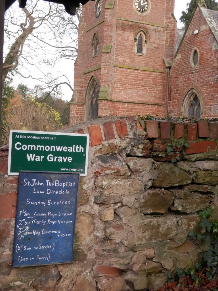
| Memorials | : | 1 |
| Location | : | Low Dinsdale, Darlington Unitary Authority, England |
| Coordinate | : | 54.4950000, -1.4660000 |
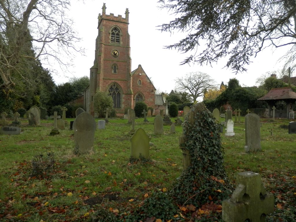
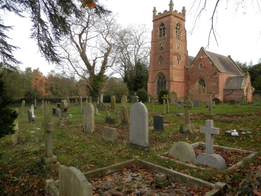
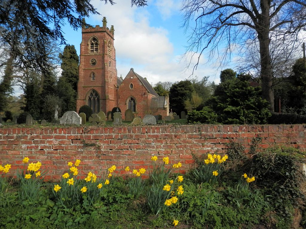
| Description | : | The hamlet of Low Dinsdale lies on the south bank of the meandering Tees, 1¼ mile east of Neasham and about 4 miles to the south-east of Darlington. The parish church of St John the Baptist stands a short distance to the north-east of the partly-medieval Manor House and its complex of encircling earthworks; the church consists of a nave with a west tower, a two-bay south aisle or chapel, with a south porch, and a chancel with combined vestry and organ chamber on the north. Most of the monuments in the churchyard are of late 19th century and more recent... Read More |
frequently asked questions (FAQ):
-
Where is Saint John the Baptist Churchyard?
Saint John the Baptist Churchyard is located at Low Dinsdale, Darlington Unitary Authority ,County Durham ,England.
-
Saint John the Baptist Churchyard cemetery's updated grave count on graveviews.com?
1 memorials
-
Where are the coordinates of the Saint John the Baptist Churchyard?
Latitude: 54.4950000
Longitude: -1.4660000
Nearby Cemetories:
1. Saint Laurence's Churchyard
Middleton St George, Darlington Unitary Authority, England
Coordinate: 54.5054700, -1.4625400
2. Saint George's Churchyard Low Middleton
Middleton St George, Darlington Unitary Authority, England
Coordinate: 54.4994000, -1.4366000
3. Neasham Priory
Sockburn, Darlington Unitary Authority, England
Coordinate: 54.4851000, -1.5035000
4. All Saints Churchyard
Girsby, Hambleton District, England
Coordinate: 54.4691000, -1.4554000
5. St Mary the Virgin Churchyard
Eryholme, Richmondshire District, England
Coordinate: 54.4754000, -1.5067000
6. All Saints Churchyard
Sockburn, Darlington Unitary Authority, England
Coordinate: 54.4582000, -1.4619000
7. All Saints Churchyard
Hurworth, Darlington Unitary Authority, England
Coordinate: 54.4869900, -1.5285200
8. St John Churchyard
High Worsall, Hambleton District, England
Coordinate: 54.4786500, -1.4059590
9. Darlington East Cemetery
Darlington, Darlington Unitary Authority, England
Coordinate: 54.5141900, -1.5324700
10. All Saints Churchyard
Low Worsall, Hambleton District, England
Coordinate: 54.4824880, -1.3898180
11. St Andrew Churchyard
Sadberge, Darlington Unitary Authority, England
Coordinate: 54.5453890, -1.4744810
12. St Peter Churchyard
Croft-on-Tees, Richmondshire District, England
Coordinate: 54.4830000, -1.5556200
13. St. Andrew Churchyard
Haughton Le Skerne, Darlington Unitary Authority, England
Coordinate: 54.5374300, -1.5257400
14. St. Mary's Churchyard
Long Newton, Stockton-on-Tees Unitary Authority, England
Coordinate: 54.5417700, -1.4098500
15. St Cuthbert Churchyard
Darlington, Darlington Unitary Authority, England
Coordinate: 54.5244260, -1.5517670
16. St Eloy Churchyard
Great Smeaton, Hambleton District, England
Coordinate: 54.4343000, -1.4647000
17. Friends Burial Ground
Darlington, Darlington Unitary Authority, England
Coordinate: 54.5240020, -1.5579930
18. Yarm Cemetery
Yarm, Stockton-on-Tees Unitary Authority, England
Coordinate: 54.5037700, -1.3559300
19. Saint Mary Magdalene Churchyard
Yarm, Stockton-on-Tees Unitary Authority, England
Coordinate: 54.5101150, -1.3575280
20. Holy Trinity Churchyard
Darlington, Darlington Unitary Authority, England
Coordinate: 54.5278310, -1.5639640
21. St. John the Baptist Churchyard
Egglescliffe, Stockton-on-Tees Unitary Authority, England
Coordinate: 54.5121000, -1.3518000
22. Egglescliffe Cemetery
Egglescliffe, Stockton-on-Tees Unitary Authority, England
Coordinate: 54.5127200, -1.3520100
23. Darlington North Cemetery
Darlington, Darlington Unitary Authority, England
Coordinate: 54.5445100, -1.5484600
24. Darlington West Cemetery
Darlington, Darlington Unitary Authority, England
Coordinate: 54.5206200, -1.5781200