
| Memorials | : | 0 |
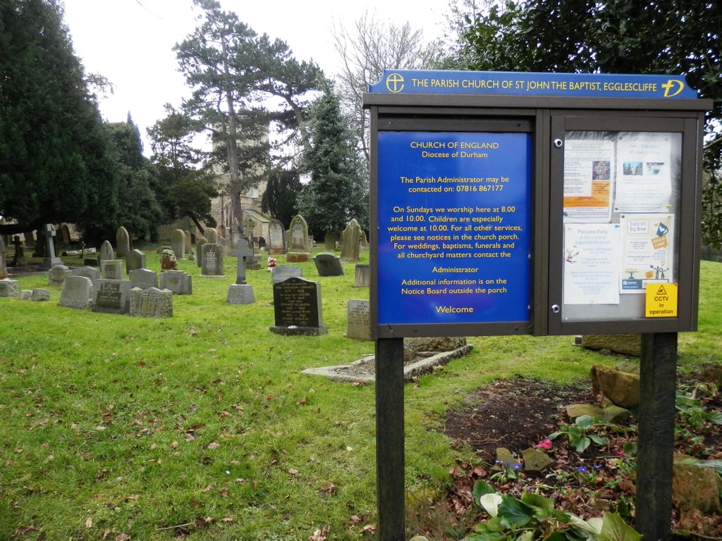
| Location | : | Egglescliffe, Stockton-on-Tees Unitary Authority, England |
| Coordinate | : | 54.5121000, -1.3518000 |
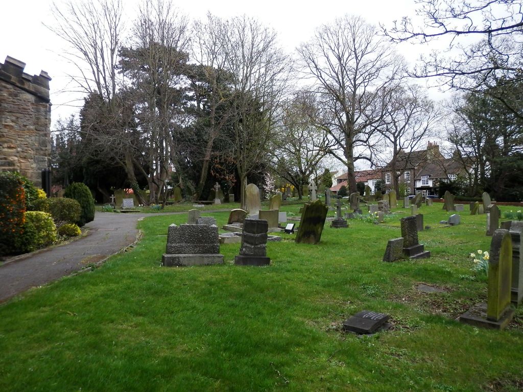
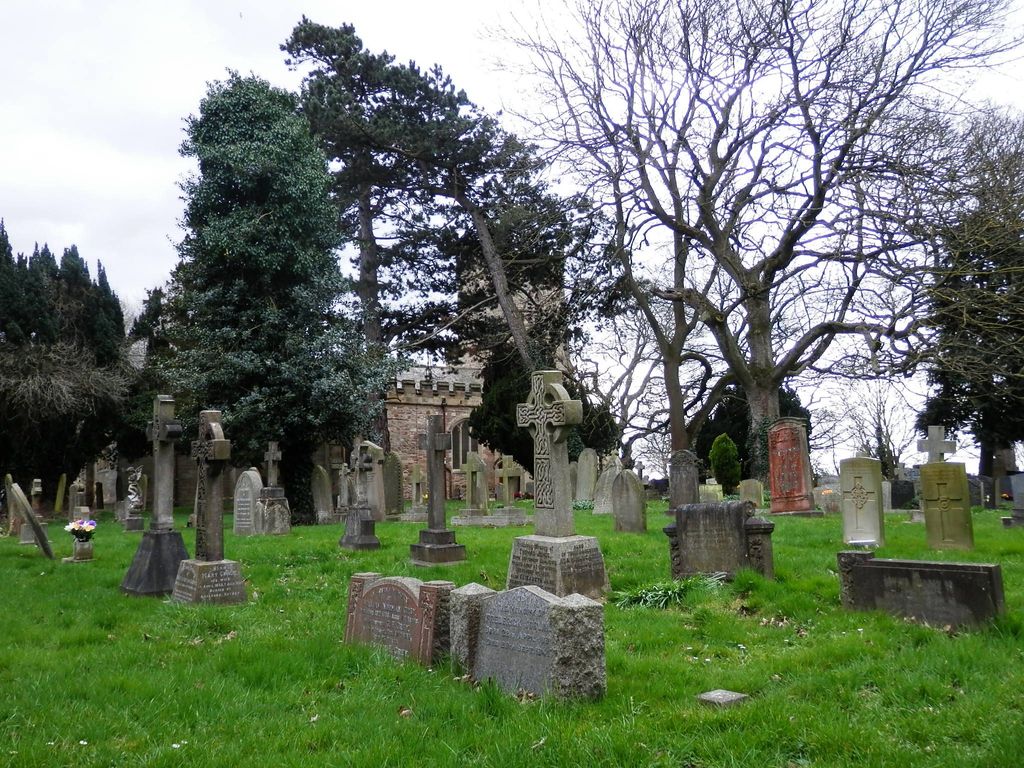
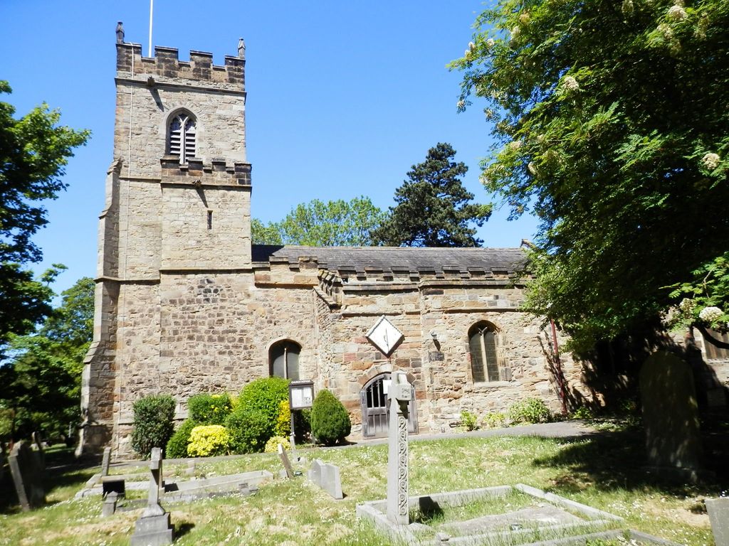
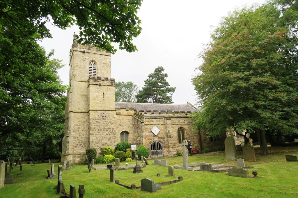
| Description | : | The parish church of St John the Baptist, Egglescliffe is an Anglican church in the village of Egglescliffe, Stockton-On-Tees. It is a perpendicular church, built in the Norman style. There has been a church on the site for at least 900 years; however the original date of construction is unknown. It is claimed that there is an underground tunnel from the church to the Friarage in the grounds of Yarm School. It is alleged that it was originally used as an escape tunnel for the monks when the Yarm School area was a catholic house. The Dominican Friars, Black Friars,... Read More |
frequently asked questions (FAQ):
-
Where is St. John the Baptist Churchyard?
St. John the Baptist Churchyard is located at 20 Church Road Egglescliffe, Stockton-on-Tees Unitary Authority ,County Durham , TS16 9DQEngland.
-
St. John the Baptist Churchyard cemetery's updated grave count on graveviews.com?
0 memorials
-
Where are the coordinates of the St. John the Baptist Churchyard?
Latitude: 54.5121000
Longitude: -1.3518000
Nearby Cemetories:
1. Egglescliffe Cemetery
Egglescliffe, Stockton-on-Tees Unitary Authority, England
Coordinate: 54.5127200, -1.3520100
2. Saint Mary Magdalene Churchyard
Yarm, Stockton-on-Tees Unitary Authority, England
Coordinate: 54.5101150, -1.3575280
3. Yarm Cemetery
Yarm, Stockton-on-Tees Unitary Authority, England
Coordinate: 54.5037700, -1.3559300
4. St. Martin's Churchyard
Kirklevington, Stockton-on-Tees Unitary Authority, England
Coordinate: 54.4822940, -1.3351050
5. Preston-on-Tees Municipal Cemetery
Stockton-on-Tees Unitary Authority, England
Coordinate: 54.5422400, -1.3367300
6. All Saints Churchyard
Low Worsall, Hambleton District, England
Coordinate: 54.4824880, -1.3898180
7. St. Peter ad Vincula Churchyard
Thornaby on Tees, Stockton-on-Tees Unitary Authority, England
Coordinate: 54.5412998, -1.3044432
8. St. John's Churchyard
Elton, Stockton-on-Tees Unitary Authority, England
Coordinate: 54.5500830, -1.3803290
9. Saint Peter’s Church
Hilton, Stockton-on-Tees Unitary Authority, England
Coordinate: 54.4950000, -1.2825000
10. St. Mary's Churchyard
Long Newton, Stockton-on-Tees Unitary Authority, England
Coordinate: 54.5417700, -1.4098500
11. St John Churchyard
High Worsall, Hambleton District, England
Coordinate: 54.4786500, -1.4059590
12. St Paul Churchyard
Thornaby on Tees, Stockton-on-Tees Unitary Authority, England
Coordinate: 54.5517940, -1.3048610
13. Saint George's Churchyard Low Middleton
Middleton St George, Darlington Unitary Authority, England
Coordinate: 54.4994000, -1.4366000
14. Oxbridge Lane Cemetery
Stockton-on-Tees, Stockton-on-Tees Unitary Authority, England
Coordinate: 54.5617050, -1.3319520
15. Holy Trinity Churchyard
Stockton-on-Tees, Stockton-on-Tees Unitary Authority, England
Coordinate: 54.5603000, -1.3151000
16. St Peter and St Paul Churchyard
Stainton, Middlesbrough Unitary Authority, England
Coordinate: 54.5195100, -1.2596600
17. All Saints Churchyard
Crathorne, Hambleton District, England
Coordinate: 54.4615000, -1.3176000
18. Thornaby Cemetery
Thornaby on Tees, Stockton-on-Tees Unitary Authority, England
Coordinate: 54.5492000, -1.2826740
19. St Thomas Churchyard
Stockton-on-Tees, Stockton-on-Tees Unitary Authority, England
Coordinate: 54.5665430, -1.3123540
20. Saint Laurence's Churchyard
Middleton St George, Darlington Unitary Authority, England
Coordinate: 54.5054700, -1.4625400
21. Durham Road Cemetery
Stockton-on-Tees, Stockton-on-Tees Unitary Authority, England
Coordinate: 54.5754110, -1.3283100
22. Teesside Crematorium
Middlesbrough, Middlesbrough Unitary Authority, England
Coordinate: 54.5360840, -1.2456050
23. Acklam Cemetery and Crematorium
Middlesbrough, Middlesbrough Unitary Authority, England
Coordinate: 54.5367830, -1.2423780
24. Saint John the Baptist Churchyard
Low Dinsdale, Darlington Unitary Authority, England
Coordinate: 54.4950000, -1.4660000