
| Memorials | : | 0 |
| Location | : | Yarm, Stockton-on-Tees Unitary Authority, England |
| Coordinate | : | 54.5101150, -1.3575280 |
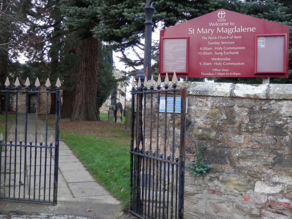
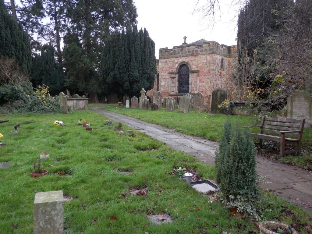
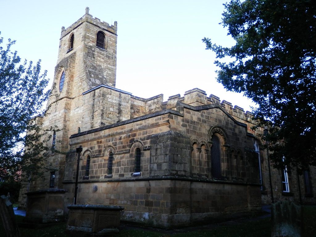
| Description | : | St Mary Magdalene is a Church of England parish church in the town of Yarm, Stockton-on-Tees, England. Administratively, it is a parish of the Diocese of York. The current church building is the third to stand on the site. The first was a wooden Saxon building of which no traces remain. A Norman church was built in the late 12th Century and remained until 1728 when it razed by fire. The present Georgian church was built from the remains of the second in 1730. In the Churchyard a modern headstone commemorates Tom Brown, "The Valiant Dragoon" hero of the Battle of Dettingen.... Read More |
frequently asked questions (FAQ):
-
Where is Saint Mary Magdalene Churchyard?
Saint Mary Magdalene Churchyard is located at Yarm, Stockton-on-Tees Unitary Authority ,County Durham ,England.
-
Saint Mary Magdalene Churchyard cemetery's updated grave count on graveviews.com?
0 memorials
-
Where are the coordinates of the Saint Mary Magdalene Churchyard?
Latitude: 54.5101150
Longitude: -1.3575280
Nearby Cemetories:
1. St. John the Baptist Churchyard
Egglescliffe, Stockton-on-Tees Unitary Authority, England
Coordinate: 54.5121000, -1.3518000
2. Egglescliffe Cemetery
Egglescliffe, Stockton-on-Tees Unitary Authority, England
Coordinate: 54.5127200, -1.3520100
3. Yarm Cemetery
Yarm, Stockton-on-Tees Unitary Authority, England
Coordinate: 54.5037700, -1.3559300
4. St. Martin's Churchyard
Kirklevington, Stockton-on-Tees Unitary Authority, England
Coordinate: 54.4822940, -1.3351050
5. All Saints Churchyard
Low Worsall, Hambleton District, England
Coordinate: 54.4824880, -1.3898180
6. Preston-on-Tees Municipal Cemetery
Stockton-on-Tees Unitary Authority, England
Coordinate: 54.5422400, -1.3367300
7. St. John's Churchyard
Elton, Stockton-on-Tees Unitary Authority, England
Coordinate: 54.5500830, -1.3803290
8. St John Churchyard
High Worsall, Hambleton District, England
Coordinate: 54.4786500, -1.4059590
9. St. Peter ad Vincula Churchyard
Thornaby on Tees, Stockton-on-Tees Unitary Authority, England
Coordinate: 54.5412998, -1.3044432
10. St. Mary's Churchyard
Long Newton, Stockton-on-Tees Unitary Authority, England
Coordinate: 54.5417700, -1.4098500
11. Saint Peter’s Church
Hilton, Stockton-on-Tees Unitary Authority, England
Coordinate: 54.4950000, -1.2825000
12. Saint George's Churchyard Low Middleton
Middleton St George, Darlington Unitary Authority, England
Coordinate: 54.4994000, -1.4366000
13. St Paul Churchyard
Thornaby on Tees, Stockton-on-Tees Unitary Authority, England
Coordinate: 54.5517940, -1.3048610
14. Oxbridge Lane Cemetery
Stockton-on-Tees, Stockton-on-Tees Unitary Authority, England
Coordinate: 54.5617050, -1.3319520
15. All Saints Churchyard
Crathorne, Hambleton District, England
Coordinate: 54.4615000, -1.3176000
16. Holy Trinity Churchyard
Stockton-on-Tees, Stockton-on-Tees Unitary Authority, England
Coordinate: 54.5603000, -1.3151000
17. St Peter and St Paul Churchyard
Stainton, Middlesbrough Unitary Authority, England
Coordinate: 54.5195100, -1.2596600
18. Thornaby Cemetery
Thornaby on Tees, Stockton-on-Tees Unitary Authority, England
Coordinate: 54.5492000, -1.2826740
19. Saint Laurence's Churchyard
Middleton St George, Darlington Unitary Authority, England
Coordinate: 54.5054700, -1.4625400
20. St Thomas Churchyard
Stockton-on-Tees, Stockton-on-Tees Unitary Authority, England
Coordinate: 54.5665430, -1.3123540
21. Saint John the Baptist Churchyard
Low Dinsdale, Darlington Unitary Authority, England
Coordinate: 54.4950000, -1.4660000
22. Durham Road Cemetery
Stockton-on-Tees, Stockton-on-Tees Unitary Authority, England
Coordinate: 54.5754110, -1.3283100
23. Teesside Crematorium
Middlesbrough, Middlesbrough Unitary Authority, England
Coordinate: 54.5360840, -1.2456050
24. All Saints Churchyard
Girsby, Hambleton District, England
Coordinate: 54.4691000, -1.4554000