
| Memorials | : | 0 |
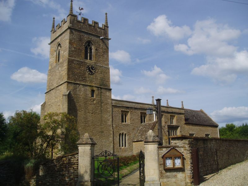
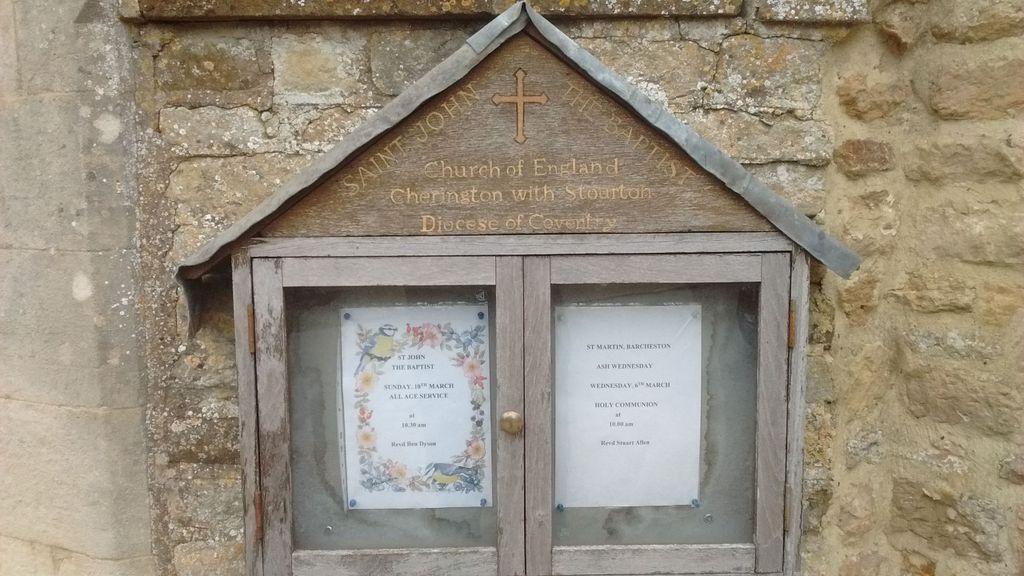
| Location | : | Cherington, Stratford-on-Avon District, England |
| Coordinate | : | 52.0271460, -1.5762520 |
frequently asked questions (FAQ):
-
Where is Saint John The Baptist Churchyard?
Saint John The Baptist Churchyard is located at Cherington, Stratford-on-Avon District ,Warwickshire ,England.
-
Saint John The Baptist Churchyard cemetery's updated grave count on graveviews.com?
0 memorials
-
Where are the coordinates of the Saint John The Baptist Churchyard?
Latitude: 52.0271460
Longitude: -1.5762520
Nearby Cemetories:
1. Stourton Wesleyan Chapel Burial Ground
Stourton, Stratford-on-Avon District, England
Coordinate: 52.0303940, -1.5704780
2. St. Thomas Becket Cemetery
Sutton-under-Brailes, Stratford-on-Avon District, England
Coordinate: 52.0342400, -1.5657800
3. St. Michael's
Whichford, Stratford-on-Avon District, England
Coordinate: 52.0094910, -1.5467784
4. St Barnabas & St Nicholas Churchyard
Burmington, Stratford-on-Avon District, England
Coordinate: 52.0393000, -1.6170100
5. Saint Peter and St Paul Churchyard
Long Compton, Stratford-on-Avon District, England
Coordinate: 51.9949740, -1.5823690
6. St. George's Church of England
Brailes, Stratford-on-Avon District, England
Coordinate: 52.0515110, -1.5414420
7. Saint Martin's Churchyard
Barcheston, Stratford-on-Avon District, England
Coordinate: 52.0570290, -1.6149230
8. Shipston Cemetery
Shipston-on-Stour, Stratford-on-Avon District, England
Coordinate: 52.0534039, -1.6225776
9. St Michael and All Angels Church
Great Wolford, Stratford-on-Avon District, England
Coordinate: 52.0091000, -1.6367450
10. Shipston-on-Stour Friends Burial Ground
Shipston-on-Stour, Stratford-on-Avon District, England
Coordinate: 52.0629460, -1.6232670
11. St Lawrence's Church
Barton-on-the-Heath, Stratford-on-Avon District, England
Coordinate: 51.9918300, -1.6272375
12. Friends Burial Ground
Sibford Gower, Cherwell District, England
Coordinate: 52.0373140, -1.4889440
13. Great Rollright St Andrews Churchyard
Rollright, West Oxfordshire District, England
Coordinate: 51.9809290, -1.5255550
14. St. Philip Church
Little Rollright, West Oxfordshire District, England
Coordinate: 51.9688330, -1.5742230
15. Holy Trinity Churchyard
Sibford Gower, Cherwell District, England
Coordinate: 52.0374300, -1.4822670
16. Compton Wynyates Burial Grounds
Compton Wynyates, Stratford-on-Avon District, England
Coordinate: 52.0747020, -1.5198000
17. All Saints Churchyard
Honington, Stratford-on-Avon District, England
Coordinate: 52.0818000, -1.6200000
18. Stretton Cemetery
Stretton-on-Fosse, Stratford-on-Avon District, England
Coordinate: 52.0413935, -1.6733470
19. St. Peter's Churchyard
Stretton-on-Fosse, Stratford-on-Avon District, England
Coordinate: 52.0430778, -1.6754209
20. Hook Norton Baptist Burial Ground
Hook Norton, Cherwell District, England
Coordinate: 51.9953000, -1.4860900
21. St Peters Churchyard
Hook Norton, Cherwell District, England
Coordinate: 51.9954200, -1.4842490
22. St Anne's Parish Church
Epwell, Cherwell District, England
Coordinate: 52.0615780, -1.4866280
23. Hook Norton Cemetery
Hook Norton, Cherwell District, England
Coordinate: 51.9969440, -1.4787690
24. St Leonard's
Moreton-in-Marsh, Cotswold District, England
Coordinate: 52.0087019, -1.6822226