
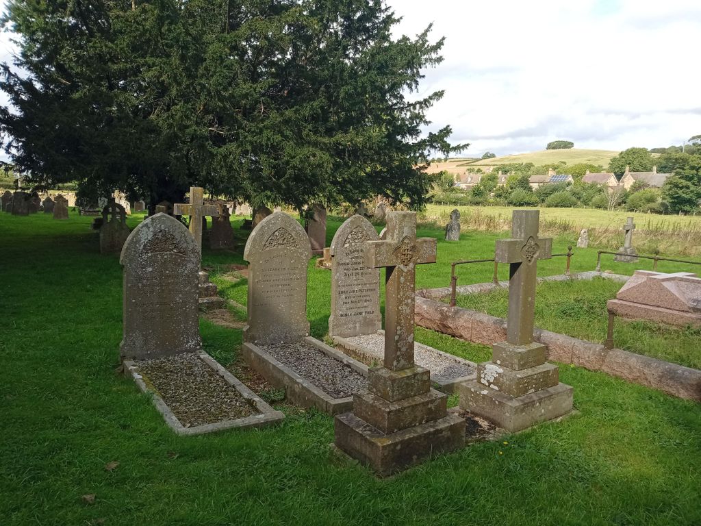
| Memorials | : | 0 |
| Location | : | Long Compton, Stratford-on-Avon District, England |
| Coordinate | : | 51.9949740, -1.5823690 |
frequently asked questions (FAQ):
-
Where is Saint Peter and St Paul Churchyard?
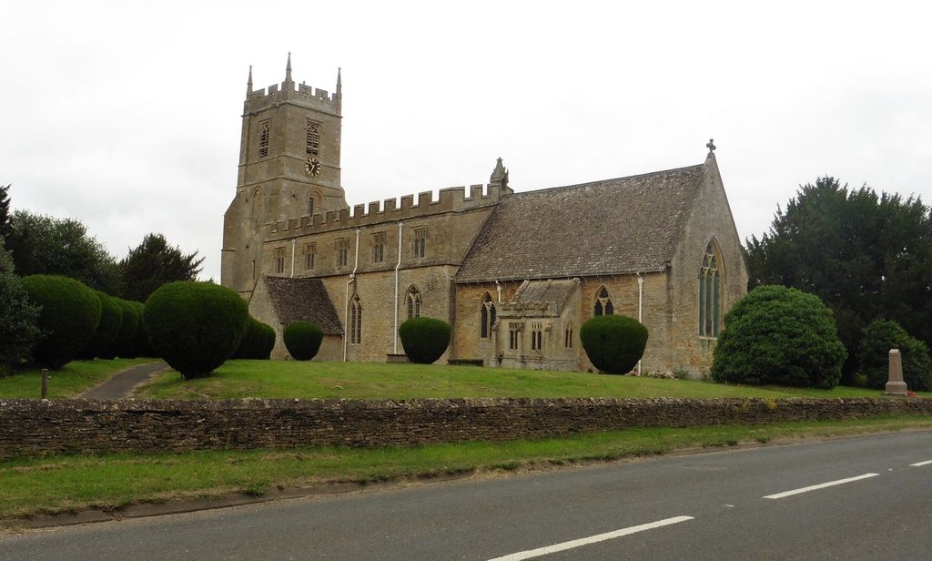
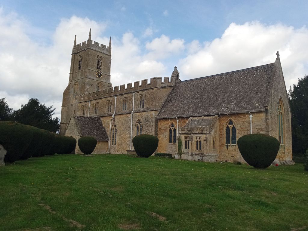
Saint Peter and St Paul Churchyard is located at Main St Long Compton, Stratford-on-Avon District ,Warwickshire , CV36 5JJEngland.
-
Saint Peter and St Paul Churchyard cemetery's updated grave count on graveviews.com?
0 memorials
-
Where are the coordinates of the Saint Peter and St Paul Churchyard?
Latitude: 51.9949740
Longitude: -1.5823690
Nearby Cemetories:
1. St. Michael's
Whichford, Stratford-on-Avon District, England
Coordinate: 52.0094910, -1.5467784
2. St. Philip Church
Little Rollright, West Oxfordshire District, England
Coordinate: 51.9688330, -1.5742230
3. St Lawrence's Church
Barton-on-the-Heath, Stratford-on-Avon District, England
Coordinate: 51.9918300, -1.6272375
4. Saint John The Baptist Churchyard
Cherington, Stratford-on-Avon District, England
Coordinate: 52.0271460, -1.5762520
5. Stourton Wesleyan Chapel Burial Ground
Stourton, Stratford-on-Avon District, England
Coordinate: 52.0303940, -1.5704780
6. St Michael and All Angels Church
Great Wolford, Stratford-on-Avon District, England
Coordinate: 52.0091000, -1.6367450
7. Great Rollright St Andrews Churchyard
Rollright, West Oxfordshire District, England
Coordinate: 51.9809290, -1.5255550
8. St. Thomas Becket Cemetery
Sutton-under-Brailes, Stratford-on-Avon District, England
Coordinate: 52.0342400, -1.5657800
9. St. Mary's Churchyard
Salford, West Oxfordshire District, England
Coordinate: 51.9505810, -1.5844700
10. St Barnabas & St Nicholas Churchyard
Burmington, Stratford-on-Avon District, England
Coordinate: 52.0393000, -1.6170100
11. St. Mary the Virgin Churchyard
Chastleton, West Oxfordshire District, England
Coordinate: 51.9595360, -1.6395330
12. St Peter's Church
Cornwell, West Oxfordshire District, England
Coordinate: 51.9418660, -1.6062440
13. St. Mary the Virgin Churchyard
Chipping Norton, West Oxfordshire District, England
Coordinate: 51.9434900, -1.5476200
14. Chipping Norton Cemetery
Chipping Norton, West Oxfordshire District, England
Coordinate: 51.9414200, -1.5555900
15. Friends Burial Ground
Chipping Norton, West Oxfordshire District, England
Coordinate: 51.9415950, -1.5498310
16. Holy Trinity Catholic Churchyard
Chipping Norton, West Oxfordshire District, England
Coordinate: 51.9439300, -1.5388200
17. Hook Norton Baptist Burial Ground
Hook Norton, Cherwell District, England
Coordinate: 51.9953000, -1.4860900
18. St Peters Churchyard
Hook Norton, Cherwell District, England
Coordinate: 51.9954200, -1.4842490
19. St. George's Church of England
Brailes, Stratford-on-Avon District, England
Coordinate: 52.0515110, -1.5414420
20. St Leonard's
Moreton-in-Marsh, Cotswold District, England
Coordinate: 52.0087019, -1.6822226
21. Shipston Cemetery
Shipston-on-Stour, Stratford-on-Avon District, England
Coordinate: 52.0534039, -1.6225776
22. Hook Norton Cemetery
Hook Norton, Cherwell District, England
Coordinate: 51.9969440, -1.4787690
23. Saint Martin's Churchyard
Barcheston, Stratford-on-Avon District, England
Coordinate: 52.0570290, -1.6149230
24. Friends Burial Ground
Sibford Gower, Cherwell District, England
Coordinate: 52.0373140, -1.4889440