
| Memorials | : | 18 |
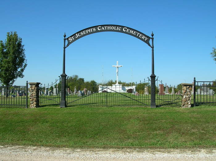
| Location | : | Pilot Grove, Cooper County, USA |
| Coordinate | : | 38.8636017, -92.9088974 |
frequently asked questions (FAQ):
-
Where is Saint Joseph's Catholic Cemetery?
Saint Joseph's Catholic Cemetery is located at Pilot Grove, Cooper County ,Missouri ,USA.
-
Saint Joseph's Catholic Cemetery cemetery's updated grave count on graveviews.com?
12 memorials
-
Where are the coordinates of the Saint Joseph's Catholic Cemetery?
Latitude: 38.8636017
Longitude: -92.9088974
Nearby Cemetories:
1. Mount Vernon Cemetery
Pilot Grove, Cooper County, USA
Coordinate: 38.8586006, -92.9150009
2. Garibaldi Mausoleum
Carano, Provincia di Latina, Italy
Coordinate: 38.8747215, -92.9113922
3. Wesley Chapel Cemetery
Pilot Grove, Cooper County, USA
Coordinate: 38.8626750, -92.9235120
4. Pilot Grove City Cemetery
Pilot Grove, Cooper County, USA
Coordinate: 38.8788930, -92.9131360
5. Saint Paul Cemetery Old
Pilot Grove, Cooper County, USA
Coordinate: 38.8631010, -92.9718320
6. Saint Paul Cemetery New
Pilot Grove, Cooper County, USA
Coordinate: 38.8642350, -92.9722930
7. Saint John's Cemetery
Clear Creek, Cooper County, USA
Coordinate: 38.8600660, -92.9772640
8. Saint Martins Cemetery
Pilot Grove, Cooper County, USA
Coordinate: 38.9169006, -92.8778000
9. Mount Nebo Baptist Church and Cemetery
Pilot Grove, Cooper County, USA
Coordinate: 38.8034970, -92.8896760
10. Pleasant Hill Cemetery
Cooper County, USA
Coordinate: 38.8955994, -92.8383026
11. Old Mount Nebo Cemetery
Bunceton, Cooper County, USA
Coordinate: 38.7999520, -92.8797250
12. Briscoe Cemetery
Cooper County, USA
Coordinate: 38.8025017, -92.8535995
13. Bethel Memorial Gardens
Speed, Cooper County, USA
Coordinate: 38.8538100, -92.8111400
14. Prairie Lick Cemetery
Billingsville, Cooper County, USA
Coordinate: 38.9170410, -92.8257630
15. Pleasant Green Cemetery
Pleasant Green, Cooper County, USA
Coordinate: 38.8016950, -92.9903690
16. Pleasant Green Methodist Church Old Cemetery
Cooper County, USA
Coordinate: 38.8013480, -92.9911630
17. Schuster Family Cemetery
Lamine, Cooper County, USA
Coordinate: 38.9526600, -92.8862720
18. Saint Johns UCC Cemetery
Billingsville, Cooper County, USA
Coordinate: 38.9042410, -92.7951050
19. Allison Family Cemetery
Blackwater, Cooper County, USA
Coordinate: 38.9447910, -92.9801270
20. Jones Chapel Cemetery
Cooper County, USA
Coordinate: 38.9433060, -92.8348710
21. Herndon Cemetery
Cooper County, USA
Coordinate: 38.9592018, -92.8767014
22. Sowers Cemetery
Cooper County, USA
Coordinate: 38.8330994, -93.0314026
23. Adams-Sowers Cemetery
Clifton City, Cooper County, USA
Coordinate: 38.8331040, -93.0317850
24. Old Lamine Cemetery
Lamine, Cooper County, USA
Coordinate: 38.9683330, -92.9275000