
| Memorials | : | 0 |
| Location | : | Leechburg, Armstrong County, USA |
| Coordinate | : | 40.6650760, -79.6245240 |
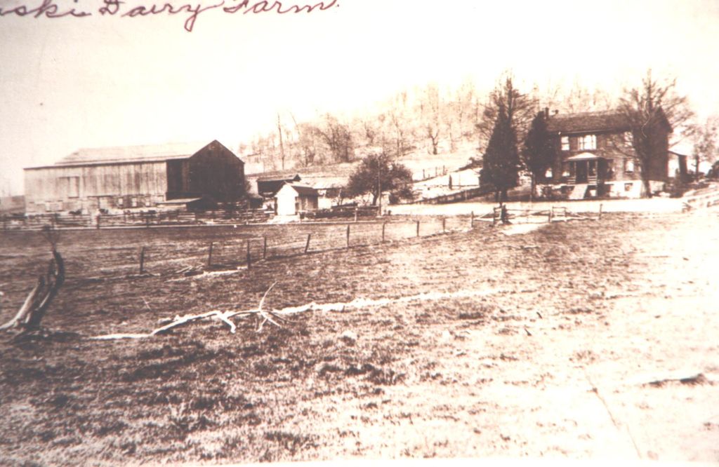
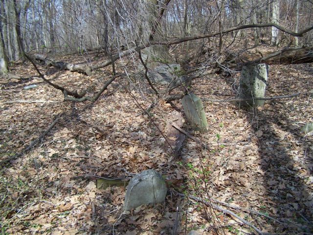
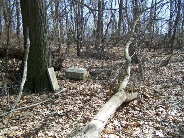
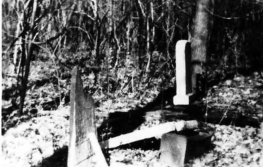
| Description | : | (HISTORY OF THE SOBER-HILL CEMETERY) The history of the cemetery is mostly lost, the Hill Family owned the property and have the most graves there. It could be the only cemetery in the area and was a community wide burial site. Most of the neighbors were also related to the Hill Family. The Sober connection is that Daniel N Sober bought the property in 1909 from the Hill family and forever after was called the Sober-Hill Cemetery. The Sober Hill Cemetery is located on the (Old Hill Family Farm) off State Route 2082, also known as (The New Schenley Road) in Gilpin Twp,... Read More |
frequently asked questions (FAQ):
-
Where is Sober Hill Cemetery?
Sober Hill Cemetery is located at State Route 2082 (Schenley Road) Leechburg, Armstrong County ,Pennsylvania , 15656USA.
-
Sober Hill Cemetery cemetery's updated grave count on graveviews.com?
0 memorials
-
Where are the coordinates of the Sober Hill Cemetery?
Latitude: 40.6650760
Longitude: -79.6245240
Nearby Cemetories:
1. Forks-Zion Lutheran Evangelical Church Cemetery
Leechburg, Armstrong County, USA
Coordinate: 40.6746490, -79.5986510
2. Kidd Farm Cemetery
Leechburg, Armstrong County, USA
Coordinate: 40.6547220, -79.5988890
3. Evergreen Cemetery
Leechburg, Armstrong County, USA
Coordinate: 40.6478004, -79.6035995
4. Saint Catherine's Cemetery
Leechburg, Armstrong County, USA
Coordinate: 40.6469994, -79.6019974
5. Murphys Cemetery
Armstrong County, USA
Coordinate: 40.6935997, -79.6425018
6. Brookland Cemetery
Bagdad, Westmoreland County, USA
Coordinate: 40.6493988, -79.6669006
7. Leechburg Cemetery
Leechburg, Armstrong County, USA
Coordinate: 40.6320220, -79.6064030
8. Silvis Cemetery
Forks Church, Armstrong County, USA
Coordinate: 40.6948260, -79.5841460
9. Saint Mary's Cemetery
Freeport, Armstrong County, USA
Coordinate: 40.6800003, -79.6781006
10. Freeport Cemetery
Freeport, Armstrong County, USA
Coordinate: 40.6810989, -79.6791992
11. Grinder Cemetery
Hyde Park, Westmoreland County, USA
Coordinate: 40.6308000, -79.5865000
12. Parks Family Cemetery
Kiskimere, Armstrong County, USA
Coordinate: 40.6267950, -79.5775470
13. Smail Family Cemetery
North Vandergrift, Armstrong County, USA
Coordinate: 40.6781730, -79.5466050
14. Keppel Burial Ground
Armstrong County, USA
Coordinate: 40.6101000, -79.5822000
15. McVille Union Cemetery
McVille, Armstrong County, USA
Coordinate: 40.7275848, -79.6052933
16. Mud Church Cemetery
Freeport, Armstrong County, USA
Coordinate: 40.7260050, -79.6556400
17. Mount Hope Cemetery
Westmoreland County, USA
Coordinate: 40.6166382, -79.6881180
18. Pet Haven at Mount Airy
Natrona Heights, Allegheny County, USA
Coordinate: 40.6388615, -79.7090183
19. Laurel Point Cemetery
Armstrong County, USA
Coordinate: 40.6203003, -79.5543976
20. Mount Airy Cemetery
Natrona Heights, Allegheny County, USA
Coordinate: 40.6371994, -79.7089005
21. Bethel Lutheran Church Cemetery
Ford City, Armstrong County, USA
Coordinate: 40.6969290, -79.5336720
22. Saint Joseph Parish Cemetery
Natrona Heights, Allegheny County, USA
Coordinate: 40.6316150, -79.7158960
23. Homewood Baptist Church Cemetery
Ford City, Armstrong County, USA
Coordinate: 40.7266000, -79.5616000
24. Highfield Lutheran Church Cemetery
North Vandergrift, Armstrong County, USA
Coordinate: 40.6392441, -79.5245590