
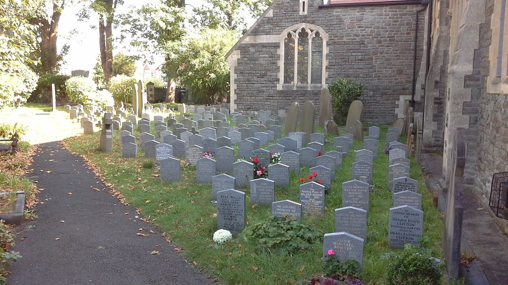
| Memorials | : | 3 |
| Location | : | Fishponds, Bristol Unitary Authority, England |
| Coordinate | : | 51.4815000, -2.5300000 |
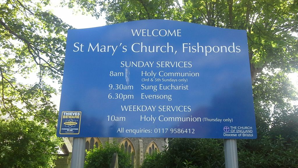
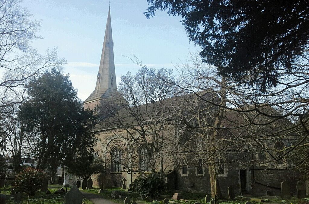
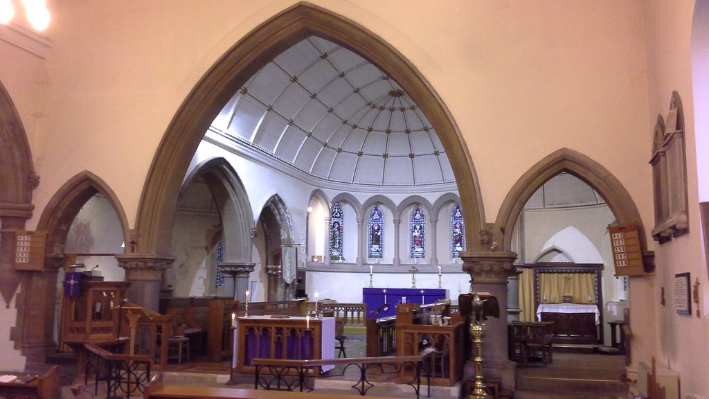
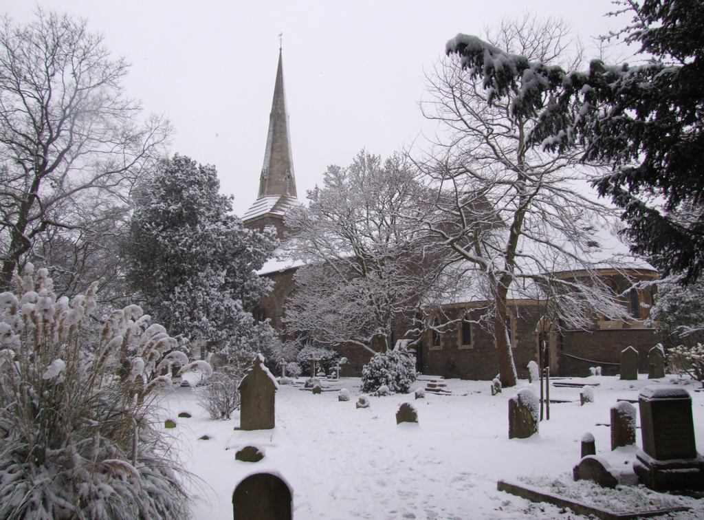
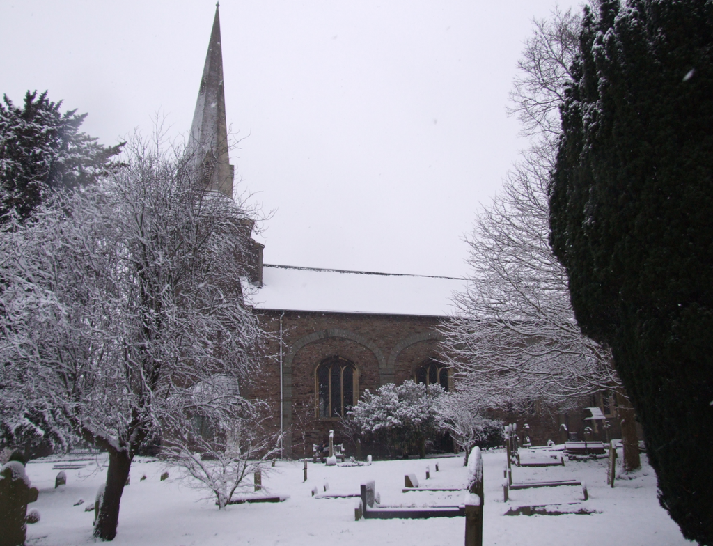
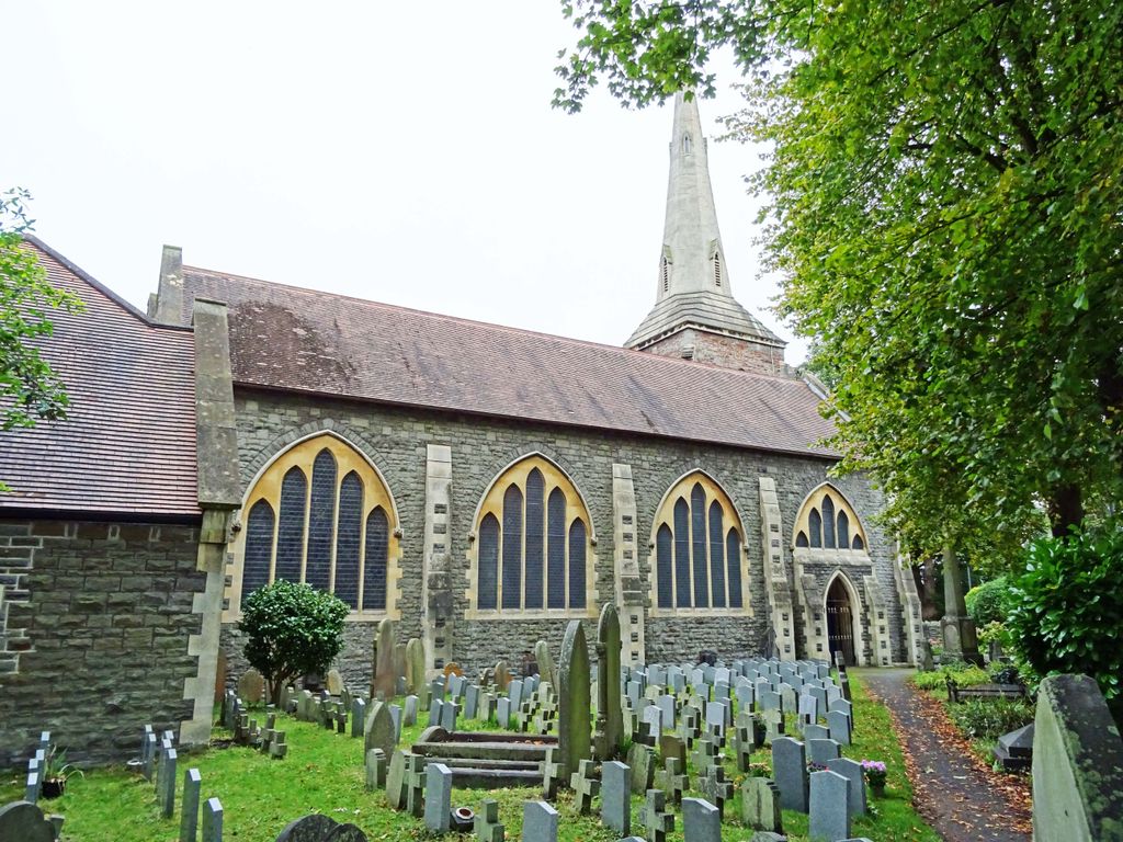
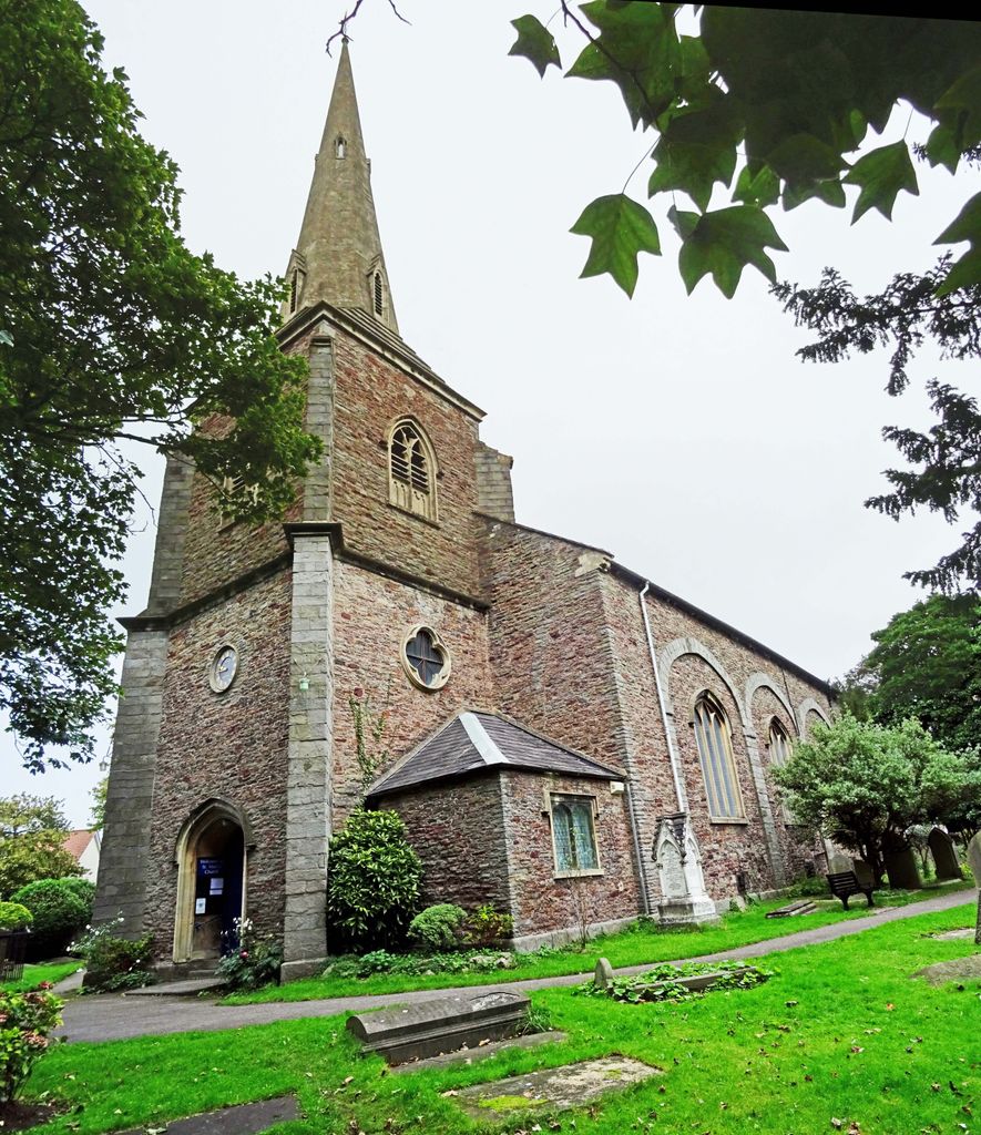
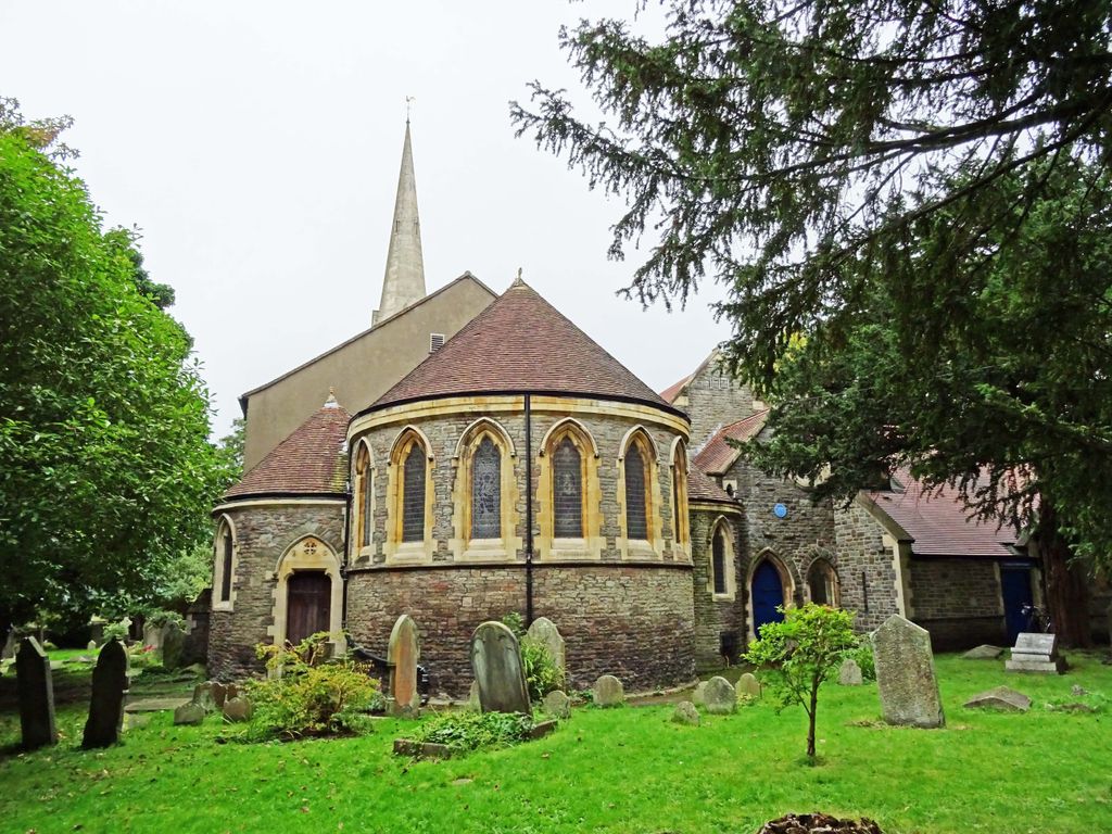
| Description | : | An Anglican church, Saint Mary's was originally known as Trinity Chapel and was consecrated on 31 August 1821. Changing demographics led to expansion, and on 14 December 1869 the church was renamed the Parish Church of Saint Mary the Virgin. Saint Mary, Fishponds Manor Road Fishponds BS16 2JB 51° 28' 53.46" N Latitude 2° 31' 47.87" W Longitude = 51.4815 Latitude -2.5300 Longitude |
frequently asked questions (FAQ):
-
Where is Saint Mary's Churchyard?
Saint Mary's Churchyard is located at Fishponds, Bristol Unitary Authority ,Bristol ,England.
-
Saint Mary's Churchyard cemetery's updated grave count on graveviews.com?
3 memorials
-
Where are the coordinates of the Saint Mary's Churchyard?
Latitude: 51.4815000
Longitude: -2.5300000
Nearby Cemetories:
1. Fishponds Baptist Churchyard
Fishponds, Bristol Unitary Authority, England
Coordinate: 51.4823300, -2.5227200
2. Ridgeway Jewish Cemetery
Bristol, Bristol Unitary Authority, England
Coordinate: 51.4749930, -2.5488700
3. Ridgeway Park Cemetery
Bristol, Bristol Unitary Authority, England
Coordinate: 51.4755800, -2.5494800
4. St John the Baptist Churchyard
Frenchay, South Gloucestershire Unitary Authority, England
Coordinate: 51.4947700, -2.5205810
5. Downend Christ Churchyard
Downend, South Gloucestershire Unitary Authority, England
Coordinate: 51.4861501, -2.5075481
6. Holy Trinity Churchyard
Stapleton, Bristol Unitary Authority, England
Coordinate: 51.4802770, -2.5579510
7. Greenbank Cemetery
Eastville, Bristol Unitary Authority, England
Coordinate: 51.4683610, -2.5540270
8. St Michael the Archangel Churchyard
Bristol Unitary Authority, England
Coordinate: 51.4619199, -2.5211279
9. Kingswood Methodist Church Burial Ground
Kingswood, South Gloucestershire Unitary Authority, England
Coordinate: 51.4637200, -2.5134100
10. Greenbank Masjid
Easton, Bristol Unitary Authority, England
Coordinate: 51.4679410, -2.5578030
11. Mangotsfield Cemetery
Mangotsfield, South Gloucestershire Unitary Authority, England
Coordinate: 51.4905440, -2.4964780
12. Master's Church Cemetery
Kingswood, South Gloucestershire Unitary Authority, England
Coordinate: 51.4630871, -2.5068932
13. Holy Trinity Churchyard
Kingswood, South Gloucestershire Unitary Authority, England
Coordinate: 51.4619990, -2.5040620
14. St Mark Churchyard
Easton, Bristol Unitary Authority, England
Coordinate: 51.4668240, -2.5646860
15. Avon View Cemetery
St George, Bristol Unitary Authority, England
Coordinate: 51.4574000, -2.5493680
16. St. James Cemetery
Mangotsfield, South Gloucestershire Unitary Authority, England
Coordinate: 51.4845130, -2.4856679
17. Wesleyan Methodist Church
Redfield, Bristol Unitary Authority, England
Coordinate: 51.4589300, -2.5569000
18. St Werburgh's Church
Bristol, Bristol Unitary Authority, England
Coordinate: 51.4717464, -2.5763725
19. Hanham United Reform Church Cemetery
Hanham, South Gloucestershire Unitary Authority, England
Coordinate: 51.4509706, -2.5189809
20. Christ Church Churchyard
Hanham, South Gloucestershire Unitary Authority, England
Coordinate: 51.4484992, -2.5222650
21. St Luke’s Church burial ground
Barton Hill, Bristol Unitary Authority, England
Coordinate: 51.4544500, -2.5639600
22. Barton Hill School Memorial
Barton Hill, Bristol Unitary Authority, England
Coordinate: 51.4544350, -2.5640030
23. Hanham Baptist Church Cemetery
Hanham, South Gloucestershire Unitary Authority, England
Coordinate: 51.4474802, -2.5107480
24. Holy Trinity Church
St Phillips, Bristol Unitary Authority, England
Coordinate: 51.4580335, -2.5760701