
| Memorials | : | 0 |
| Location | : | Stapleton, Bristol Unitary Authority, England |
| Coordinate | : | 51.4802770, -2.5579510 |
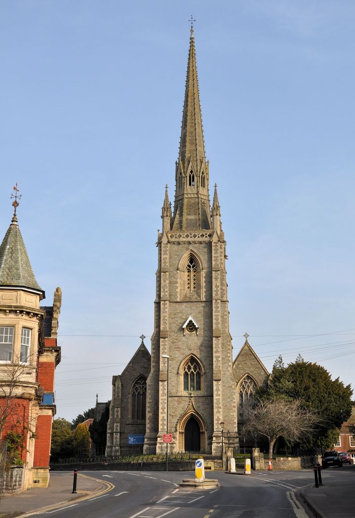
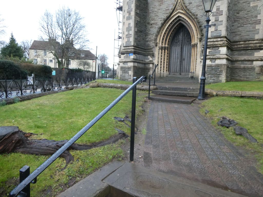
| Description | : | Holy Trinity Stapleton 23 Park Road Stapleton Bristol BS16 1AZ 51‹ 28Œ 49 N Latitude 2‹ 33Œ 28.63 W Longitude = 51.48028 Latitude -2.55795 Longitude |
frequently asked questions (FAQ):
-
Where is Holy Trinity Churchyard?
Holy Trinity Churchyard is located at Stapleton, Bristol Unitary Authority ,Bristol ,England.
-
Holy Trinity Churchyard cemetery's updated grave count on graveviews.com?
0 memorials
-
Where are the coordinates of the Holy Trinity Churchyard?
Latitude: 51.4802770
Longitude: -2.5579510
Nearby Cemetories:
1. Ridgeway Park Cemetery
Bristol, Bristol Unitary Authority, England
Coordinate: 51.4755800, -2.5494800
2. Ridgeway Jewish Cemetery
Bristol, Bristol Unitary Authority, England
Coordinate: 51.4749930, -2.5488700
3. Greenbank Cemetery
Eastville, Bristol Unitary Authority, England
Coordinate: 51.4683610, -2.5540270
4. Greenbank Masjid
Easton, Bristol Unitary Authority, England
Coordinate: 51.4679410, -2.5578030
5. St Mark Churchyard
Easton, Bristol Unitary Authority, England
Coordinate: 51.4668240, -2.5646860
6. St Werburgh's Church
Bristol, Bristol Unitary Authority, England
Coordinate: 51.4717464, -2.5763725
7. Saint Mary's Churchyard
Fishponds, Bristol Unitary Authority, England
Coordinate: 51.4815000, -2.5300000
8. Holy Trinity Churchyard
Horfield, Bristol Unitary Authority, England
Coordinate: 51.4879930, -2.5893570
9. Wesleyan Methodist Church
Redfield, Bristol Unitary Authority, England
Coordinate: 51.4589300, -2.5569000
10. Fishponds Baptist Churchyard
Fishponds, Bristol Unitary Authority, England
Coordinate: 51.4823300, -2.5227200
11. Avon View Cemetery
St George, Bristol Unitary Authority, England
Coordinate: 51.4574000, -2.5493680
12. Holy Trinity Church
St Phillips, Bristol Unitary Authority, England
Coordinate: 51.4580335, -2.5760701
13. St Pauls Churchyard
Bristol, Bristol Unitary Authority, England
Coordinate: 51.4611550, -2.5847190
14. St Luke’s Church burial ground
Barton Hill, Bristol Unitary Authority, England
Coordinate: 51.4544500, -2.5639600
15. Barton Hill School Memorial
Barton Hill, Bristol Unitary Authority, England
Coordinate: 51.4544350, -2.5640030
16. Brunswick Square Unitarian Burying Ground
Bristol, Bristol Unitary Authority, England
Coordinate: 51.4605400, -2.5877800
17. St John the Baptist Churchyard
Frenchay, South Gloucestershire Unitary Authority, England
Coordinate: 51.4947700, -2.5205810
18. Whitfield's Tabernacle
St Pauls, Bristol Unitary Authority, England
Coordinate: 51.4579500, -2.5860800
19. Redcross Street Burial Ground (Defunct)
Bristol Unitary Authority, England
Coordinate: 51.4563073, -2.5833100
20. St Michael the Archangel Churchyard
Bristol Unitary Authority, England
Coordinate: 51.4619199, -2.5211279
21. Black Friars Priory
Bristol, Bristol Unitary Authority, England
Coordinate: 51.4572220, -2.5877780
22. Quakers Friars Burial Ground
Bristol, Bristol Unitary Authority, England
Coordinate: 51.4572220, -2.5877780
23. Barton Road Jewish Cemetery
St Phillips, Bristol Unitary Authority, England
Coordinate: 51.4531400, -2.5779800
24. St Philip and St Jacob Churchyard
Bristol, Bristol Unitary Authority, England
Coordinate: 51.4545420, -2.5844690