
| Memorials | : | 0 |
| Location | : | Barton Hill, Bristol Unitary Authority, England |
| Coordinate | : | 51.4544350, -2.5640030 |
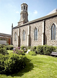
| Description | : | Located in St. Lukes Memorial Garden. The Barton Hill History Group placed a War Memorial which honors 108 former Barton Hill men who died during WWI (1914-1918). On concrete plinth in churchyard at St. Luke's Church (Church St, Barton Hill, Bristol, England). |
frequently asked questions (FAQ):
-
Where is Barton Hill School Memorial?
Barton Hill School Memorial is located at Barton Hill, Bristol Unitary Authority ,Bristol ,England.
-
Barton Hill School Memorial cemetery's updated grave count on graveviews.com?
0 memorials
-
Where are the coordinates of the Barton Hill School Memorial?
Latitude: 51.4544350
Longitude: -2.5640030

Nearby Cemetories:
1. St Luke’s Church burial ground
Barton Hill, Bristol Unitary Authority, England
Coordinate: 51.4544500, -2.5639600
2. Wesleyan Methodist Church
Redfield, Bristol Unitary Authority, England
Coordinate: 51.4589300, -2.5569000
3. Holy Trinity Church
St Phillips, Bristol Unitary Authority, England
Coordinate: 51.4580335, -2.5760701
4. Barton Road Jewish Cemetery
St Phillips, Bristol Unitary Authority, England
Coordinate: 51.4531400, -2.5779800
5. Avon View Cemetery
St George, Bristol Unitary Authority, England
Coordinate: 51.4574000, -2.5493680
6. St. Mary Redcliffe Cemetery
Arnos Vale, Bristol Unitary Authority, England
Coordinate: 51.4428370, -2.5646220
7. Arnos Vale Cemetery and Crematorium
Arnos Vale, Bristol Unitary Authority, England
Coordinate: 51.4423740, -2.5648680
8. Holy Souls Catholic Cemetery
Arnos Vale, Bristol Unitary Authority, England
Coordinate: 51.4422800, -2.5639300
9. Redcross Street Burial Ground (Defunct)
Bristol Unitary Authority, England
Coordinate: 51.4563073, -2.5833100
10. St Mark Churchyard
Easton, Bristol Unitary Authority, England
Coordinate: 51.4668240, -2.5646860
11. St Philip and St Jacob Churchyard
Bristol, Bristol Unitary Authority, England
Coordinate: 51.4545420, -2.5844690
12. Greenbank Masjid
Easton, Bristol Unitary Authority, England
Coordinate: 51.4679410, -2.5578030
13. Whitfield's Tabernacle
St Pauls, Bristol Unitary Authority, England
Coordinate: 51.4579500, -2.5860800
14. Temple Church Churchyard
Redcliffe, Bristol Unitary Authority, England
Coordinate: 51.4521160, -2.5867630
15. Temple Churchyard
Bristol, Bristol Unitary Authority, England
Coordinate: 51.4520010, -2.5868870
16. St Pauls Churchyard
Bristol, Bristol Unitary Authority, England
Coordinate: 51.4611550, -2.5847190
17. Black Friars Priory
Bristol, Bristol Unitary Authority, England
Coordinate: 51.4572220, -2.5877780
18. Quakers Friars Burial Ground
Bristol, Bristol Unitary Authority, England
Coordinate: 51.4572220, -2.5877780
19. Greenbank Cemetery
Eastville, Bristol Unitary Authority, England
Coordinate: 51.4683610, -2.5540270
20. Brunswick Square Unitarian Burying Ground
Bristol, Bristol Unitary Authority, England
Coordinate: 51.4605400, -2.5877800
21. St. Peter's Churchyard
Bristol, Bristol Unitary Authority, England
Coordinate: 51.4553560, -2.5896930
22. St Mary the Virgin Churchyard
Redcliffe, Bristol Unitary Authority, England
Coordinate: 51.4482800, -2.5895460
23. Holy Trinity Church
Bristol, Bristol Unitary Authority, England
Coordinate: 51.4559548, -2.5915587
24. Broadmead Baptist Church
Bristol, Bristol Unitary Authority, England
Coordinate: 51.4575500, -2.5915500