
| Memorials | : | 0 |
| Location | : | Hutton Magna, Durham Unitary Authority, England |
| Coordinate | : | 54.5074500, -1.8060900 |
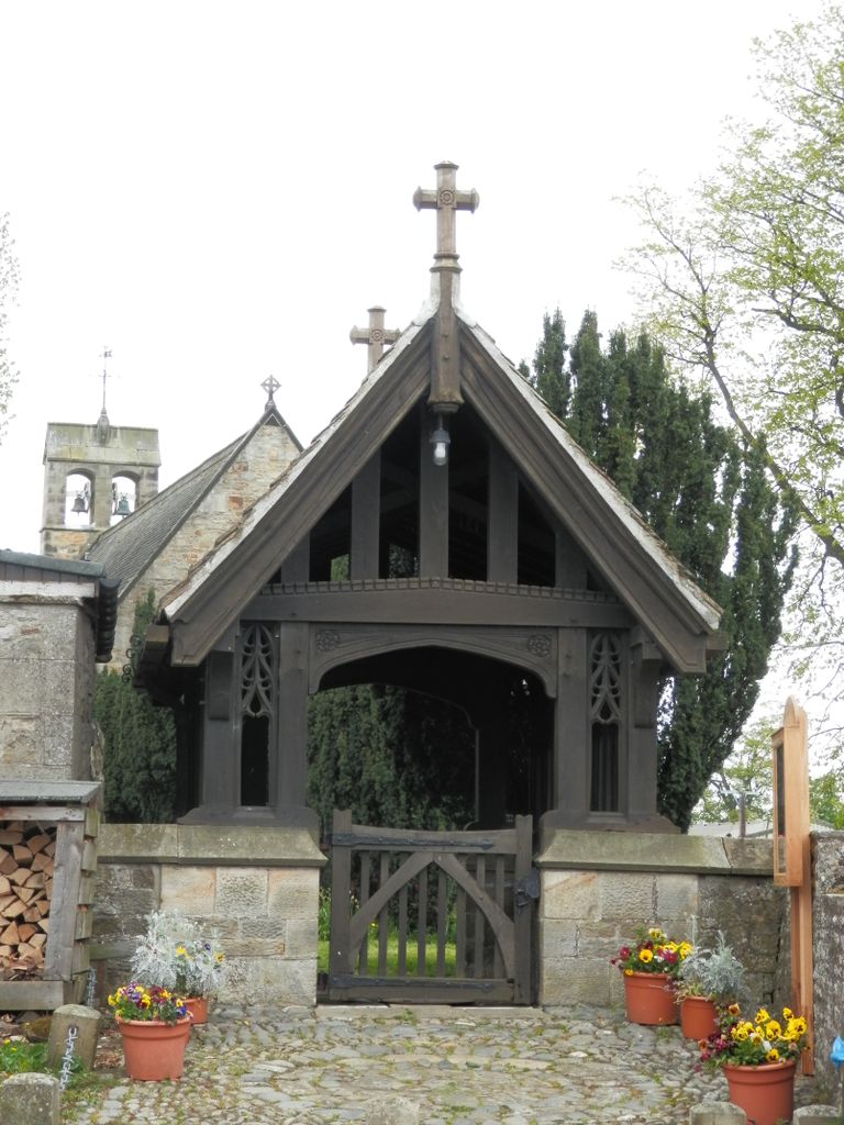
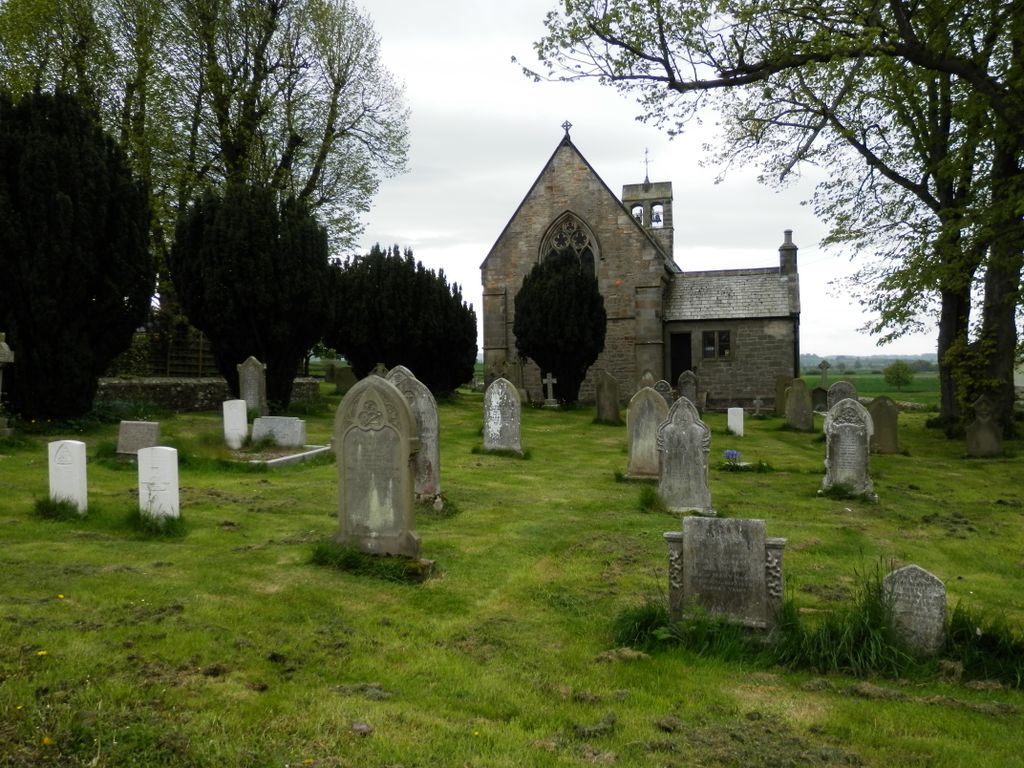
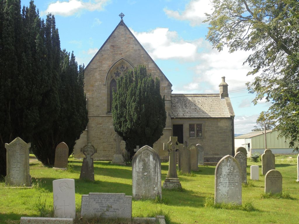
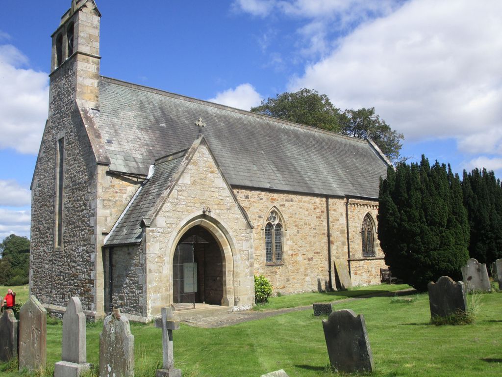
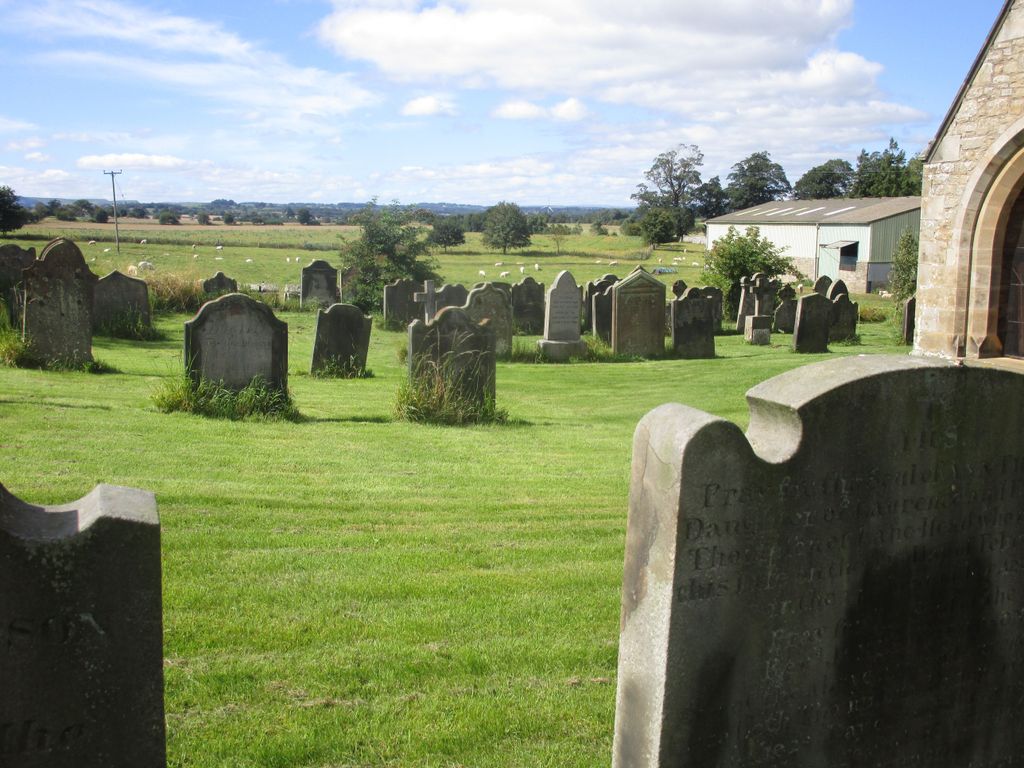
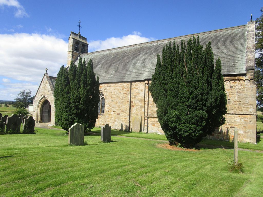
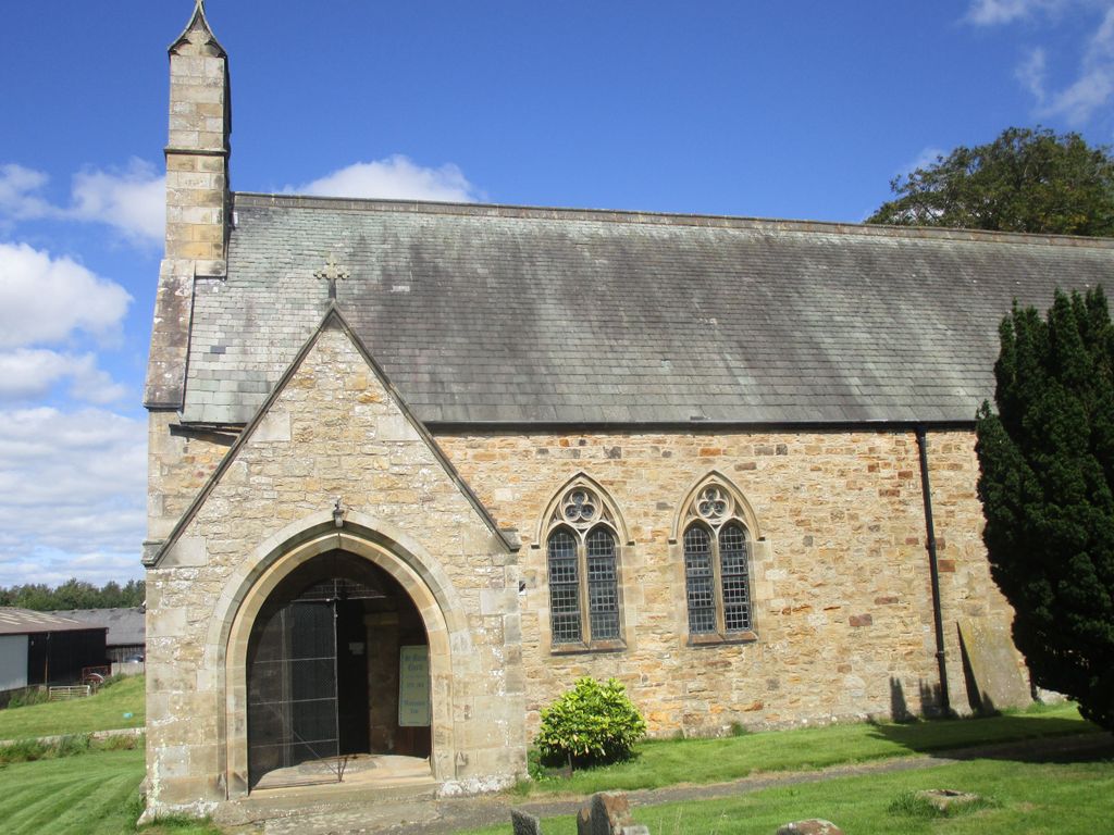
| Description | : | The village dates back to the Domesday Book (1086), when it was known as Hotton, and is described as having eleven households; but was mostly “waste”, thought to be the result of William the Conqueror’s “Harrying of the North”. The current church dates from 1878, but built on the site of a much older building. Part of the old Saxon cross and the old font can be seen in the porch which has a Norman doorway. The lych-gate was built by Robert Thompson, “The Mouseman of Kilburn”, and also acts as the war memorial for twelve men who fell in the Great... Read More |
frequently asked questions (FAQ):
-
Where is Saint Mary’s Churchyard?
Saint Mary’s Churchyard is located at Hutton Magna, Durham Unitary Authority ,County Durham ,England.
-
Saint Mary’s Churchyard cemetery's updated grave count on graveviews.com?
0 memorials
-
Where are the coordinates of the Saint Mary’s Churchyard?
Latitude: 54.5074500
Longitude: -1.8060900
Nearby Cemetories:
1. St. Hilda's Churchyard
Caldwell, Richmondshire District, England
Coordinate: 54.5156390, -1.7508220
2. St Michael and All Angels Churchyard
Barningham, Durham Unitary Authority, England
Coordinate: 54.4895190, -1.8691942
3. St Cuthbert Churchyard
Forcett, Richmondshire District, England
Coordinate: 54.5051660, -1.7304510
4. Brignall Old Churchyard
Brignall, Durham Unitary Authority, England
Coordinate: 54.5051000, -1.8826400
5. St Mary's Churchyard
Brignall, Durham Unitary Authority, England
Coordinate: 54.5061090, -1.8896890
6. Saint Mary's Churchyard
Rokeby, Durham Unitary Authority, England
Coordinate: 54.5193100, -1.8894300
7. Gainford Cemetery
Gainford, Durham Unitary Authority, England
Coordinate: 54.5441400, -1.7417800
8. St John the Baptist Churchyard
Stanwick St John, Richmondshire District, England
Coordinate: 54.5028550, -1.7155730
9. St. Peter and St. Felix Churchyard
Kirby Hill, Richmondshire District, England
Coordinate: 54.4546050, -1.7851500
10. Saint Mary's Churchyard
Gainford, Durham Unitary Authority, England
Coordinate: 54.5453800, -1.7389100
11. St Osmund's Roman Catholic Churchyard
Gainford, Durham Unitary Authority, England
Coordinate: 54.5476300, -1.7359500
12. Eggleston Abbey
Barnard Castle, Durham Unitary Authority, England
Coordinate: 54.5311600, -1.9049600
13. St Mary's Roman Catholic Church
Barnard Castle, Durham Unitary Authority, England
Coordinate: 54.5414010, -1.9183080
14. Roman Catholic Cemetery
Barnard Castle, Durham Unitary Authority, England
Coordinate: 54.5442300, -1.9184500
15. Barnard Castle Dissenters Cemetery
Barnard Castle, Durham Unitary Authority, England
Coordinate: 54.5451000, -1.9182900
16. Victoria Road Cemetery
Barnard Castle, Durham Unitary Authority, England
Coordinate: 54.5456000, -1.9183000
17. St James the Great Churchyard
Melsonby, Richmondshire District, England
Coordinate: 54.4711100, -1.6916100
18. St. Mary's Churchyard
Barnard Castle, Durham Unitary Authority, England
Coordinate: 54.5416950, -1.9230780
19. St. Mary's Churchyard
Piercebridge, Darlington Unitary Authority, England
Coordinate: 54.5366780, -1.6766370
20. St. Agatha and St. Oswin Churchyard
Gilling West, Richmondshire District, England
Coordinate: 54.4414840, -1.7209980
21. St John the Evangelist Churchyard
Ingleton, Durham Unitary Authority, England
Coordinate: 54.5795310, -1.7326110
22. All Saints Churchyard
Manfield, Richmondshire District, England
Coordinate: 54.5154080, -1.6573120
23. St Edwin New Churchyard
High Coniscliffe, Darlington Unitary Authority, England
Coordinate: 54.5338700, -1.6554100
24. St. Edwin Churchyard
High Coniscliffe, Darlington Unitary Authority, England
Coordinate: 54.5322290, -1.6525190