
| Memorials | : | 56 |
| Location | : | Gilling West, Richmondshire District, England |
| Coordinate | : | 54.4414840, -1.7209980 |
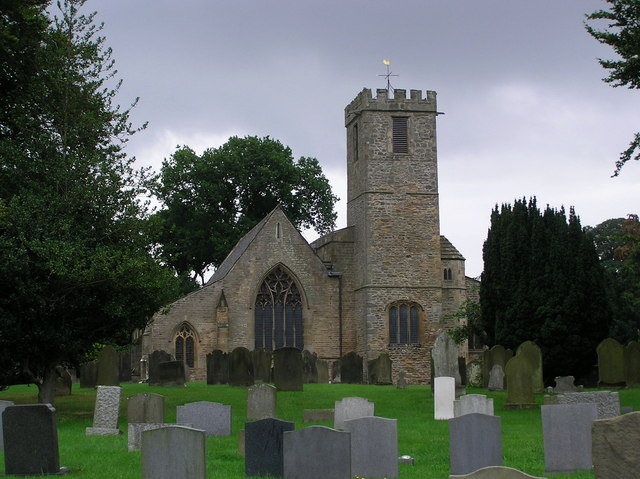
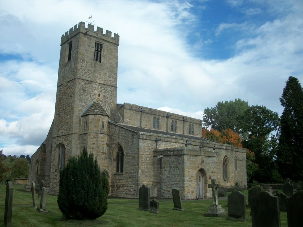
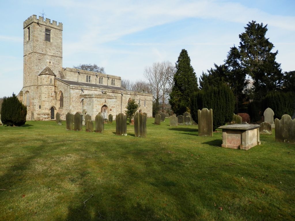
| Description | : | Gilling West is a large village in the Richmond district of North Yorkshire, England. It is located in the civil parish of Gilling with Hartforth and Sedbury.The village was the seat of power for Edwin, Earl of Mercia.The artist William Sawrey Gilpin lived and was buried there. |
frequently asked questions (FAQ):
-
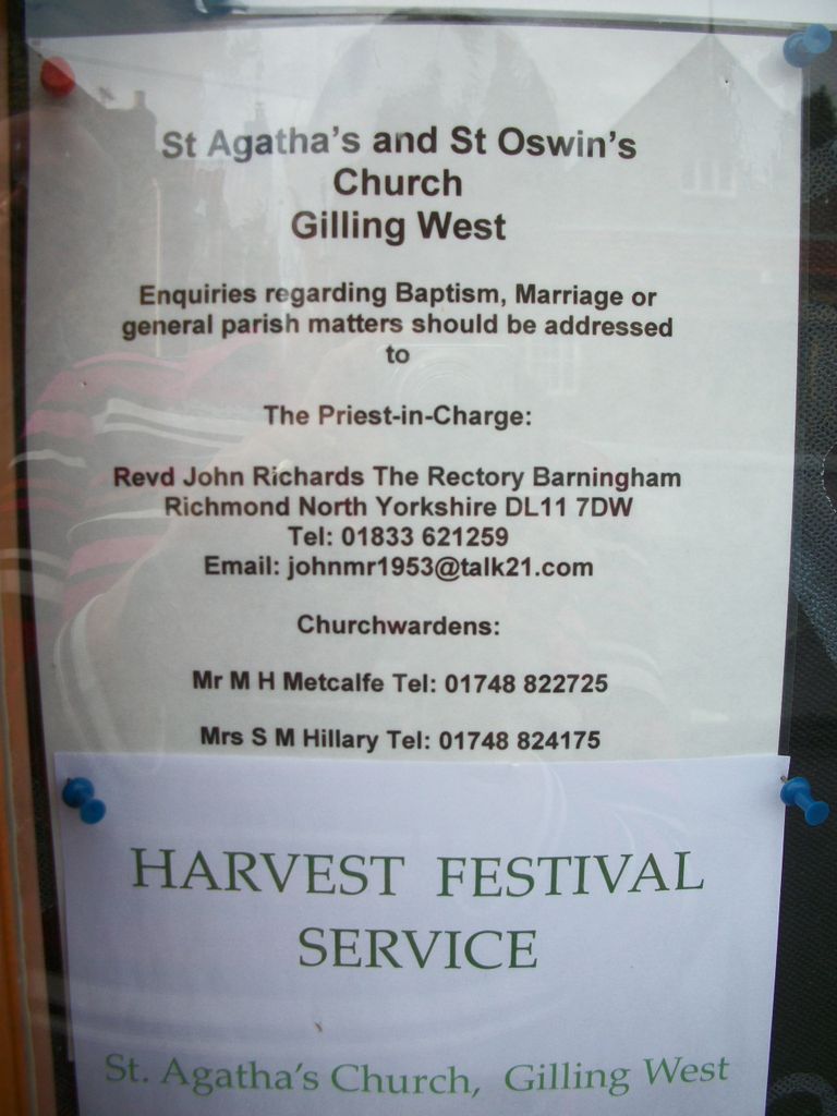
Where is St. Agatha and St. Oswin Churchyard?
St. Agatha and St. Oswin Churchyard is located at Gilling West, Richmondshire District ,North Yorkshire , DL10 5JNEngland.
-
St. Agatha and St. Oswin Churchyard cemetery's updated grave count on graveviews.com?
56 memorials
-
Where are the coordinates of the St. Agatha and St. Oswin Churchyard?
Latitude: 54.4414840
Longitude: -1.7209980
Nearby Cemetories:
1. St James the Great Churchyard
Melsonby, Richmondshire District, England
Coordinate: 54.4711100, -1.6916100
2. St Mary the Virgin Churchyard
Richmond, Richmondshire District, England
Coordinate: 54.4046600, -1.7333700
3. St. Peter and St. Felix Churchyard
Kirby Hill, Richmondshire District, England
Coordinate: 54.4546050, -1.7851500
4. Middleton Lodge Chapel
Middleton Tyas, Richmondshire District, England
Coordinate: 54.4562000, -1.6567000
5. Richmond Cemetery
Richmond, Richmondshire District, England
Coordinate: 54.4053750, -1.7572010
6. St Agatha Churchyard
Easby, Richmondshire District, England
Coordinate: 54.3976010, -1.7158320
7. St Michael and All Angels Churchyard
Middleton Tyas, Richmondshire District, England
Coordinate: 54.4451400, -1.6390500
8. St Cuthbert and St Mary Churchyard
Barton, Richmondshire District, England
Coordinate: 54.4754490, -1.6458250
9. St Michael and All Angels Churchyard
Hudswell, Richmondshire District, England
Coordinate: 54.3990300, -1.7846500
10. Brompton-On-Swale Cemetery
Brompton on Swale, Richmondshire District, England
Coordinate: 54.3917400, -1.6608900
11. Catterick Garrison Military Cemetery
Hipswell, Richmondshire District, England
Coordinate: 54.3803100, -1.7138300
12. St John the Baptist Churchyard
Stanwick St John, Richmondshire District, England
Coordinate: 54.5028550, -1.7155730
13. St John The Evangelist Churchyard
Hipswell, Richmondshire District, England
Coordinate: 54.3798700, -1.7130100
14. St Cuthbert Churchyard
Forcett, Richmondshire District, England
Coordinate: 54.5051660, -1.7304510
15. St Paulinus Roman Catholic Churchyard
Brough with St Giles, Richmondshire District, England
Coordinate: 54.3779100, -1.6698900
16. St. Hilda's Churchyard
Caldwell, Richmondshire District, England
Coordinate: 54.5156390, -1.7508220
17. Scorton & District Joint Cemetery
Scorton, Richmondshire District, England
Coordinate: 54.3914400, -1.6156200
18. St Edmund the Martyr Churchyard
Marske, Richmondshire District, England
Coordinate: 54.3997500, -1.8403700
19. Catterick Cemetery
Catterick, Richmondshire District, England
Coordinate: 54.3774700, -1.6349100
20. Saint Mary’s Churchyard
Hutton Magna, Durham Unitary Authority, England
Coordinate: 54.5074500, -1.8060900
21. All Saints Churchyard
Manfield, Richmondshire District, England
Coordinate: 54.5154080, -1.6573120
22. St Anne Churchyard
Catterick, Richmondshire District, England
Coordinate: 54.3768500, -1.6319800
23. St Mary Churchyard
Bolton-on-Swale, Richmondshire District, England
Coordinate: 54.3875300, -1.6127600
24. St Michael and All Angels Churchyard
Downholme, Richmondshire District, England
Coordinate: 54.3799700, -1.8313400