
| Memorials | : | 0 |
| Location | : | Rokeby, Durham Unitary Authority, England |
| Coordinate | : | 54.5193100, -1.8894300 |
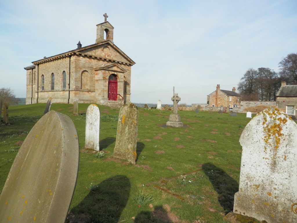
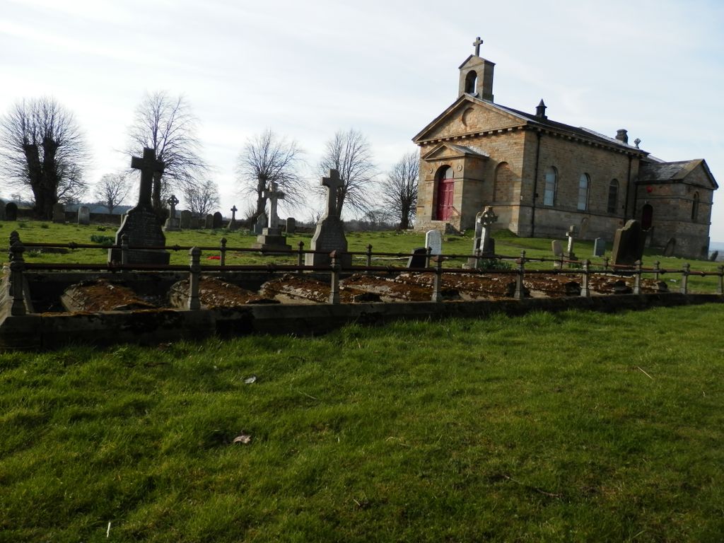
| Description | : | Situated on the north side of the busy A66 trans-Pennine road, the church of St Mary the Virgin is a small and plain structure of Renaissance design, built by Sir Thomas Robinson in 1740, in place of the older church, which stood to the north-east of Rokeby Hall, near the River Tees; nothing but a few marks in the turf remain to show its site, and a few gravestones only are left in position. The group of tombs in the South East corner is covered in moss and very little of the inscriptions is visible. Under the chancel of the church is... Read More |
frequently asked questions (FAQ):
-
Where is Saint Mary's Churchyard?
Saint Mary's Churchyard is located at The Street Rokeby, Durham Unitary Authority ,County Durham , DL12 9RYEngland.
-
Saint Mary's Churchyard cemetery's updated grave count on graveviews.com?
0 memorials
-
Where are the coordinates of the Saint Mary's Churchyard?
Latitude: 54.5193100
Longitude: -1.8894300
Nearby Cemetories:
1. St Mary's Churchyard
Brignall, Durham Unitary Authority, England
Coordinate: 54.5061090, -1.8896890
2. Brignall Old Churchyard
Brignall, Durham Unitary Authority, England
Coordinate: 54.5051000, -1.8826400
3. Eggleston Abbey
Barnard Castle, Durham Unitary Authority, England
Coordinate: 54.5311600, -1.9049600
4. St Mary's Roman Catholic Church
Barnard Castle, Durham Unitary Authority, England
Coordinate: 54.5414010, -1.9183080
5. St. Mary's Churchyard
Barnard Castle, Durham Unitary Authority, England
Coordinate: 54.5416950, -1.9230780
6. Roman Catholic Cemetery
Barnard Castle, Durham Unitary Authority, England
Coordinate: 54.5442300, -1.9184500
7. Barnard Castle Dissenters Cemetery
Barnard Castle, Durham Unitary Authority, England
Coordinate: 54.5451000, -1.9182900
8. Victoria Road Cemetery
Barnard Castle, Durham Unitary Authority, England
Coordinate: 54.5456000, -1.9183000
9. St Michael and All Angels Churchyard
Barningham, Durham Unitary Authority, England
Coordinate: 54.4895190, -1.8691942
10. Saint Mary’s Churchyard
Hutton Magna, Durham Unitary Authority, England
Coordinate: 54.5074500, -1.8060900
11. St Giles Churchyard
Bowes, Durham Unitary Authority, England
Coordinate: 54.5169000, -2.0124000
12. Bowes and Gilmonby Cemetery
Bowes, Durham Unitary Authority, England
Coordinate: 54.5164600, -2.0124100
13. Cotherstone Cemetery
Cotherstone, Durham Unitary Authority, England
Coordinate: 54.5680830, -1.9804850
14. Cotherstone Friends Burial Ground
Cotherstone, Durham Unitary Authority, England
Coordinate: 54.5722230, -1.9824740
15. St. Hilda's Churchyard
Caldwell, Richmondshire District, England
Coordinate: 54.5156390, -1.7508220
16. St. Peter and St. Felix Churchyard
Kirby Hill, Richmondshire District, England
Coordinate: 54.4546050, -1.7851500
17. Gainford Cemetery
Gainford, Durham Unitary Authority, England
Coordinate: 54.5441400, -1.7417800
18. Saint Mary's Churchyard
Gainford, Durham Unitary Authority, England
Coordinate: 54.5453800, -1.7389100
19. St Cuthbert Churchyard
Forcett, Richmondshire District, England
Coordinate: 54.5051660, -1.7304510
20. St Osmund's Roman Catholic Churchyard
Gainford, Durham Unitary Authority, England
Coordinate: 54.5476300, -1.7359500
21. St. Romald Churchyard
Romaldkirk, Durham Unitary Authority, England
Coordinate: 54.5941550, -2.0089636
22. St John the Baptist Churchyard
Stanwick St John, Richmondshire District, England
Coordinate: 54.5028550, -1.7155730
23. Romaldkirk Cemetery
Romaldkirk, Durham Unitary Authority, England
Coordinate: 54.5977800, -2.0083200
24. St Mary the Virgin Churchyard
Cockfield, Durham Unitary Authority, England
Coordinate: 54.6131690, -1.8017530